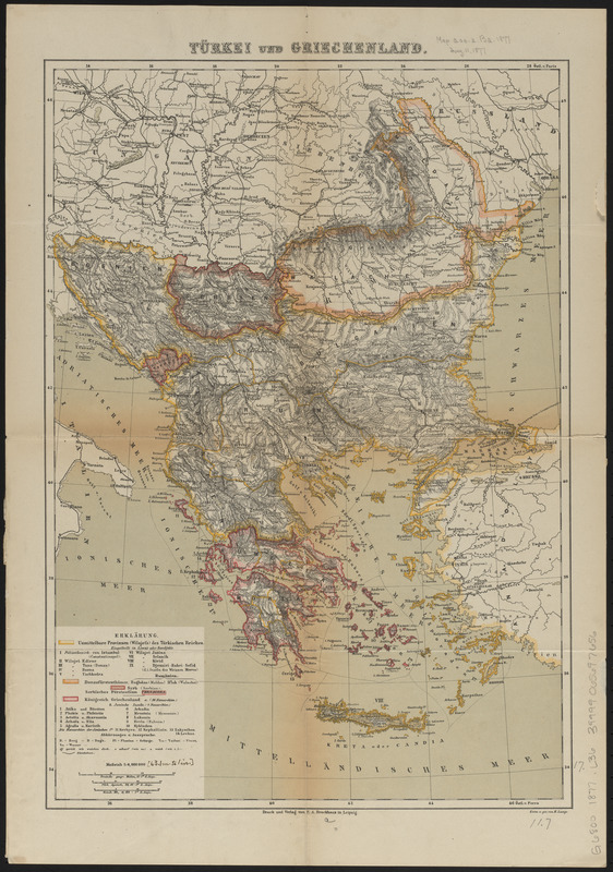
Türkei und Griechenland
Item Information
- Title:
- Türkei und Griechenland
- Title (alt.):
-
Europäische Türkei und Griechenland
- Cartographer:
- Lange, Henry, 1821-1893
- Name on Item:
-
entro. u. gez. von H. Lange
- Date:
-
[1877?]
- Format:
-
Maps/Atlases
- Location:
-
Boston Public Library
Norman B. Leventhal Map & Education Center - Collection (local):
-
Norman B. Leventhal Map & Education Center Collection
- Subjects:
-
Balkan Peninsula--Maps
Turkey--Maps
Greece--Maps
- Places:
-
Balkan Peninsula (area)
- Extent:
- 1 map : color ; 30 x 42 cm
- Terms of Use:
-
No known copyright restrictions.
No known restrictions on use.
- Publisher:
-
Leipzig :
F.A. Brockhaus
- Scale:
-
Scale 1:4,000,000
- Language:
-
German
- Notes:
-
Date of publication estimated from date of acquisition.
Relief shown by hachures.
Prime meridian: Paris.
- Identifier:
-
06_01_012606
- Call #:
-
G6800 1877 .L36
- Barcode:
-
39999065697656