Toggle navigation
LMEC Home
Exhibitions
Georeferencing
Tools for Teachers
Collections
My Favorites
Sign Up / Log In
Search
Search the map portal
Map Collection
Map Collection
Map Sets
Search
Search
Search for
Search In
All Fields
Creator
Title
Subject
Place
Search All Digital Collections
Advanced Search
8198 Results
My Search
Start Over
More Like
commonwealth:3f462v04v
Remove constraint More Like: commonwealth:3f462v04v
Filter your Search
Place
North and Central America
4,922
United States
3,631
Suffolk (county)
1,026
Boston
999
Europe
963
Canada
433
France
269
Massachusetts
249
more
Place
»
Topic
Boston (Mass.)--Maps
574
United States--Maps
270
Real property--Massachusetts--Boston--Maps
174
Massachusetts--Maps
160
Landowners--Massachusetts--Boston--Maps
132
North America--Maps--Early works to 1800
109
New England--Maps
99
Europe--Maps
78
more
Topic
»
Date
Date range begin
–
Date range end
Current results range from
1482
to
2023
View distribution
Creator
United States. Hydrographic Office
357
O.H. Bailey & Co
148
Des Barres, Joseph F. W. (Joseph Frederick Wallet), 1722-1824
123
United States. Post Office Dept
120
Ptolemy, 2nd cent
100
Walling, Henry Francis, 1825-1888
94
Jefferys, Thomas, -1771
84
Geological Survey (U.S.)
82
more
Creator
»
Format
Maps/Atlases
8,139
Manuscripts
215
Prints
51
Books
36
Objects/Artifacts
10
Drawings/Illustrations
8
Posters
4
Georeferenced
Yes
873
No
7,325
Collection
Norman B. Leventhal Map Center Collection
8,164
Boston and New England Maps
2,184
Urban Maps
1,925
Maritime Charts and Atlases
750
American Revolutionary War-Era Maps
650
Boston Redevelopment Authority Collection
86
New York Public Library Collection
15
Richard H. Brown Revolutionary War Map Collection at Mount Vernon
11
more
Collection
»
Available to use
No known restrictions
8,025
Creative Commons license
76
Search Constraints
Sort by relevance
relevance
title
date (asc)
date (desc)
Number of results to display per page
50 per page
10
per page
20
per page
50
per page
100
per page
View results as:
grid view
map view
Search Results
1.
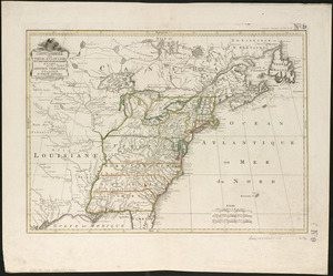
Amplissimae regionis Mississipi seu provinciae Ludovicianae â R.P. Ludovico Hennepin Francisc. Miss. in America septentrionali...
2.
Amplissimae regionis Mississipi seu Provinciae Ludovicianae â R.P. Ludovico Hennepin Francisc Miss in America Septentrionali...
3.
Carte de la Louisiane et du cours de Mississipi
4.
Carte de la Louisiane et du cours du Mississipi avec les colonies anglaises
5.
A map of Louisiana and of the River Mississipi
6.
An accurate map of the United States of America, with part of the surrounding provinces agreeable to the Treaty of Peace of 1783
7.
Bowles's new one-sheet map of the independent states of Virginia, Maryland, Delaware, Pensylvania, New Jersey, New York,...
8.
British dominions in America, drawn from the latest and best authorities
9.
Carte de la Louisiane cours du Mississipi et pais voisins : dediée à M. le Comte de Maurepas, ministre et secretaire d'etat...
10.
Carte du Mexique et des Etats Unis d'Amérique, partie meridionale
11.
Carte d'une partie de l'Amérique Septentrionale pour servir à l'intelligence du mémoire sur les prétentions des Anglois au...
12.
Carte generale des treize Etats Unis, de l'Amerique septentrionale
13.
Carte minéralogique, où l'on voit la nature des terreins du Canada et de la Louisiane
14.
Carte nouvelle de l'Amérique Angloise contenant tout ce que les Anglois possédent sur le continent de l'Amérique...
15.
Charte über die XIII Vereinigte Staaten von Nord-America
16.
A map of Canada and the north part of Louisiana with the adjacent countrys
17.
A Map of the British American plantations, extending from Boston in New England to Georgia : including all the back settlements...
18.
A map of the northern and middle states : comprehending the western territory & the British dominions in North America : from...
19.
Map of the United States exhibiting the post-roads, the situations, connections & distances of the post-offices, stage roads,...
20.
Map of the United States in North America : with the British, French and Spanish dominions adjoining, according to the treaty...
21.
A new map of North America
22.
A new map of the United States of North America with the British dominions on that continent &c
23.
Partie de l'Amérique septentrionale, qui comprend le cours de l'Ohio, la Nlle. Angleterre, la Nlle York, le New Jersey, la...
24.
States of America, drawn from the best authorities
25.
The United States of America with the British possessions of Canada, Nova Scotia, & of Newfoundland, divided with the French :...
26.
The United States of America with the British possessions of Canada, Nova Scotia, New Brunswick and Newfoundland divided with...
27.
The United States of North America : with the British & Spanish territories according to the treaty
28.
The United States of North America : with the British territories and those of Spain according to the treaty of 1784
29.
A new map of the western parts of Virginia, Pennsylvania, Maryland and North Carolina : comprehending the river Ohio, and all...
30.
Partie occidentale de la Virginie, Pensylvanie, Maryland, et Caroline septle. la Rivière d'Ohio, et toutes celles qui s'y...
31.
An accurate map of the English colonies in North America, bordering on the river Ohio
32.
An accurate map of the United States of America : according to the Treaty of Peace of 1783
33.
L'Amerique Septentrionale, ou se remarquent les Etats Unis
34.
BOWLES'S NEW POCKET MAP OF THE UNITED STATES OF AMERICA : WITH THE BRITISH POSSESSIONS OF CANADA, NOVA SCOTIA, AND OF...
35.
Carta della Nuova Inghilterra, Nuova Iork, e Pensilvania
36.
Carte du Canada et des Etats-Unis de l'Amérique Septentrionale
37.
Carte du theatre de la guerre presente en Amerique
38.
Carte du theatre de la guerre presente en Amerique
39.
Carte generale des colonies angloises dans l'Amerique Septentrionale pour l'intelligence de la guerre presente : d'apres des...
40.
Carte générale des Etats Unis de l'Amérique Septentrionale : renfermant aussi quelques provinces Angloises adjacentes
41.
Carte génerale des Etats-Unis de l'Amérique Septentrionale : divisée en ses 17 provinces
42.
Carte generale des treize Etats Unis, de l'Amerique septentrionale = Kaart van de dertien Verénigde Staaten, in Noord Amerika
43.
Carte réduite du nord des Etat-Unis avec l'intérieur du pays : pour servir à l'intelligence de cette histoire ; copieé par...
44.
A general map of the middle British colonies, in America : viz Virginia, Màriland, Dèlaware, Pensilvania, New-Jersey, New-York,...
45.
A general map of the middle British colonies, in America : viz Virginia, Màriland, Dèlaware, Pensilvania, New-Jersey,...
46.
Map for the interior travels through America : delineating the march of the army
47.
A map of the British and French dominions in North America : with the roads, distances, limits, and extent of the settlements,...
48.
A map of the United States of America, as settled by the peace of 1783
49.
A map of the United States of N. America
50.
A map of the United States of North America : drawn from a number of critical researches
‹ Prev
Next ›
1
2
3
4
5
…
163
164