Toggle navigation
LMEC Home
Exhibitions
Georeferencing
Tools for Teachers
Collections
My Favorites
Sign Up / Log In
Search
Search the map portal
Map Collection
Map Collection
Map Sets
Search
Search
Search for
Search In
All Fields
Creator
Title
Subject
Place
Search All Digital Collections
Advanced Search
107 Results
My Search
Start Over
new brunswick
Remove constraint new brunswick
Filter your Search
Place
North and Central America
87
Canada
80
Province of New Brunswick
35
United States
28
Maine
16
Nova Scotia
12
Saint John
9
Fort Beauséjour National Historic Park
8
more
Place
»
Topic
New Brunswick--Maps
9
Maine--Maps
7
Canada--Boundaries--United States--Maps
6
Coasts--New Brunswick--Maps
6
Fort Cumberland (N.B.)--Maps, Manuscript--Early works to 1800
6
New Brunswick--Maps--Early works to 1800
6
New England--Maps
6
Nova Scotia--Maps
6
more
Topic
»
Date
Date range begin
–
Date range end
Current results range from
1662
to
1992
View distribution
Creator
Amherst, Jeffery Amherst, Baron, 1717-1797
9
Royal United Services Institute for Defence and Security Studies
9
Des Barres, Joseph F. W. (Joseph Frederick Wallet), 1722-1824
8
George, III, King of Great Britain, 1738-1820
8
George, IV, King of Great Britain, 1762-1830
8
Bruce, Robert George
7
Parr, John, 1725-1791
6
United States. Hydrographic Office
6
more
Creator
»
Format
Maps/Atlases
107
Manuscripts
16
Objects/Artifacts
1
Georeferenced
Yes
5
No
102
Collection
Norman B. Leventhal Map Center Collection
59
American Revolutionary War-Era Maps
56
British Library Collection
17
Boston and New England Maps
13
Maritime Charts and Atlases
11
Library of Congress Collection
10
Urban Maps
10
William L. Clements Library Collection
9
more
Collection
»
Available to use
No known restrictions
58
Creative Commons license
33
Search Constraints
Sort by title
relevance
title
date (asc)
date (desc)
Number of results to display per page
50 per page
10
per page
20
per page
50
per page
100
per page
View results as:
grid view
map view
Search Results
1.
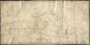
[A map of Nova Scotia showing the post roads]
2.
[A map showing the post route between the River St. Lawrence and the Bay of Fundy] : [on a scale of 5 1/3 miles to an inch.]
3.
[A map showing the post route between the River St. Lawrence and the Bay of Fundy] : [on a scale of 5 1/3 miles to an inch.]
4.
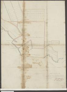
The above plan is a discription of a new township called Royalsborough in the county of Cumberland : bounded southeasterly on...
5.
[Acadie, Isle Saint Jean and part of Isle Royale with the Baye Francoise]
6.
Buctouche, New Brunswick
7.
Carte du theatre de la guerre presente en Amerique
8.
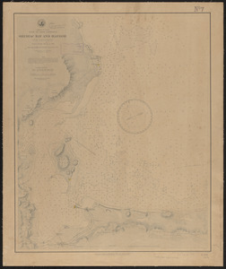
Chart of Passamaquoddy Bay and Grand Manan Island, New Brunswick
9.
Chart of the Bay of Fundy from Machias Bay to 64°35' west longitude
10.
A chart of the North-American coast, for the navigation between Halifax and Philadelphia
11.
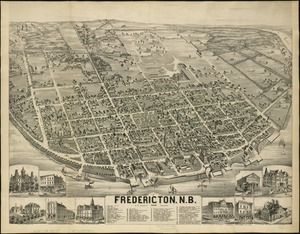
City of Fredericton, N.B
12.
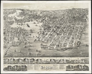
The city of St. John : New Brunswick
13.
Coal fields of Nova Scotia and New Brunswick
14.
The coast from St. Johns, New Brunswick, to Goldsborough Bay, Maine
15.
Dominion of Canada, Gulf of Saint Lawrence, Shediac Bay and Harbor (New Brunswick) : from a British survey in 1885
16.
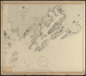
Dominion of Canada, New Brunswick, L'Etang Harbor (Bay of Fundy) : from a British survey in 1847
17.
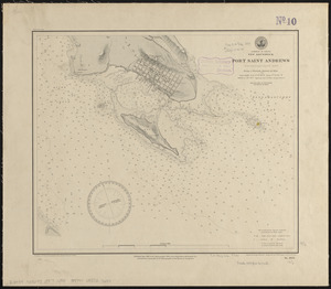
Dominion of Canada, New Brunswick, Port Saint Andrews (Passamaquoddy Bay) : from a British survey in 1844
18.
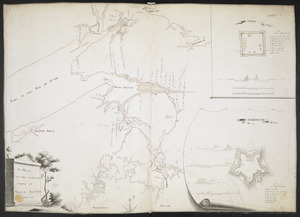
Draught of the River Pittquioyack in the Bay of Fundy 1758
19.
The environs of Fort Cumberland in the Bay of Fundy
20.
An exact map of Nova Scotia, Newfoundland, gulf and river St. Laurence, and coast of Labrador from the latest observations 1777
21.
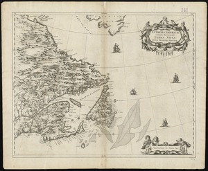
Extrema Americae versus Boream, ubi Terra Nova, Nova Francia, adjacentiaque
22.
Fitz globe
23.
Frank Leslie's war maps and companion to the newspaper
24.
G. Woolworth Colton's railroad, township & distance map of New England : with adjacent portions of New York, Canada & New...
25.
G. Woolworth Colton's railroad, township & distance map of New England with adjacent portions of New York, Canada & New Brunswick
26.
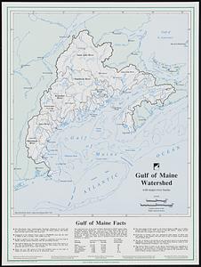
Gulf of Maine watershed : with major river basins
27.
The harbours of Rishibucto & Buctush : on the west shore of the Gulph of St. Lawrence
28.
Lloyd's new map of the United States, the Canadas, and New Brunswick, from the latest surveys showing every railroad & station...
29.
A map & chart of the bays harbours post roads and settlements in Passamaquoddy & Machias with the large island of Grand Manan
30.
Map of Nova Scotia, or Acadia : with the islands of Cape Breton and St. John's, from actual surveys
31.
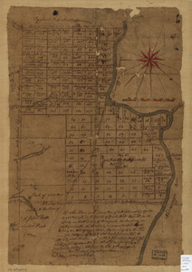
[Map of the area along the Saint Croix River in Maine and New Brunswick]
32.
Map of the boundary lines between the United States and the adjacent British provinces from the mouth of the River St. Croix to...
33.
Map of the County of Middlesex, New Jersey
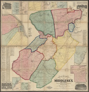
34.
Map of the disputed territory with the boundaries claimed by Maine & Great Britain and that proposed by the King of the...
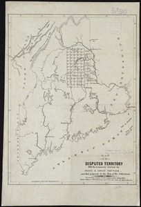
35.
Map of the disputed territory,with a full description
36.
A map of the New England states : Maine, New Hampshire, Vermont, Massachusetts, Rhode Island & Connecticut, with the adjacent...
37.
A map of the New England states : Maine, New Hampshire, Vermont, Massachusetts, Rhode Island & Connecticut, with the adjacent...
38.
Map of the northern part of the state of Maine and of the adjacent British provinces : shewing the portion of that state to...
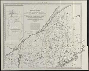
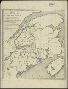
39.
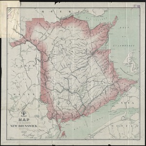
Map of the province of New Brunswick
40.
Map of the province of Nova Scotia including Cape Breton Prince Edwards Island and part of New Brunswick
41.
Map of the state of Maine : exhibiting the disputed territory in connexion with the adjacent British provinces of N. Brunswick...
42.
Map of the state of Maine with the province of New Brunswick
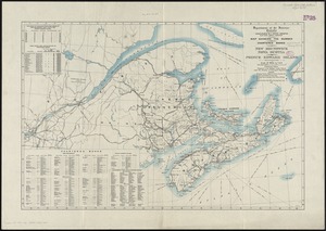
43.
A MAP OF THE SURVEYED PARTS OF NOVA SCOTIA MDCCLVI
44.
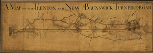
A Map of the Trenton and New-Brunswick Turnpike-road
45.
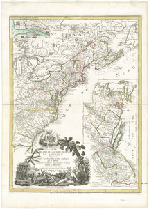
A map of the United States and Canada, New-Scotland, New-Brunswick and New-Foundland = Carte des Etats-Unis avec le Canada, la...
46.
Map of the United States of North America, upper & lower Canada, New Brunswick, Nova Scotia & British Columbia, Mexico, Cuba,...
47.
Map showing land grants to the east of St. John
48.
Map showing the number of chartered banks in New Brunswick, Nova Scotia, and Prince Edward Island
49.
McMillan's map of New Brunswick, 1867
50.
Miramichi Bay
‹ Prev
Next ›
1
2
3
![[A map of Nova Scotia showing the post roads]](https://bpldcassets.blob.core.windows.net/derivatives/images/commonwealth:hx11z494j/image_thumbnail_300.jpg)
![[A map showing the post route between the River St. Lawrence and the Bay of Fundy]](https://bpldcassets.blob.core.windows.net/derivatives/images/commonwealth:hx11z4963/image_thumbnail_300.jpg)
![[A map showing the post route between the River St. Lawrence and the Bay of Fundy]](https://bpldcassets.blob.core.windows.net/derivatives/images/commonwealth:hx11z498n/image_thumbnail_300.jpg)
![[Acadie, Isle Saint Jean and part of Isle Royale with the Baye Francoise]](https://bpldcassets.blob.core.windows.net/derivatives/images/commonwealth:hx11z490f/image_thumbnail_300.jpg)


![[Map of the area along the Saint Croix River in Maine and New Brunswick]](https://bpldcassets.blob.core.windows.net/derivatives/images/commonwealth:6108vt00n/image_thumbnail_300.jpg)