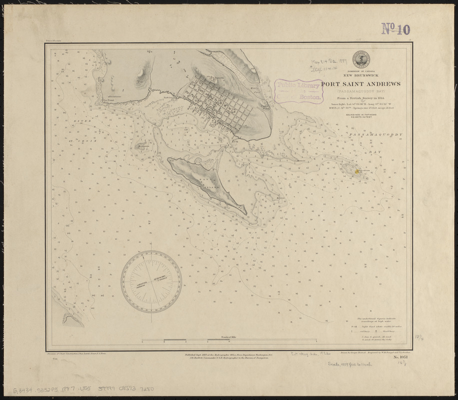
Dominion of Canada, New Brunswick, Port Saint Andrews (Passamaquoddy Bay) : from a British survey in 1844
Item Information
- Title:
- Dominion of Canada, New Brunswick, Port Saint Andrews (Passamaquoddy Bay) : from a British survey in 1844
- Title (alt.):
-
Port Saint Andrews (Passamaquoddy Bay)
- Issuing body:
- United States. Hydrographic Office
- Engraver:
- Dougal, W. M. (William M.)
- Draftsman:
- Noetzel, G. (Gregor)
- Engraver:
- Ourdan, V. L. (Vincent L.)
- Name on Item:
-
drawn by Gregor Noetzel ; engraved by W.M. Dougal and V.L. Ourdan
- Date:
-
1887
- Format:
-
Maps/Atlases
- Location:
-
Boston Public Library
Norman B. Leventhal Map & Education Center - Collection (local):
-
Norman B. Leventhal Map & Education Center Collection
- Subjects:
-
Harbors--New Brunswick--St. Andrews--Maps
Nautical charts--New Brunswick--St. Andrews
St. Andrews (N.B.)--Maps
- Places:
-
CanadaProvince of New Brunswick (province)Saint Andrews
- Extent:
- 1 map : hand colored ; 34 x 41 cm
- Terms of Use:
-
No known copyright restrictions.
No known restrictions on use.
- Publisher:
-
Washington, D.C. :
Hydrographic Office
- Scale:
-
Scale approximately 1:18,600
- Language:
-
English
- Notes:
-
Relief shown by hachures and spot heights. Depths shown by soundings and form lines.
- Identifier:
-
06_01_015541
- Call #:
-
G9096.P5 svar .U55
- Barcode:
-
39999085937280


