Search Constraints
Search Results


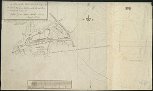
![[Plan of channels and flats as they were before the 200 feet outside of the Mill Dam was filled up]](https://bpldcassets.blob.core.windows.net/derivatives/images/commonwealth:b8516207x/image_thumbnail_300.jpg)
![[Plan of boundary lines in Roxbury and the City of Boston]](https://bpldcassets.blob.core.windows.net/derivatives/images/commonwealth:1257bb127/image_thumbnail_300.jpg)


219. Plan of Boston


228. Map of Dorchester


231. Plan of Charlestown

232. Plan of Charlestown


234. Plan of Dorchester


239. Roxbury


241. Plan of Boston


![[Plan of lots in Chinatown (Boston), between Avery and Eliot Streets, and Tremont Street and Harrison Avenue]](https://bpldcassets.blob.core.windows.net/derivatives/images/commonwealth:cj82kz565/image_thumbnail_300.jpg)


![[An unfinished tracing of Joshua Fisher's copy on parchment of Oliver's paper plat of land in Dorchester, made in 1661]](https://bpldcassets.blob.core.windows.net/derivatives/images/commonwealth:wd376179d/image_thumbnail_300.jpg)


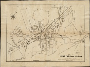
261. Hyde Park


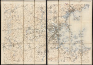
![[Map of Boston and vicinity]](https://bpldcassets.blob.core.windows.net/derivatives/images/commonwealth:9s161d374/image_thumbnail_300.jpg)
![[Map of Boston and vicinity]](https://bpldcassets.blob.core.windows.net/derivatives/images/commonwealth:wd376691q/image_thumbnail_300.jpg)


276. Map of Massachusetts


279. Map of West Roxbury


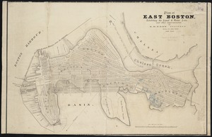

284. Plan of East Boston

285. Plan of South Boston


288. South Boston

289. Map of Boston Harbor


