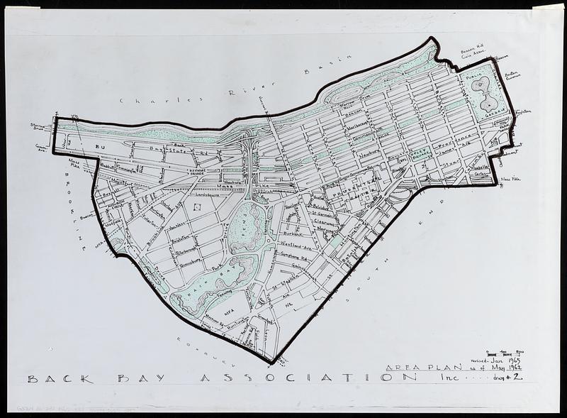
Area plan as of May 1962
Item Information
- Title:
- Area plan as of May 1962
- Cartographer:
- Back Bay Association Inc.
- Date:
-
[2000–2009]
- Format:
-
Maps/Atlases
- Location:
-
Boston Public Library
Norman B. Leventhal Map & Education Center - Collection (local):
-
Norman B. Leventhal Map & Education Center Collection
- Subjects:
-
Back Bay (Boston, Mass.)--Maps
Fenway (Boston, Mass.)--Maps
- Places:
-
MassachusettsSuffolk (county)BostonBack Bay
MassachusettsSuffolk (county)BostonFens
- Extent:
- 1 map : color ; 46 x 64 cm
- Terms of Use:
-
No known copyright restrictions.
No known restrictions on use.
- Scale:
-
Scale approximately 1:6,800
- Language:
-
English
- Notes:
-
Reproduction of a map showing the Back Bay and Fenway areas.
"Drwg #2."
- Notes (date):
-
This date is inferred.
- Notes (exhibitions):
-
Exhibited: "More or less in common: environment and justice in the human landscape," organized by Leventhal Map & Education Center at the Boston Public Library, 2022.
- Identifier:
-
06_01_018279
- Call #:
-
G3764.B6:2B2 1965 .B33
- Barcode:
-
39999065704387


