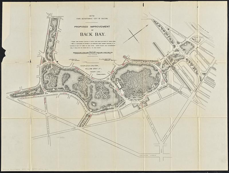
Proposed improvement of Back Bay
Item Information
- Title:
- Proposed improvement of Back Bay
- Cartographer:
- Olmsted, Frederick Law, 1822-1903
- Issuing body:
- Boston (Mass.). Department of Parks
- Contributor:
- Boston Water Power Company
- Name on Item:
-
Park Department, City of Boston ; F.L. Olmsted, landscape architect ; J.R. Davis, city engineer ; Walter Stranders, draughtsman
- Date:
-
[1880]
- Format:
-
Maps/Atlases
- Location:
-
Boston Public Library
Norman B. Leventhal Map & Education Center - Collection (local):
-
Norman B. Leventhal Map & Education Center Collection
- Subjects:
-
Back Bay (Boston, Mass.)--Maps
Fenway (Boston, Mass.)--Maps
City planning--Massachusetts--Boston--Maps
- Places:
-
MassachusettsSuffolk (county)BostonBack Bay
- Extent:
- 1 map : color ; sheet 61 x 82 cm
- Terms of Use:
-
No known copyright restrictions.
No known restrictions on use.
- Publisher:
-
[Boston] :
[Rockwell and Churchill]
- Scale:
-
Scale 1:2,400
- Language:
-
English
- Notes:
-
From: Annual report of the Boston Water-Power Company for the year ending March 31, 1880.
Shows Back Bay Fens from Charles River to Huntington Ave. and Brookline Ave.
Relief shown by spot heights.
Oriented with north toward the upper right.
- Notes (date):
-
This date is inferred.
- Identifier:
-
06_01_018784
- Call #:
-
G3764.B6:2F4G52 1879 .O46
- Barcode:
-
39999085969671


