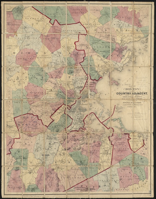
Map of Boston and the country adjacent, from actual surveys
Item Information
- Title:
- Map of Boston and the country adjacent, from actual surveys
- Creator:
- Walling, Henry Francis, 1825-1888
- Name on Item:
-
by H.F. Walling ; engraved by D. Griffing.
- Date:
-
1872
- Format:
-
Maps/Atlases
- Location:
-
Boston Public Library
Norman B. Leventhal Map & Education Center - Collection (local):
-
Norman B. Leventhal Map & Education Center Collection
- Subjects:
-
Boston (Mass.)--Maps
Massachusetts--Maps
- Places:
-
MassachusettsSuffolk (county)Boston
- Extent:
- 1 map : col. ; 102 x 78 cm.
- Terms of Use:
-
No known copyright restrictions.
No known restrictions on use.
- Publisher:
-
Boston, Mass :
E.P. Dutton & Co.
- Scale:
-
Scale 1:63,630.
- Language:
-
English
- Notes:
-
Relief shown by hachures.
"Entered according to Act of Congress in the year 1867 by E.P. Dutton & Co. in the Clerk's Office of the District Court for the District of Massachusetts."
- Identifier:
-
06_01_003762
- Call #:
-
G3764.B6 1872 .W35
- Barcode:
-
39999059001972


![[Boston and Northwestern Junction Railroad]](https://bpldcassets.blob.core.windows.net/derivatives/images/commonwealth:x059cc74n/image_thumbnail_300.jpg)

