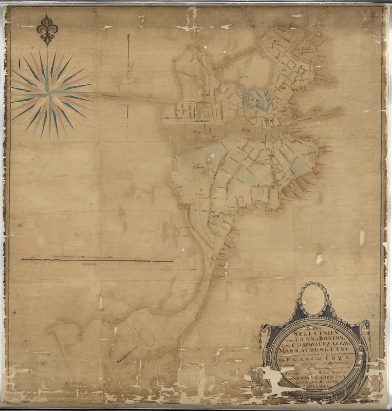
To the select-men of the town of Boston, in the Commonwealth of Massachusetts; ever distinguished for their zeal for the good of their constituents : this plan of said town, is with due deference most humbly dedicated, being made from an actual survey, carefully taken by their most obedient humble servant
This map is also available in American Revolutionary Geographies Online (ARGO), a collections portal especially built for material relating to the American Revolutionary War Era. Visit ARGO to learn more about this item and explore the historical geography of North America in the late eighteenth century.
Item Information
- Title:
- To the select-men of the town of Boston, in the Commonwealth of Massachusetts; ever distinguished for their zeal for the good of their constituents : this plan of said town, is with due deference most humbly dedicated, being made from an actual survey, carefully taken by their most obedient humble servant
- Title (alt.):
-
Town of Boston
- Cartographer:
- Carleton, Osgood, 1742-1816
- Name on Item:
-
Osgood Carleton annoque domini MDCCXCV
- Date:
-
1795
- Format:
-
Maps/Atlases
- Genre:
-
Manuscript maps
- Location:
-
Boston Public Library
Norman B. Leventhal Map & Education Center - Collection (local):
-
Norman B. Leventhal Map & Education Center Collection
- Subjects:
-
Boston (Mass.)--Maps
- Places:
-
MassachusettsSuffolk (county)Boston
- Extent:
- 1 manuscript map : hand color ; 213 x 199 cm
- Terms of Use:
-
No known copyright restrictions.
No known restrictions on use.
- Scale:
-
Scale approximately 1:2,000
- Language:
-
English
- Notes:
-
Manuscript map in ink and watercolor.
Decorative title cartouche.
Shows streets and wards.
- Identifier:
-
06_01_018499
- Call #:
-
G3764.B6 1795 .C37
- Barcode:
-
39999085964987


