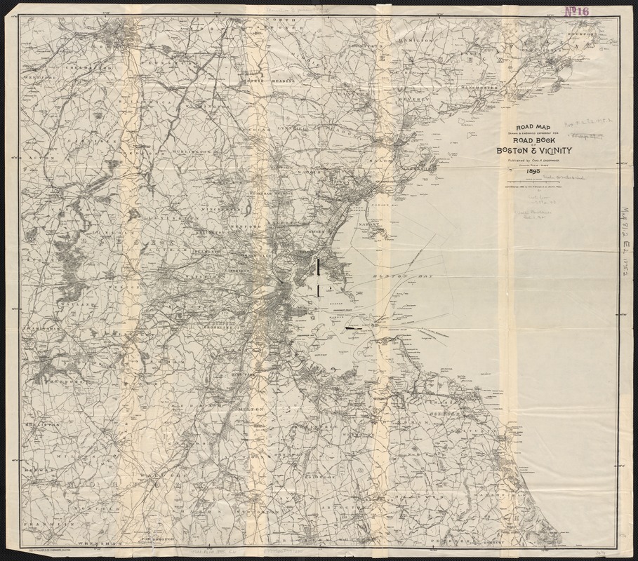
Road map, drawn & engraved expressly for Road book of Boston & vicinity
Item Information
- Title:
- Road map, drawn & engraved expressly for Road book of Boston & vicinity
- Date:
-
1895
- Format:
-
Maps/Atlases
- Location:
-
Boston Public Library
Norman B. Leventhal Map & Education Center - Collection (local):
-
Norman B. Leventhal Map & Education Center Collection
- Subjects:
-
Boston (Mass.)--Maps
Massachusetts--Maps
- Places:
-
MassachusettsSuffolk (county)Boston
- Extent:
- 1 map : col. ; 70 x 78 cm.
- Terms of Use:
-
No known copyright restrictions.
No known restrictions on use.
- Publisher:
-
Jamaica Plain, Mass :
Chas. A. Underwood
- Scale:
-
Scale 1:95,000.
- Language:
-
English
- Notes:
-
Relief shown by spot heights.
"Copyrighted 1892 by Geo. H. Walker & Co., Boston, Mass."
- Identifier:
-
06_01_003037
- Call #:
-
G3764.B6P2 1895 .R6
- Barcode:
-
39999058997295


![[Boston and Northwestern Junction Railroad]](https://bpldcassets.blob.core.windows.net/derivatives/images/commonwealth:x059cc74n/image_thumbnail_300.jpg)

