Toggle navigation
LMEC Home
Exhibitions
Georeferencing
Tools for Teachers
Collections
My Favorites
Sign Up / Log In
Search
Search the map portal
Map Collection
Map Collection
Map Sets
Search
Search
Search for
Search In
All Fields
Creator
Title
Subject
Place
Search All Digital Collections
Advanced Search
8185 Results
My Search
Start Over
More Like
commonwealth:x633f9935
Remove constraint More Like: commonwealth:x633f9935
Filter your Search
Place
North and Central America
4,934
United States
3,624
Suffolk (county)
1,026
Boston
999
Europe
963
Canada
428
France
269
Massachusetts
249
more
Place
»
Topic
Boston (Mass.)--Maps
574
United States--Maps
270
Real property--Massachusetts--Boston--Maps
174
Massachusetts--Maps
160
Landowners--Massachusetts--Boston--Maps
132
North America--Maps--Early works to 1800
103
New England--Maps
99
Europe--Maps
78
more
Topic
»
Date
Date range begin
–
Date range end
Current results range from
1482
to
2023
View distribution
Creator
United States. Hydrographic Office
357
O.H. Bailey & Co
148
Des Barres, Joseph F. W. (Joseph Frederick Wallet), 1722-1824
123
United States. Post Office Dept
120
Ptolemy, 2nd cent
100
Walling, Henry Francis, 1825-1888
94
Jefferys, Thomas, -1771
84
Geological Survey (U.S.)
81
more
Creator
»
Format
Maps/Atlases
8,126
Manuscripts
215
Prints
51
Books
36
Objects/Artifacts
10
Drawings/Illustrations
9
Posters
4
Georeferenced
Yes
870
No
7,315
Collection
Norman B. Leventhal Map Center Collection
8,163
Boston and New England Maps
2,184
Urban Maps
1,925
Maritime Charts and Atlases
750
American Revolutionary War-Era Maps
638
Boston Redevelopment Authority Collection
86
William L. Clements Library Collection
21
American Antiquarian Society Collection
1
Available to use
No known restrictions
8,022
Creative Commons license
46
Search Constraints
Sort by relevance
relevance
title
date (asc)
date (desc)
Number of results to display per page
50 per page
10
per page
20
per page
50
per page
100
per page
View results as:
grid view
map view
Search Results
1.
Fowler's new map of the Hudson River : with a description of the adjoining country : the distances of the different towns, &c....
2.
A new map of the Hudson River : the post roads between N. York & Albany, the northern and western canals, &c., &c
3.
Willard's new map of the Hudson River
4.
[Willard's new map of the Hudson River for 1844]
5.
Map and profile of the Champlain Canal as made from Lake Champlain to the Hudson River and surveyed thence to the tide at...
6.
Carte pour servir à l'itinéraire pittoresque du fleuve Hudson et des parties latérales de l'Amerique du Nord
7.
Map of the state of New York
8.
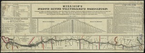
Morrison's North River traveller's companion : containing a map of the Hudson River, with a description of the adjoining...
9.
Map of the Hudson River Rail Road from New York to Albany
10.
Distances North River
11.
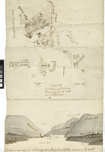
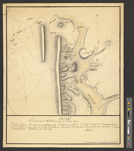
Geographick scetch [sic], 1754
12.
Hudson River from Anthony's Nose to Stony Point
13.
Hudson River from Peekskill to Slaughters Landing
14.
Hudson River from Stony Point to West Point
15.
Hudson River from West Point to Dobbs Ferry
16.
Hudson River highlands at Martelaers Rock
17.
Hudson's River from New York to Albany
18.
Hudson's River from Stony Pt. to Fort Montgomery
19.
Lent's Creek and Baillies Creek
20.
Map from Albany to Crown Point
21.
Map of North River from Stoney Point to Peeks Kill
22.
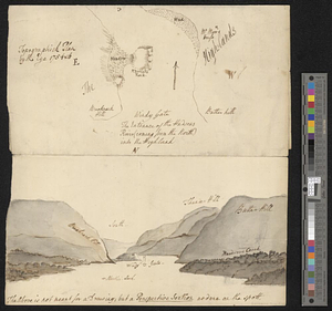
Moore's sketch of the navigation of the Highlands
23.
Part of the modern counties of Dutchess, Putnam, and Westchester
24.
Plan des environs de West Point jusqu'au Croton River... : Morrishous ce 14me Juin 1779
25.
The provinces of New York, and New Jersey, : with part of Pensilvania [sic], and the province of Quebec
26.
The seat of action between the British and American forces or an authentic plan of Staten Island with the neighbouring...
27.
The seat of action, between the British and American forces or an authentic plan of the western part of Long Island, with the...
28.
Topographick plan by the eye, 1754 & 6
29.
Valley of the Hudson River from Fishkill to Teller's Point
30.
Verplanks
31.
West Point; or Fort Defiance
32.
The 100th anniversary map of Abraham Lincoln's visit to Massachusetts, September 11-23, 1848
33.
1630 shoreline
34.
1879. Progress map of the U.S. Geographical Surveys west of the 100th Meridian : prepared under the direction of 1st Lieut....
35.
1903 Map of Salem and surrounding places
36.
19th annual convention of the National Association of Real Estate Boards : at Tulsa, June 7 to June 11 in 1926
37.
2005 significant U.S. hurricane strikes
38.
The 2100 project : an atlas for the Green New Deal
39.
227 Harzgerode
40.
305 Glatz
41.
38,000,000 escaped -- 10,000,000 died
42.
4 Kinten
43.
660 Wakulah St., Roxbury
44.
[A chart of Boston Bay and vicinity]
45.
[A chart of New York Island & North River : East River, passage through Hell Gate, Flushing Bay, Hampstead Bay, Oyster,...
46.
The A.A.A. key road map of continental Europe
47.
Aaron Bohrod's America, its history
48.
ABC pathfinder railway guide map : eastern division
49.
Abolition of Slavery, 1863
50.
Aboriginal map of North America, denoting the boundaries and the locations of various Indian tribes
‹ Prev
Next ›
1
2
3
4
5
…
163
164


![[Willard's new map of the Hudson River for 1844]](https://bpldcassets.blob.core.windows.net/derivatives/images/commonwealth:b8516310f/image_thumbnail_300.jpg)


![Geographick scetch [sic], 1754](https://bpldcassets.blob.core.windows.net/derivatives/metadata/commonwealth-oai:pk02h894n/image_thumbnail_300.jpg)


![[A chart of Boston Bay and vicinity]](https://bpldcassets.blob.core.windows.net/derivatives/images/commonwealth:cj82m2976/image_thumbnail_300.jpg)


