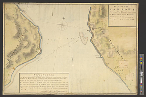
The seat of action, between the British and American forces or an authentic plan of the western part of Long Island, with the engagement of the 27th August 1776 between the king's forces and the Americans : containing also Staten Island, and the environs of Amboy and New York, with the course of Hudson's River, from Courtland the great magazine of the American army to Sandy Hook

This map is also available in American Revolutionary Geographies Online (ARGO), a collections portal especially built for material relating to the American Revolutionary War Era. Visit ARGO to learn more about this item and explore the historical geography of North America in the late eighteenth century.
Item Information
- Title:
- The seat of action, between the British and American forces or an authentic plan of the western part of Long Island, with the engagement of the 27th August 1776 between the king's forces and the Americans : containing also Staten Island, and the environs of Amboy and New York, with the course of Hudson's River, from Courtland the great magazine of the American army to Sandy Hook
- Title (alt.):
-
Road from Amboy to Philadelphia
- Contributor:
- Robert Sayer and John Bennett (Firm)
- Creator:
- Holland, Samuel, 1728-1801
- Name on Item:
-
from the surveys of Major Holland
- Date:
-
October 22, 1776
- Format:
-
Maps/Atlases
- Location:
- William L. Clements Library
- Collection (local):
-
William L. Clements Library Collection
- Subjects:
-
Long Island, Battle of, New York, N.Y., 1776--Maps
New York (N.Y.)--Maps
Staten Island (New York, N.Y.)--Maps
New York Harbor (N.Y. and N.J.)--Maps
Hudson River (N.Y. and N.J.)--Maps
United States--History--Revolution, 1775-1783--Maps
- Places:
-
New YorkNew York
New YorkRichmond (county)Staten Island (island)
Hudson River
- Extent:
- 1 map : col. ; 45 x 40 cm
- Terms of Use:
-
The University of Michigan Library provides access to these materials for educational and research purposes. These materials may be under copyright. If you decide to use any of these materials, you are responsible for making your own legal assessment and securing any necessary permission. If you have questions about the collection, please contact the William L. Clements Library.
Contact host institution for more information.
- Publisher:
-
London :
Printed for Robt. Sayer and Jno. Bennett, map and sea chartsellers, no. 53 Fleet Street, as the act directs
- Scale:
-
Scale [ca. 1:225,000].
- Language:
-
English
- Catalog Record:
-
Catalog record
- Notes:
-
Shows movements of troops during the Battle of Long Island.
- Identifier:
-
8358
- Barcode:
-
B1936334