Toggle navigation
LMEC Home
Exhibitions
Georeferencing
Tools for Teachers
Collections
My Favorites
Sign Up / Log In
Search
Search the map portal
Map Collection
Map Collection
Map Sets
Search
Search
Search for
Search In
All Fields
Creator
Title
Subject
Place
Search All Digital Collections
Advanced Search
334 Results
My Search
Start Over
More Like
commonwealth:j3860823c
Remove constraint More Like: commonwealth:j3860823c
Filter your Search
Place
North America
170
North and Central America
150
New England
94
United States
63
Canada
28
Massachusetts
23
Middle Atlantic
22
New York
15
more
Place
»
Topic
North America--Maps--Early works to 1800
180
New England--Maps--Early works to 1800
91
Middle Atlantic States--Maps--Early works to 1800
20
Canada--Maps--Early works to 1800
15
Great Britain--Colonies--America--Maps--Early works to 1800
15
United States--Maps--Early works to 1800
14
World maps--Early works to 1800
13
America--Maps--Early works to 1800
12
more
Topic
»
Date
Date range begin
–
Date range end
Current results range from
1482
to
1999
View distribution
Creator
Jefferys, Thomas, -1771
16
Mitchell, John, 1711-1768
13
Sayer, Robert, 1725-1794
13
Moll, Herman, d. 1732
11
Jefferys, Thomas, d. 1771
10
Anville, Jean Baptiste Bourguignon d', 1697-1782
9
Bellin, Jacques Nicolas, 1703-1772
7
Hinton, John, -1781
6
more
Creator
»
Format
Maps/Atlases
334
Manuscripts
3
Books
1
Georeferenced
Yes
20
No
314
Collection
American Revolutionary War-Era Maps
174
Norman B. Leventhal Map Center Collection
171
Sidney R. Knafel Map Collection at Phillips Academy
87
New York Public Library Collection
35
Boston and New England Maps
31
Mapping Boston Collection
31
Richard H. Brown Revolutionary War Map Collection at Mount Vernon
24
Maritime Charts and Atlases
10
more
Collection
»
Available to use
No known restrictions
144
Creative Commons license
98
Search Constraints
Sort by date (asc)
relevance
title
date (asc)
date (desc)
Number of results to display per page
100 per page
10
per page
20
per page
50
per page
100
per page
View results as:
grid view
map view
Search Results
1.
The world
2.
Garden of Eden
3.
Secunda etas mundi = Secunda etas mũdi
4.
Map of the Caribbean Area
5.
World map
6.
Generale Ptholemei
7.
Orbis typus uniuersalis iuxta hydrographorum traditionem
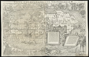
8.
Tipus orbis uniuersalis iuxta Ptolomei cosmographi traditionem et Americi Vespucii alior[um]que
9.
Praeclara Ferna[n]di Cortesii de Noua maris Oceani Hyspania Narratio . . .
10.
Oceani occidetalis seu terre nove tabula
11.
Oval map of the world
12.
Scandinavia
13.
Terra de Lavoratore
14.
Typus cosmographicus uniuersalis
15.
Nova, et integra universi orbis descriptio
16.
Novae insulae XVII, nova tabula
17.
Carta marina nova tabula
18.
Tierra nveva
19.
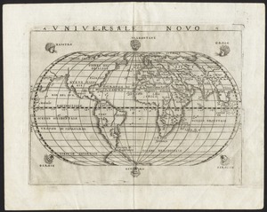
Universale novo
20.
Universalis de terrao orarium ex vera recen [...] traditione
21.
Atlantic Ocean
22.
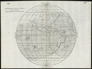
Universale della parte del mondo nuovamente ritrovata
23.
Herbipolis occidens Wurtzpurg
24.
Tierra nueua
25.
La Nuoua Francia
26.
Americae siue noui orbis, noua descriptio
27.
Quarte partie du monde
28.
La heroike enterprinse faict par le Signeur Draeck d'avoir cirquit toute la terre
29.
Pars Prima. Speculum Nauticum super navigatione maris Occidentalis confectum, continens omnes oras maritimas Gallia, Hispaniae...
30.
Americae siue noui orbis, noua descriptio
31.
Americae pars Borealis, Florida, Baccalaos, Canada, Corterealis
32.
America sive India Nova : ad magnae Gerardi Mercatoris aui universalis imitationem in compendium redacta
33.
America sive novvs orbis respectv Evropaeorvm inferior globi terrestris pars
34.
America sive novvs orbis respectv Evropaeorvm inferior globi terrestris pars
35.
Norumbega et Virginia
36.
Orbis terrae compendiosa descriptio : quam ex magna universali Gerardi Mercatoris Domino Richardo Gartho, geographie ac...
37.
Typus orbis terrarum
38.
Maris Pacifici (quod vulgo Mar del Zur) cum regionibus circumiacentibus, insulisque in eodem passim sparsis, novissima descriptio
39.
Theatro del mondo di Abrahamo Ortelio : da lui poco inanzi la sua morte riueduto, & di tauole nuoue, et commenti adorno, &...
40.
Carte geographique de la Nouvelle Franse
41.
New England : die mercklichsten dheile, also genennet durch den durchl: und mechtigen Prinzen und h.h. Carolus, Prinzen von...
42.
Virginia et Nova Francia
43.
New England : the most remarqueable parts thus named by the high and mighty Prince Charles, prince of great Britaine
44.
New France, New Englande, New Scotlande, and New Foundlande
45.
The north part of America : conteyning Newfoundland, new England, Virginia, Florida, new Spaine, and Noua Francia wth ye rich...
46.
The north part of America : conteyning Newfoundland, new England, Virginia, Florida, new Spaine, and Noua Francia wth ye rich...
47.
America
48.
Nova Anglia, Novum Belgium et Virginia
49.
Septentrionalium terrarum descriptio
50.
Carte de la Nouuelle France, augmentée depuis la derniere, seruant a la navigation faicte en son vray Meridien
51.
The south part of New England as it planted this yeare, 1634
52.
New England : the most remarqueable parts thus named by the high and mighty Prince Charles, nowe King of great Britaine
53.
Nova Belgica et Anglia Nova
54.
Noua Anglia, Nouum Belgium, et Virginia
55.
America septentrionalis
56.
Nova Anglia Novum Belgium et Virginia
57.
New Englands prospect : A true, lively, and experimentall description of that part of America, commonly called New England:...
58.
The south part of New England, as it planted this yeare, 1639
59.
America Septentrionalis
60.
Carta particolare della nuoua Belgia è parte della nuoua Anglia
61.
Nova Belgica et Anglia Nova
62.
Belgii Novi, Angliae Novae, et partis Virginiae : novissima delineatio
63.
Novi Belgii, Novaeque Angliae nec non partis Virginiae tabula
64.
Le Canada, ou Nouvelle France, &c : ce qui est le plus advance vers le Septentrion est tiré de diverses relations des Anglois,...
65.
Le Nouveau Mexique et la Floride : tirées de diverses cartes, et relations
66.
Novi Belgii Novaeqve Angliae nec non partis Virginiae Tabula
67.
Noua et accurata totius Americae tabula
68.
Noui Belgii Nouaeque Angliae nec non partis Virginiae tabula
69.
Pas caert van Nieu Nederland, Virginia en Nieu Engelant
70.
America : with those known parts in that unknowne worlde both people and manner of buildings discribed and inlarged
71.
L'Atlas de mer ou monde aquatique, remontrant toutes les côtes de la mer, a scavoir de la partie connuë de I'Univers, avec une...
72.
Pas-caert van Terra Nova, Nova Francia, Nieuw-Engeland en de groote rivier van Canada
73.
A chart of the province of New England, with the soundings on the coast; drawn about 1670, on a scale of 1 2/3 English league...
74.
Novissima et accuratissima totius Americae descriptio
75.
Mexicum in hac forma in lucem
76.
Pas caerte van Nieu Nederlandt en de Engelsche Virginies van Cabo Cod tot Cabo Canrick
77.
Paskaerte van Nova Granada en t'Eylandt California
78.
Costes et rivieres de Virginie, de Mariland, et de Nouvelle Angletere
79.
A chart of the coast of America from New found Land to Cape Cod
80.
A mapp of New England
81.
Pascaert van Nieu Nederland van Hendrick Christiaens Eijland tot staten hoeck of Cabo Cod
82.
Pascaerte van Terra Nova Nova Francia Nievw Engeland En de Groote Revier van Canada
83.
A map of New England and New York
84.
A map of New-England, being the first that ever was here cut, and done by the best pattern that could be had, which being in...
85.
A map of New-England, being the first that ever was here cut, and done by the best pattern that could be had, which being in...
86.
A map of New-England, being the first that ever was here cut, and done by the best pattern that could be had, which being in...
87.
New England and New York
88.
North America, divided into its principall parts where are distinguished the severall states which belong to the English,...
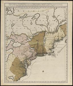
89.
Carte de la Nouuelle France et de la Louisiane nouuellement découuerte : dediée au Roy l'an 1683
90.
Pas-kaart vande zee kusten inde boght van Niew Engeland : tusschen de staaten Hoek en C. de Sable
91.
North America divided into its III principall parts : 1st English part viz. English Empire containing ye Articklands near...
92.
A new map of New England, New York, New Iarsey, Pensilvania, Maryland and Virginia
93.
[A map of the east coast of America from Newfoundland to the Bay of Honduras]
94.
Nouvelle Angleterre et Nouvel York
95.
Pas-caert van Nieu Nederland, Virginia, Nieu Engeland als mede Penn-silvania, met de stad Philadelfia van Baston tot Carrik = a...
96.
A new mapp of New England and Annapolis and the countrys adjacent
97.
America Settentrionale : colle nuove scoperte fin alle' anno 1688 divisa nelle sue partu secondo lo stato presente
98.
Amerique septentrionale divisée en ses principale parties
99.
Amerique septentrionale divisée en ses principales parties : ou sont distingués les uns des autres les etats suivant quils...
100.
Nova tabula geographica complectens borealiorem Americae partem : in qua exacte delineatae sunt Canada sive Nova Francia, Nova...
‹ Prev
Next ›
1
2
3
4


![Tipus orbis uniuersalis iuxta Ptolomei cosmographi traditionem et Americi Vespucii alior[um]que](https://bpldcassets.blob.core.windows.net/derivatives/images/commonwealth:j3860806q/image_thumbnail_300.jpg)
![Praeclara Ferna[n]di Cortesii de Noua maris Oceani Hyspania Narratio . . .](https://bpldcassets.blob.core.windows.net/derivatives/images/commonwealth:zk51wc44m/image_thumbnail_300.jpg)


![Universalis de terrao orarium ex vera recen [...] traditione](https://bpldcassets.blob.core.windows.net/derivatives/images/commonwealth:hq37vv39x/image_thumbnail_300.jpg)


![[A map of the east coast of America from Newfoundland to the Bay of Honduras]](https://bpldcassets.blob.core.windows.net/derivatives/images/commonwealth:hx11z584h/image_thumbnail_300.jpg)