Toggle navigation
LMEC Home
Exhibitions
Georeferencing
Tools for Teachers
Collections
My Favorites
Sign Up / Log In
Search
Search the map portal
Map Collection
Map Collection
Map Sets
Search
Search
Search for
Search In
All Fields
Creator
Title
Subject
Place
Search All Digital Collections
Advanced Search
293 Results
My Search
Start Over
More Like
commonwealth:dz010v069
Remove constraint More Like: commonwealth:dz010v069
Filter your Search
Place
North and Central America
226
United States
158
New York
31
Suffolk (county)
31
Boston
29
Canada
27
North America
27
Charleston (county)
10
more
Place
»
Topic
North America--Maps--Early works to 1800
18
Boston (Mass.)--History--Revolution, 1775-1783--Maps--Early works to 1800
16
Vues d'optique
10
Gibraltar--History--Siege, 1779-1783--Maps--Early works to 1800
9
New York (N.Y.)--Pictorial works--Early works to 1800
9
United States--History--French and Indian War, 1754-1763--Maps--Early works to 1800
9
United States--Maps--Early works to 1800
9
Boston (Mass.)--Pictorial works--Early works to 1800
8
more
Topic
»
Date
Date range begin
–
Date range end
Current results range from
1740
to
1799
View distribution
Creator
Faden, William, 1749-1836
33
Jefferys, Thomas, -1771
29
Le Rouge, Georges-Louis
23
Des Barres, Joseph F. W. (Joseph Frederick Wallet), 1722-1824
21
Sayer, Robert, 1725-1794
19
Korn, Christoph Heinrich, 1726-1783
11
Raspe, Gabriel Nicolaus, 1712-1785
11
Simcoe, John Graves, 1752-1806
10
more
Creator
»
Format
Maps/Atlases
251
Prints
31
Manuscripts
23
Drawings/Illustrations
9
Books
2
Georeferenced
Yes
12
No
281
Collection
Richard H. Brown Revolutionary War Map Collection at Mount Vernon
293
American Revolutionary War-Era Maps
292
Boston and New England Maps
4
Maritime Charts and Atlases
2
Urban Maps
2
Available to use
Creative Commons license
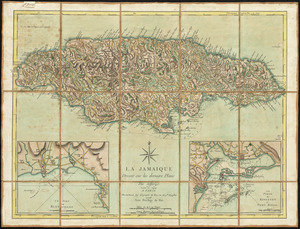
293
Search Constraints
Sort by date (desc)
relevance
title
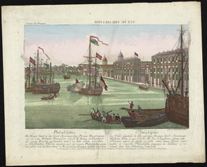
date (asc)
date (desc)
Number of results to display per page
100 per page
10
per page
20
per page
50
per page
100
per page
View results as:
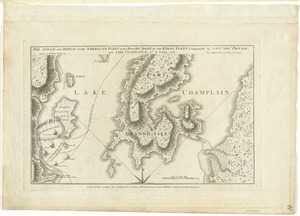
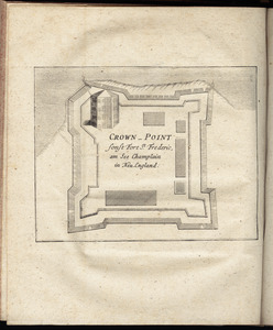
grid view
map view
Search Results
101.
[Chart of the coast of Georgia]
102.
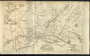
A chorographical map of the Province of New-York in North America, divided into counties, manors, patents and townships :...
103.
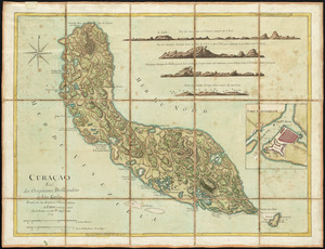
Curaçao : tiré des originaux Hollandois de Van Keulen ; dressé sur les dernieres observations
104.
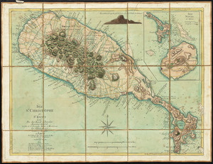
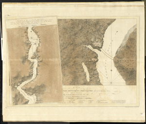
Isle St. Christophe ou St. Kitts
105.
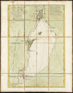
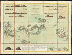
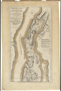
Les Isles Turques d'après les levées de 1753 par le sloop l'Aigle et l'Emeraude par ordre du Gouverneur de St. Domingue...
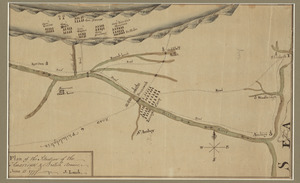
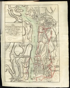
106.
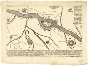
A plan of Fort Montgomery & Fort Clinton, taken by His Majesty's forces, under the command of Maj. Genl. Sir Henry Clinton, K:B
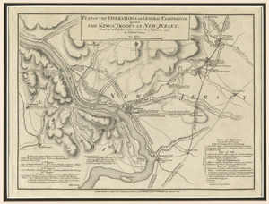
107.
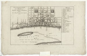
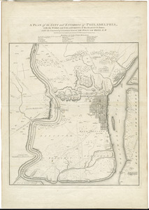
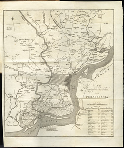
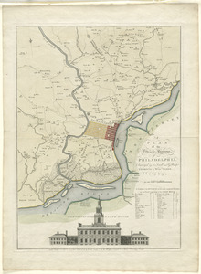
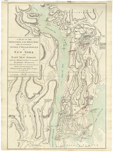
A plan of the city and environs of Philadelphia : with the works and encampments of His Majesty's forces under the command of...
108.
Ste. Lucie : d'après les plans levés par les Anglois lors qu'ils le possedoient
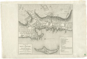
109.
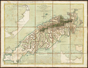
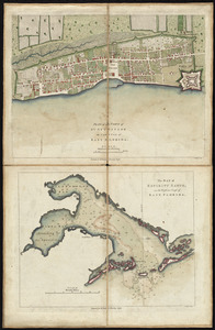
Tabago
110.
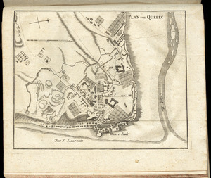
[The coasts, rivers and inlets of the province of Georgia]
111.
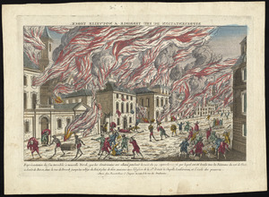
Les Vierges, levées par les Anglais, et par les Dannois : traduit de l'Anglais
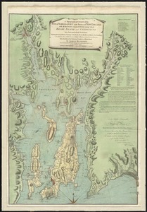
112.
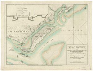
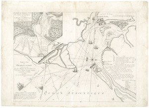
Barre et port de Charles-Town levé en 1776 : avec les attaques du Fort Sulivan du 28 juin 1776 par l'escadre anglaise...
113.
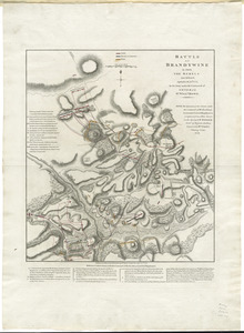
Battle of Brandywine in which the rebels were defeated, September the 11th. 1777, by the army under the command of General Sr....
114.
Baye de Chesapeake en 4 feuilles avec les bas fonds, passes, entrées, sondes et routes ou l'on donne les parties navigables...
115.
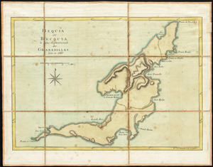
Bequia ou Becouya, le plus septentrionale des Granadilles : levé en 1763
116.
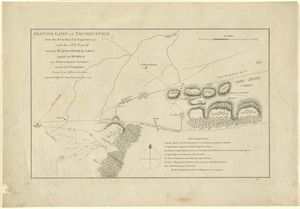
British camp at Trudruffrin from the 18th. to the 21st. of September 1777 : with the attack made by Major General Grey against...
117.
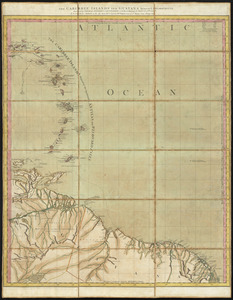
Carte de l'affaire de Montmouth, ou le Général Washington commandon l'armée Americaine, et le Général Clinton l'armée...
118.
Carte du Canada et des Etats-Unis de l'Amérique Septentrionale
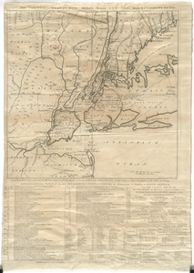
119.
Carte du théatre de la guerre actuel entre les Anglais et les Treize Colonies Unies de l'Amerique Septentrionale
120.
Carte du théatre de la guerre dans l'Amérique Septentrionale, pendant les années 1775, 76, 77, et 78 : où se trouvent les...
121.
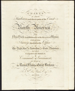
Charts of several harbours, and divers parts of the coast of North America, from New York south westwards to the Gulph of Mexico
122.
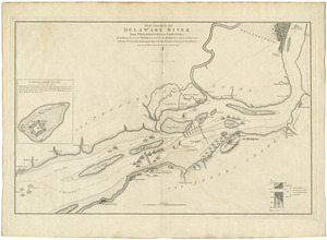
The course of Delaware River from Philadelphia to Chester, exhibiting the several works erected by the rebels to defend its...
123.
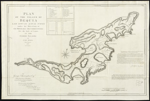
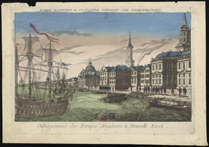
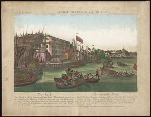
Débarquement des troupes Angloises à Nouvelle Yorck
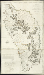
124.
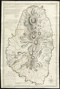
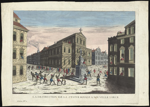
La destruction de la statue royale a Nouvelle Yorck
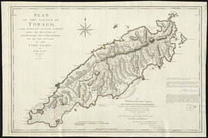
125.
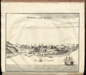
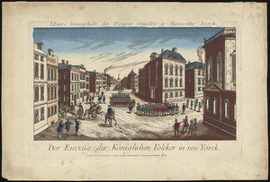
Der einzug der königlichen völcker in Neu Yorck
126.
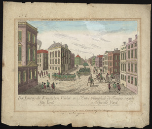
Der einzug der königlichen völcker in Neu Yorck = : L'entré triumphale de troupes royales á Nouvelle Yorck
127.
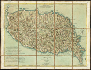
La Grenade : divisée par paroisses
128.
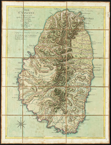
Isle St. Vincent
129.
La Jamaique
130.
Neu Yorck = : La Nouvelle Yorck
131.
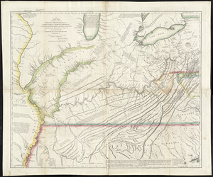
A new map of the western parts of Virginia, Pennsylvania, Maryland and North Carolina : comprehending the river Ohio, and all...
132.
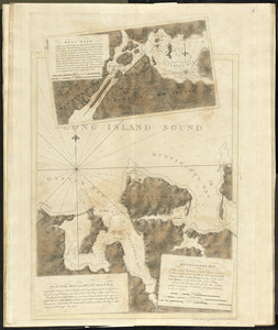
Oyster Bay and Huntington : Huntington Bay
133.
Partie septentrionale des possessions angloise en Amérique : pour servire d'intelligence à la guerre présente entre les...
134.
Philadelphia = : Philadelphie
135.
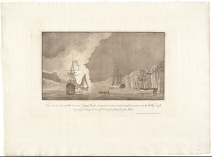
The Phoenix and the Rose engaged by the enemy's fire ships and galleys on the 16 Augst. 1776
136.
Plan der gegend und stadt von Philadelphia
137.
A plan of the action at Bunkers Hill, on the 17th. of June, 1775 : between His Majesty's troops under the command of Major...
138.
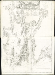
Port de Rhode Island et Narraganset Baye : publié à la requête du Vicomte Howe par le Chevalier des Barres ; traduit de...
139.
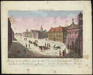
Prospect der grossen plazes gegn der alten Sud Kirche der Presbiterianer zu Boston = : Vuë de la Rue grande vers l'Eglise du...
140.
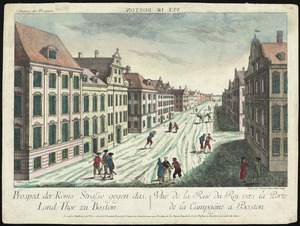
Prospect der König Strasse gegen das land thor zu Boston = : Vuë de la Rue du Roi vers la porte de la campagne a Boston
141.
Die zerstörung der königlichen bild säule zu Neu Yorck = : La destruction de la statue royale a Nouvelle Yorck
142.
Carte de l'Amérique Septle. pour servir à l'intelligence de la guerre entre les Anglois et les insurgents
143.
Carte des possessions angloises dans l'Amerique Septentrionale pour servir d'intelligence à la guerre presente traduite de...
144.
Carte nouvelle des posséssions angloises en Amérique : dressée pour l'intelligence de la guerre présente et divisée...
145.
A chart of New York Harbour with the soundings views of land marks and nautical directions : for the use of pilotage
146.
Connecticut and parts adjacent
147.
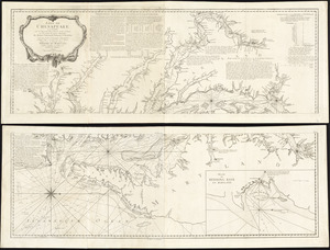
Crown Point : sonst Fort St. Frederic, am See Champlain in Neu England
148.
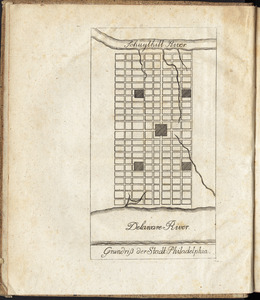
Grundriss der stadt Philadelphia
149.
Grundriss des nördlichen theils der Neujorks Insel : nebst den am 16. Novbr. 1776. eroberten Fort Washington nun das Fort...
150.
The harbour and part of the town of Havannah : The entrance of Havannah, from within the harbour
151.
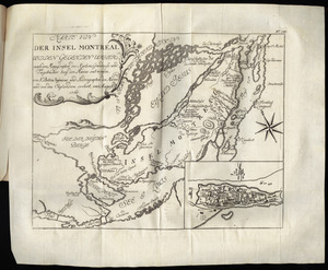
Karte von der Insel Montreal und den gegenden umher, nach den manuscripten der karten, grundrisse und tagebücher beÿ der...
152.
Karte von Neu England, Neu Yorck und Pensilvanien
153.
Krigs theatreni i America, 1777 = : seat of war in America, 1777
154.
A map of the inhabited part of Canada from the French surveys : with the frontiers of New York and New England from the large...
155.
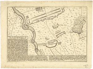
[Map of the Siege of Mud Island Fort]
156.
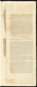
Nautical directions to sail into the harbour of New-York, &c.
157.
Plan des befestigten lagers der Amerikaner bey Whitemarsh
158.
A plan of Boston in New England with its environs : including Milton, Dorchester, Roxbury, Brooklin, Cambridge, Medford,...
159.
A plan of New York Island, and part of Long Island, with the circumjacent country, as far as Dobbs's Ferry to the north, and...
160.
[Plan of the battles of Saratoga]
161.
A plan of the city and environs of Philadelphia
162.
Plan of the operations of General Washington, against the Kings troops in New Jersey : from the 26th. of December 1776, to the...
163.
A plan of the operations of the King's army under the command of General Sr. William Howe, K.B. in New York and east New Jersey...
164.
Plan of the situation of the American & British armies, June 15st 1777
165.
A plan of the town of Boston, with the intrenchments &c. of His Majestys forces in 1775 : from the observations of Lieut. Page...
166.
A plan of the town of Newport in Rhode Island
167.
Plan of the town of St. Augustine, the capital of East Florida ; The bay of Espiritu Santo, on the western coast of East Florida
168.
Plan von den operationen der Koeniglichen Armee unter dem General Sir William Howe : in Neuyorck und Ost-Neujerseÿ gegen die...
169.
Plan von Quebec
170.
The province of New Jersey, divided into east and west, commonly called the Jerseys
171.
Représentation du feu terrible à Nouvelle Yorck, que les Américains ont allumé pendant la nuit du 19 Septembre 1776 ... et...
172.
A topographical chart of the bay of Narraganset in the province of New England : with all the isles contained therein, among...
173.
A topographical map of the northn. part of New York Island, exhibiting the plan of Fort Washington, now Fort Knyphausen, with...
174.
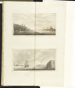
[Views of the entrance to New York Harbor]
175.
[Views of the entrance to New York Harbor]
176.
Vorstellung der diversio welche der Enll. Generel Lieutenant Clinton samt dene Generals Vaughan u. Tryon in de Ierseys im Sept....
177.
An accurate map of Staten Island : with that part of New York, Long Island and the Jerseys, which is the rendesvous of the two...
178.
An accurate map of the country round Boston in New England from the best authorities
179.
Allgemeine charte von Nord America als den sitz des krieges zwischen den Konigl. Engl. truppen u:den provinzialen
180.
L'Amerique Septentrionale
181.
The attack and defeat of the American fleet under Benedict Arnold, by the King's fleet commanded by Capt. Thos. Pringle, upon...
182.
Attaque de l'armée des provinciaux dans Long Island du 27. Aoust 1776 : dessin de l'isle de New-York et des Etats
183.
The Caribbee Islands and Guayana
184.
Carte du port et havre de Boston avec les côtes adjacentes, dans laquel on a tracée les camps et les retranchemens occupé,...
185.
A chart of the Harbour of Boston, with the soundings, sailing-marks, and other directions
186.
The country twenty five miles round New York
187.
A map of the Province of New-York : reduc'd from the large drawing of that province, compiled from actual surveys by order of...
188.
Philadelphie, par Easburn, arpenteur general de Pensilvanie
189.
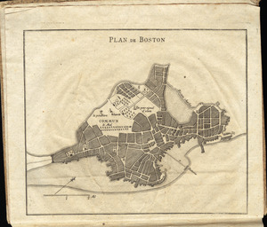
Plan de Boston
190.
A plan of Boston, and its environs : shewing the true situation of His Majesty's army, and also those of the rebels
191.
A plan of New York Island, with part of Long Island, Staten Island & east New Jersey, with a particular description of the...
192.
A plan of the attack of Fort Sulivan, near Charles Town in South Carolina : by a squadron of His Majesty's ships, on the 28th...
193.
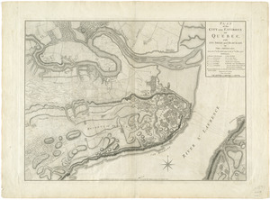
Plan of the city and environs of Quebec, with its siege and blockade by the Americans, from the 8th of December 1775 to the...
194.
A plan of the city of Philadelphia, the capital of Pennsylvania, from an actual survey
195.
Plan of the island of Bequia laid down by actual survey under the direction of the honorable the Commissioners for the Sale of...
196.
Plan of the island of Dominica laid down by actual survey under the direction of the honorable the Commissioners for the Sale...
197.
Plan of the island of St. Vincent laid down by actual survey under the direction of the honorable the Commissioners for the...
198.
Plan of the island of Tobago laid down by actual survey under the direction of the honorable the Commissioners for the Sale of...
199.
Prospect von Quebec
200.
Schauplatz des Kriegs zwischen Engelland und seinen Collonien in America
‹ Prev
Next ›
1
2
3
![[Chart of the coast of Georgia]](https://bpldcassets.blob.core.windows.net/derivatives/images/commonwealth:z603vv33t/image_thumbnail_300.jpg)

![[The coasts, rivers and inlets of the province of Georgia]](https://bpldcassets.blob.core.windows.net/derivatives/images/commonwealth:z603vv37x/image_thumbnail_300.jpg)


![[Map of the Siege of Mud Island Fort]](https://bpldcassets.blob.core.windows.net/derivatives/images/commonwealth:z603vr43f/image_thumbnail_300.jpg)


![[Plan of the battles of Saratoga]](https://bpldcassets.blob.core.windows.net/derivatives/images/commonwealth:z603vw07d/image_thumbnail_300.jpg)


![[Views of the entrance to New York Harbor]](https://bpldcassets.blob.core.windows.net/derivatives/images/commonwealth:dz010v158/image_thumbnail_300.jpg)
![[Views of the entrance to New York Harbor]](https://bpldcassets.blob.core.windows.net/derivatives/images/commonwealth:dz010v514/image_thumbnail_300.jpg)