Toggle navigation
LMEC Home
Exhibitions
Georeferencing
Tools for Teachers
Collections
My Favorites
Sign Up / Log In
Search
Search the map portal
Map Collection
Map Collection
Map Sets
Search
Search
Search for
Search In
All Fields
Creator
Title
Subject
Place
Search All Digital Collections
Advanced Search
8551 Results
My Search
Start Over
More Like
commonwealth:9g54xx66p
Remove constraint More Like: commonwealth:9g54xx66p
Filter your Search
Place
North and Central America
5,846
United States
4,770
Massachusetts
2,052
Europe
1,359
Suffolk (county)
1,035
Boston
1,008
Canada
448
Asia
422
more
Place
»
Topic
Boston (Mass.)--Maps
577
United States--Maps
273
Real property--Massachusetts--Boston--Maps
175
Massachusetts--Maps
160
Landowners--Massachusetts--Boston--Maps
133
North America--Maps--Early works to 1800
103
New England--Maps
99
Europe--Maps
78
more
Topic
»
Date
Date range begin
–
Date range end
Current results range from
1482
to
2023
View distribution
Creator
United States. Hydrographic Office
594
O.H. Bailey & Co
148
Des Barres, Joseph F. W. (Joseph Frederick Wallet), 1722-1824
123
United States. Post Office Dept
120
Ptolemy, 2nd cent
100
Walling, Henry Francis, 1825-1888
94
Geological Survey (U.S.)
86
Jefferys, Thomas, -1771
85
more
Creator
»
Format
Maps/Atlases
8,492
Manuscripts
215
Prints
56
Books
36
Objects/Artifacts
10
Drawings/Illustrations
8
Posters
4
Georeferenced
Yes
869
No
7,682
Collection
Norman B. Leventhal Map & Education Center Collection
8,550
Boston and New England Maps
2,204
Urban Maps
1,936
Maritime Charts and Atlases
1,081
American Revolutionary War-Era Maps
616
Boston Redevelopment Authority Collection
87
Massachusetts Real Estate Atlases
1
Available to use
No known restrictions
8,409
Creative Commons license
46
Search Constraints
Sort by date (asc)
relevance
title
date (asc)
date (desc)
Number of results to display per page
50 per page
10
per page
20
per page
50
per page
100
per page
View results as:
grid view
map view
Search Results
8151.
Land utilization in Korea
8152.
Morocco, location of mineral resources
8153.
Philippine Islands population, 1939 census
8154.
Philippine Islands radio stations and cables
8155.
Radiotelegraph and radiotelephone communication systems of France : radiotelegraph communication system of the French Ministry...
8156.
Saishin ōshū daichizu
8157.
South Pacific Ocean, Solomon Islands, Guadalcanal and Florida Is. with a portion of Malaita I. : from British surveys to 1912
8158.
South-east New Guinea
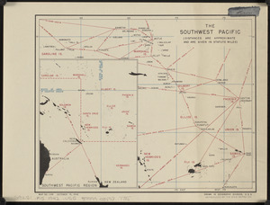
8159.
The southwest Pacific
8160.
Total war battle map
8161.
Tribal map of Morocco
8162.
The victory war map
8163.
Algeria and Tunisia, port capacities and major transport routes
8164.
Boston Elevated Railway system route map
8165.
Global map for global war and global peace
8166.
Great circle airways
8167.
Invasion and total war victory maps : with decorations, illustrations and military and naval insignia
8168.
Iraq water supply and land use
8169.
Japan, the target : a pictorial Jap-map
8170.
Newsmap : week of October 14 to October 21, 215th week of the war, 97th week of U.S. participation. Monday, October 25, 1943
8171.
Newsmap : week of December 16 to December 22, 224th week of the war, 106th week of U.S. Participation. Monday, December 27, 1943
8172.
A pictorial map of loveland
8173.
Railroads of Lithuania, 1939
8174.
Roads and communications of Sinkiang
8175.
Town of Brookline Mass. Assessors' plans 1943
8176.
The adventures of Mark Twain
8177.
Atlas of town of Weymouth Massachusetts
8178.
Caroline Islands, Yap Island
8179.
China east coast population density
8180.
Eight views of the world
8181.
Germany, concentration camps (June--1944)
8182.
Germany, postal administrative districts, March 1943
8183.
Great Britain, her natural & industrial resources
8184.
Indians of the U.S.A.
8185.
Italy with Vatican City
8186.
Mercator map of the world united : a pictorial history of transport and communications and paths to permanent peace
8187.
Netherlands New Guinea : approximation of population distribution
8188.
Northern Philippines land utilization
8189.
Peace map of the world united : a pictorial history of transportation and communications from Jonah to the jet plane as paths...
8190.
A pictorial map of the United States
8191.
The story map of flying : being a chronicle of man's conquest of the air
8192.
Town of Brookline, Mass. assessors' plans 1944
8193.
World map of the major tropical diseases
8194.
Bataan
8195.
Camarines Sur : (western part)
8196.
Cavite
8197.
China, south coast, principal ethnic groups and dialects
8198.
Climate zones for Eastern Asia
8199.
Germany, western border regions, agricultural areas (north of the Main and west of the Rhine Rivers)
8200.
Germany western border regions rail traffic volume (excluding inter-Ruhr traffic) summer 1939
‹ Prev
Next ›
1
2
…
160
161
162
163
164
165
166
167
168
…
171
172