Toggle navigation
LMEC Home
Exhibitions
Georeferencing
Tools for Teachers
Collections
My Favorites
Sign Up / Log In
Search
Search the map portal
Map Collection
Map Collection
Map Sets
Search
Search
Search for
Search In
All Fields
Creator
Title
Subject
Place
Search All Digital Collections
Advanced Search
8551 Results
My Search
Start Over
More Like
commonwealth:0r96fk906
Remove constraint More Like: commonwealth:0r96fk906
Filter your Search
Place
North and Central America
5,846
United States
4,770
Massachusetts
2,052
Europe
1,359
Suffolk (county)
1,034
Boston
1,007
Canada
448
Asia
422
more
Place
»
Topic
Boston (Mass.)--Maps
577
United States--Maps
273
Real property--Massachusetts--Boston--Maps
174
Massachusetts--Maps
160
Landowners--Massachusetts--Boston--Maps
132
North America--Maps--Early works to 1800
103
New England--Maps
99
Europe--Maps
78
more
Topic
»
Date
Date range begin
–
Date range end
Current results range from
1482
to
2023
View distribution
Creator
United States. Hydrographic Office
594
O.H. Bailey & Co
148
Des Barres, Joseph F. W. (Joseph Frederick Wallet), 1722-1824
123
United States. Post Office Dept
120
Ptolemy, 2nd cent
100
Walling, Henry Francis, 1825-1888
94
Geological Survey (U.S.)
86
Jefferys, Thomas, -1771
85
more
Creator
»
Format
Maps/Atlases
8,492
Manuscripts
215
Prints
56
Books
36
Objects/Artifacts
10
Drawings/Illustrations
8
Posters
4
Georeferenced
Yes
870
No
7,681
Collection
Norman B. Leventhal Map & Education Center Collection
8,550
Boston and New England Maps
2,204
Urban Maps
1,936
Maritime Charts and Atlases
1,081
American Revolutionary War-Era Maps
616
Boston Redevelopment Authority Collection
87
MacLean Collection Map Library
1
Available to use
No known restrictions
8,409
Creative Commons license
46
Search Constraints
Sort by relevance
relevance
title
date (asc)
date (desc)
Number of results to display per page
50 per page
10
per page
20
per page
50
per page
100
per page
View results as:
grid view
map view
Search Results
1.
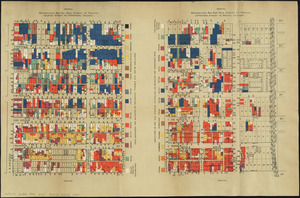
Nationalities map no. 1 - Polk Street to Twelfth, Halsted Street to Jefferson, Chicago ; Nationalities map no. 2 - Polk Street...
2.
Nationalities map no. 3 - Polk Street to Twelfth, Beach Street to Pacific Avenue, Chicago ; Nationalities map no. 4 - Polk...
3.
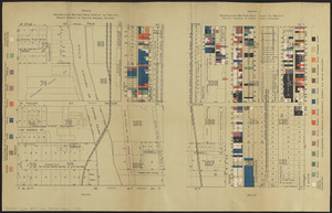
Wage map no. 1 - Polk Street to Twelfth, Halsted Street to Jefferson, Chicago ; Wage map no. 2 - Polk Street to Twelfth,...
4.
Chicago
5.
Chicago
6.
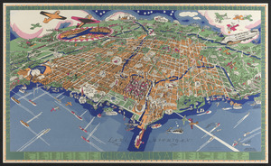
Chicago motor coach pictorial map of Chicago
7.
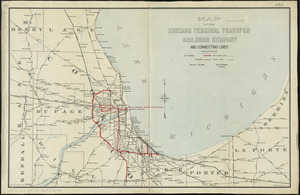
Chicago Terminal Transfer Railroad Co. map showing property of railroads in the business center of Chicago
8.
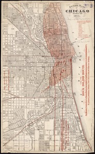
Guide map of Chicago, October 11th, 1871
9.
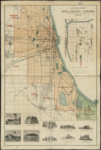
Guide map of new Chicago and suburbs
10.
An illustrated map of Chicago : youthful city of the big shoulders, restless, ingenious, wilful, violent, proud to be alive!
11.
Insurance map of Chicago, 1868-9
12.
A map of Chicago : incorporated as a town August 5, 1833
13.
Map of Chicago showing the burnt district
14.
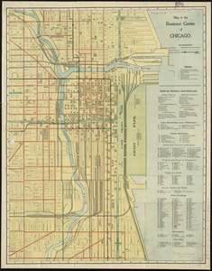
Map of the business center of Chicago
15.
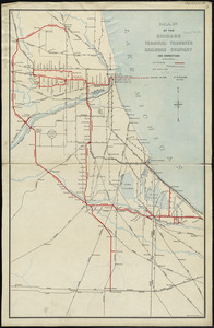
Map of the Chicago Terminal Transfer Railroad Company and connecting lines
16.
Map of the Chicago Terminal Transfer Railroad Company and connections
17.
New map of Chicago : comprising the whole city, taken from Lowe's map, with all the recent additions, subdivisions & extensions
18.
Plan of the South Open Ground, the Upper Plaisance, the Midway Plaisance, the Lake Open Ground, the Lagoon Plaisance and the...
19.
Rand McNally & Co.'s map of Chicago : no. 3
20.
Rand McNally & Co.'s map of Chicago : no. 3
21.
Rand, McNally & Co.'s new and concise map of Chicago : showing the city limits and location of the world's Columbian...
22.
System of parks and boulevards of the city of Chicago
23.
Touring road map of Chicago and environs : 6 counties
24.
Travelers' and shippers' railway guide map of Chicago
25.
Chicago
26.
Chicago
27.
The 100th anniversary map of Abraham Lincoln's visit to Massachusetts, September 11-23, 1848
28.
1630 shoreline
29.
1879. Progress map of the U.S. Geographical Surveys west of the 100th Meridian : prepared under the direction of 1st Lieut....
30.
1903 Map of Salem and surrounding places
31.
19th annual convention of the National Association of Real Estate Boards : at Tulsa, June 7 to June 11 in 1926
32.
2005 significant U.S. hurricane strikes
33.
The 2100 project : an atlas for the Green New Deal
34.
227 Harzgerode
35.
305 Glatz
36.
38,000,000 escaped -- 10,000,000 died
37.
4 Kinten
38.
660 Wakulah St., Roxbury
39.
[A chart of Boston Bay and vicinity]
40.
[A chart of New York Island & North River : East River, passage through Hell Gate, Flushing Bay, Hampstead Bay, Oyster,...
41.
The A.A.A. key road map of continental Europe
42.
Aaron Bohrod's America, its history
43.
ABC pathfinder railway guide map : eastern division
44.
Abolition of Slavery, 1863
45.
Aboriginal map of North America, denoting the boundaries and the locations of various Indian tribes
46.
Acapulco, México
47.
Accurata delineatio Castrorum Suecicorum, ut et Haffniae, Regni Daniae Metropolis
48.
Accurata delineatio oppugnatae a faederatis, Caesareis, Polonicis, Danicis, et Brandeburgicis copijs sub-ductu Seren: Electoris...
49.
Accurata delineatio regionis circa Nieburgum Fioniæ cum prælio ibi commisso inter Danorum et fæderatorum exercitum ab una et...
50.
Accurata Scaniae, Blekingiae et Hallandiae descriptio
‹ Prev
Next ›
1
2
3
4
5
…
171
172


![[A chart of Boston Bay and vicinity]](https://bpldcassets.blob.core.windows.net/derivatives/images/commonwealth:cj82m2976/image_thumbnail_300.jpg)


