Toggle navigation
LMEC Home
Exhibitions
Georeferencing
Tools for Teachers
Collections
My Favorites
Sign Up / Log In
Search
Search the map portal
Map Collection
Map Collection
Map Sets
Search
Search
Search for
Search In
All Fields
Creator
Title
Subject
Place
Search All Digital Collections
Advanced Search
150 Results
My Search
Start Over
1903
Remove constraint 1903
Filter your Search
Place
North and Central America
123
United States
69
Boston
36
Suffolk (county)
36
Oklahoma
10
Canada
8
Massachusetts
6
Middlesex (county)
5
more
Place
»
Topic
Boston (Mass.)--Maps
22
Landowners--Massachusetts--Boston--Maps
20
Indian reservations--Oklahoma--Maps
9
Indian Territory--Maps
7
Oklahoma--Maps
7
Boston (Mass.)--History--Colonial period, ca. 1600-1775--Maps
5
Homeowners--Massachusetts--Boston--Maps
5
Boston (Mass.)--Maps--Early works to 1800
4
more
Topic
»
Date
Date range begin
–
Date range end
Current results range from
1757
to
1999
View distribution
Creator
United States. Post Office Dept
34
Lamb, George
16
Olmsted, Frederick Law, 1822-1903
9
United States. Commission to the Five Civilized Tribes
8
Julius Bien & Co.
6
United States. Post Office Department
5
Lamb, George.
4
Norris Peters Co.
4
more
Creator
»
Format
Maps/Atlases
149
Manuscripts
2
Books
1
Objects/Artifacts
1
Georeferenced
Yes
21
No
129
Collection
Norman B. Leventhal Map Center Collection
143
Boston and New England Maps
32
Urban Maps
31
American Revolutionary War-Era Maps
5
Maritime Charts and Atlases
5
Mapping Boston Collection
2
Massachusetts Real Estate Atlases
2
American Textile History Museum Image Collection
1
more
Collection
»
Available to use
No known restrictions
143
Creative Commons license
4
Search Constraints
Sort by date (desc)
relevance
title
date (asc)
date (desc)
Number of results to display per page
100 per page
10
per page
20
per page
50
per page
100
per page
View results as:
grid view
map view
Search Results
1.
Philips Radio
2.
A map of Cape Cod
3.
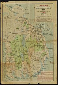
Path map of the eastern part of Mount Desert Island, Maine
4.
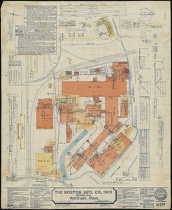
The Boston Mfg. Co., 1901 (Cotton Mill), Waltham, Mass.
5.
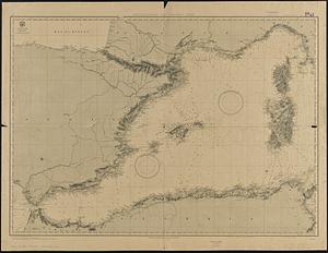
Mediterranean Sea, western sheet
6.
Map of Bretton Woods and surroundings
7.
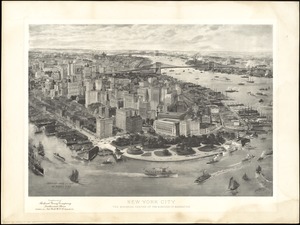
New York City : the business center of the borough of Manhattan
8.
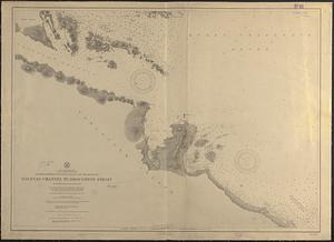
North America, west coast, Canada, British Columbia, waters between Vancouver Island and the mainland, Goletas Channel to...
9.
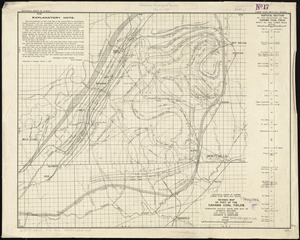
Revised map of part of the Cahaba coal fields
10.
Index map, city of Manila
11.
Map showing Indian reservations within the limits of the United States, 1903
12.
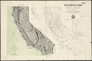
Relief and mineral map of California showing the topography and the approximate locations of all the principal mineral deposits...
13.
1903 Map of Salem and surrounding places
14.
Alberta and western portions of Saskatchewan and Assiniboia
15.
Arizona (Coconino County), Bright Angel quadrangle
16.
Assiniboia
17.
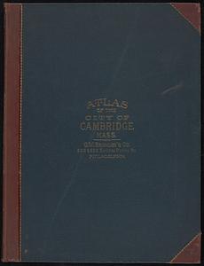
Atlas of the city of Cambridge, Massachusetts : from actual surveys and official plans
18.
Atlas of the city of Cambridge, Massachusetts
19.
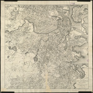
Boston
20.
Boston Harbor
21.
Carte générale des grandes communications télégraphiques du monde
22.
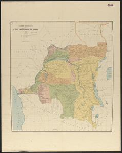
Carte politique de l'État Indépendant du Congo
23.
Center of New York, first city of the world
24.
Central part of Boston Elevated Railway system showing connections
25.
Central part of Boston Elevated Railway system showing connections 1903
26.
Charles River Basin contour map of lower basin from surveys and soundings made in Aug. and Sept. 1902 for Committee on Charles...
27.
Charles River Basin contour map of upper basin from surveys and soundings
28.
Charles River, Boston Harbor, and the proposed Charles River basin : prepared to accompany report made to Henry L. Higginson,...
29.
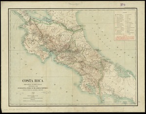
Costa Rica : from official and other sources
30.
Elihu Geer's sons' new map of Hartford from the latest surveys
31.
Gesandtschaftsviertel in Peking
32.
Gloucester, Essex County, Massachusetts : Oct. 1903
33.
Highway map of Plymouth County, Massachusetts : prepared for the Plymouth County atlas
34.
Indian Territory : progress of sub-division survey, June 30, 1902
35.
Indian Territory
36.
Indian Territory showing railroad systems - June 30, 1902
37.
Indian Territory showing townsites approved to June 30-1902
38.
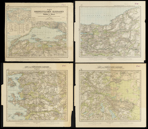
Karte des nordwestlichen Kleinasien : nach eigenen aufnahmen und unveröffentlichtem material auf Heinrich Kiepert's grundlage
39.
Lake Winnipesaukee, New Hampshire
40.
Maine Central Railroad : through the White Mountains
41.
Map of British Columbia and part of western Canada, showing the lines and lands of the Canadian Pacific Railway
42.
Map of Cambridge in the vicinity of Harvard College 1903-4
43.
Map of Choctaw Nation, Indian Territory
44.
Map of Manitoba
45.
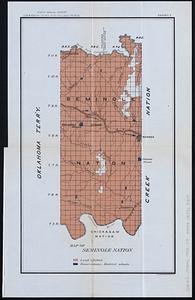
Map of Seminole Nation
46.
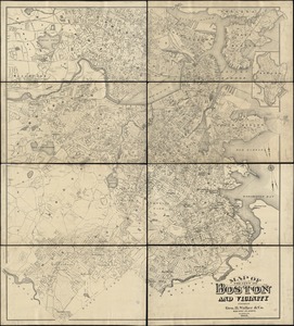
Map of the city of Boston and vicinity
47.
Map of the city of Boston and vicinity
48.
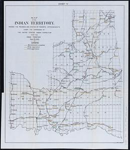
Map of the Indian Territory : showing the progress and status of townsite appraisements, under the supervision of the United...
49.
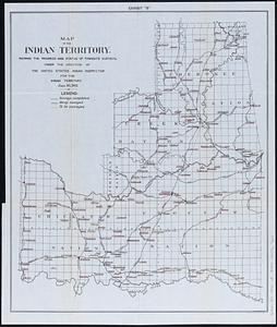
Map of the Indian Territory : showing the progress and status of townsite surveys, under the direction of the United States...
50.
Map showing progress of allotment in Creek Nation
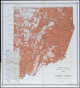
51.
Mediterranean Sea, middle sheet
52.
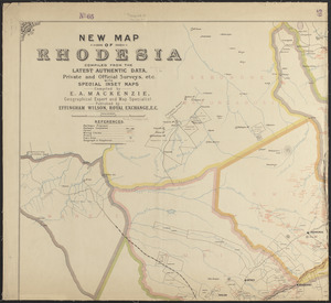
New map of Rhodesia : compiled from the latest authentic data, private and official surveys, etc. with special inset maps
53.
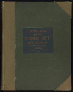
New topographical atlas of surveys Plymouth County, together with town of Cohasset, Norfolk County, Massachusetts
54.
New topographical atlas of surveys Plymouth County, together with town of Cohasset, Norfolk County, Massachusetts ... based...
55.
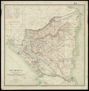
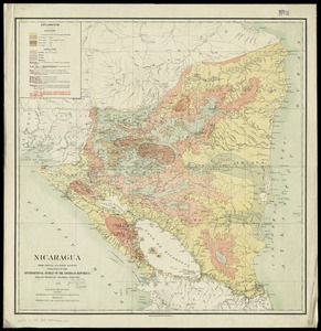
Nicaragua
56.
Nicaragua
57.
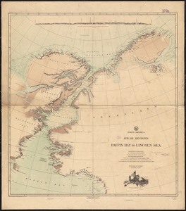
North America, polar regions, Baffin Bay to Lincoln Sea : showing the recent discoveries by civil engineer R.E. Peary, U.S.N.,...
58.
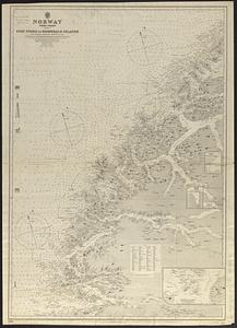
Norway, west coast : from Norwegian surveys, with corrections to 1886
59.
Path map of the eastern part of Mount Desert Island, Maine
60.
Peking
61.
Peru
62.
Plan of Boston showing existing ways and owners on December 25, 1630
63.
Plan of Boston showing existing ways and owners on December 25, 1630
64.
Plan of Boston showing existing ways and owners on December 25, 1631
65.
Plan of Boston showing existing ways and owners on December 25, 1632
66.
Plan of Boston showing existing ways and owners on December 25, 1633
67.
Plan of Boston showing existing ways and owners on December 25, 1634
68.
Plan of Boston showing existing ways and owners on December 25, 1635
69.
Plan of Boston showing existing ways and owners on December 25, 1635
70.
Plan of Boston showing existing ways and owners on December 25, 1636
71.
Plan of Boston showing existing ways and owners on December 25, 1637
72.
Plan of Boston showing existing ways and owners on December 25, 1638
73.
Plan of Boston showing existing ways and owners on December 25, 1639
74.
Plan of Boston showing existing ways and owners on December 25, 1640
75.
Plan of Boston showing existing ways and owners on December 25, 1640
76.
Plan of Boston showing existing ways and owners on December 25, 1641
77.
Plan of Boston showing existing ways and owners on December 25, 1642
78.
Plan of Boston showing existing ways and owners on December 25, 1643
79.
Plan of Boston showing existing ways and owners on December 25, 1644
80.
Plan of Boston showing existing ways and owners on December 25, 1645
81.
Plan of Boston showing existing ways and owners on December 25, 1645
82.
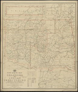
Post route map of Oklahoma and Indian territories showing post offices with the intermediate distances on mail routes in...
83.
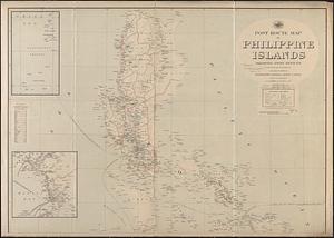
Post route map of Philippine Islands showing post offices in operation on the 1st of December, 1903
84.
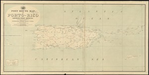
Post route map of Porto-Rico showing post offices in operation on the 1st of December, 1903
85.
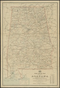
Post route map of the state of Alabama showing post offices with the intermediate distances on mail routes in operation on the...
86.
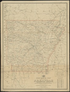
Post route map of the state of Arkansas showing post offices with the intermediate distances on mail routes in operation on the...
87.
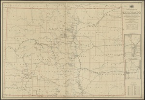
Post route map of the State of Colorado showing post offices with the intermediate distances on mail routes in operation on the...
88.
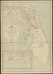
Post route map of the state of Florida showing post offices with the intermediate distances on mail routes in operation on the...
89.
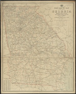
Post route map of the state of Georgia showing post offices with the intermediate distances on mail routes in operation on the...
90.
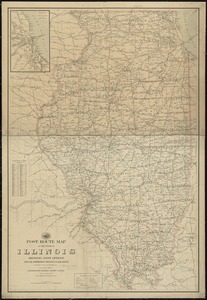
Post route map of the state of Illinois showing post offices with the intermediate distances on mail routes in operation on the...
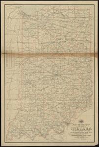
91.
Post route map of the state of Indiana showing post offices with the intermediate distances on mail routes in operation on the...
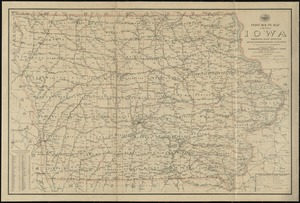
92.
Post route map of the state of Iowa showing post offices with the intermediate distances on mail routes in operation on the 1st...
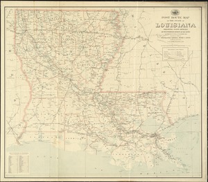
93.
Post route map of the state of Louisiana showing post offices and the intermediate distances on mail routes in operation on the...
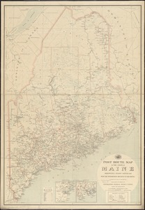
94.
Post route map of the state of Maine showing post offices with the intermediate distances on mail routes in operation on the...
95.
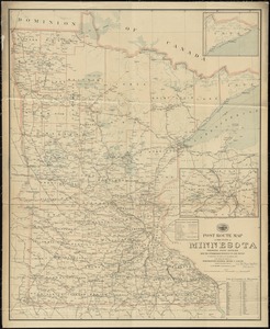
Post route map of the state of Minnesota showing post offices with the intermediate distances and mail routes in operation on...
96.
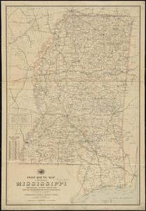
Post route map of the state of Mississippi showing post offices with the intermediate distances on mail routes in operation on...
97.
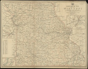
Post route map of the state of Missouri showing post offices with the intermediate distances on mail routes in operation on the...
98.
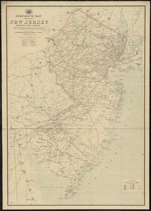
Post route map of the state of New Jersey showing post offices with the intermediate distances on mail routes in operation on...
99.
Post route map of the state of New York showing post offices with the intermediate distances on mail routes in operation on the...
100.
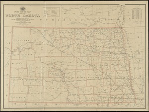
Post route map of the state of North Dakota showing post offices with the intermediate distances and mail routes in operation...
‹ Prev
Next ›
1
2