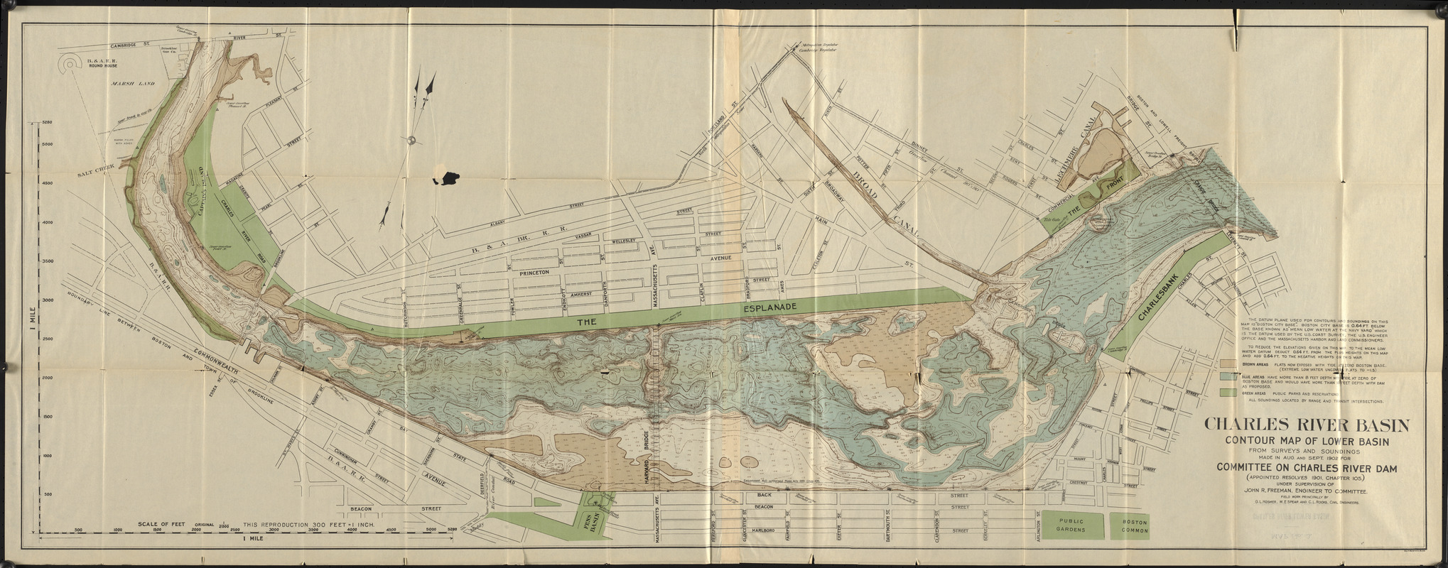
Charles River Basin contour map of lower basin from surveys and soundings made in Aug. and Sept. 1902 for Committee on Charles River Dam (appointed resolves 1901, chapter 105) under supervision of John r. Freeman, engineer to committee
Item Information
- Title:
- Charles River Basin contour map of lower basin from surveys and soundings made in Aug. and Sept. 1902 for Committee on Charles River Dam (appointed resolves 1901, chapter 105) under supervision of John r. Freeman, engineer to committee
- Title (alt.):
-
Charles River lower basin, Cambridge-River St. to Craigie Bridge
- Contributor:
- Massachusetts. Committee on Charles River Dam
- Surveyor:
- Hosmer, G. L.
- Surveyor:
- Spear, W. E.
- Surveyor:
- Rooks, C. L.
- Name on Item:
-
field work principally by G.L. Hosmer, W.E. Spear and C.L. Rooks, civil engineers
- Date:
-
1903
- Format:
-
Maps/Atlases
- Location:
-
Boston Public Library
Central Library in Copley Square - Collection (local):
-
Boston Public Library Collection
- Subjects:
-
Charles River Dam (Mass.)--Maps
Charles River (Mass.)--Maps
River engineering--Massachusetts--Charles River--Maps
- Places:
-
MassachusettsCharles (river)
- Extent:
- 1 map : color ; 57 x 152 cm, on sheet 61 x 155 cm
- Terms of Use:
-
No known copyright restrictions.
No known restrictions on use.
- Publisher:
-
Massachusetts :
Committee on Charles River Dam
- Scale:
-
Scale 1:3,600
- Language:
-
English
- Catalog Record:
-
http://bpl.bibliocommons.com/item/show/3652846075
- Notes:
-
In Report of the Committee on Charles River Dam appointed under resolves of 1901, chapter 105, to consider the advisability and feasibility of building a dam across the Charles River at or near Craigie bridge.
Depths shown by soundings and isolines.
- Identifier:
-
06_01_017381
- Call #:
-
M3/CRD/03.1
- Barcode:
-
mq6319167


