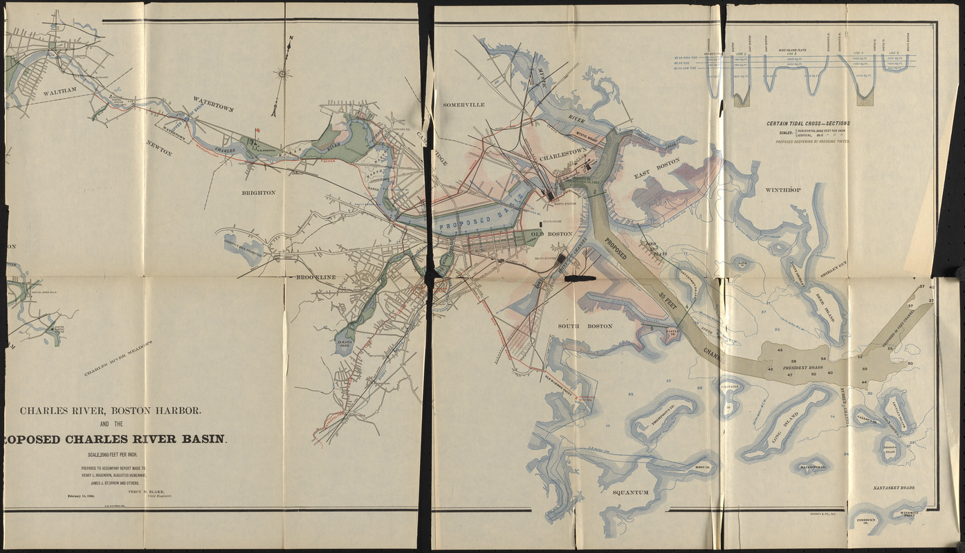
Charles River, Boston Harbor, and the proposed Charles River basin : prepared to accompany report made to Henry L. Higginson, Augustus Hemenway, James J. Storrow and others
Item Information
- Title:
- Charles River, Boston Harbor, and the proposed Charles River basin : prepared to accompany report made to Henry L. Higginson, Augustus Hemenway, James J. Storrow and others
- Cartographer:
- Blake, Percy M.
- Contributor:
- Massachusetts. Committee on Charles River Dam
- Name on Item:
-
Percy M. Blake, civil engineer ; A. B. Whitman, del.
- Date:
-
1903
- Format:
-
Maps/Atlases
- Location:
-
Boston Public Library
Central Library in Copley Square - Collection (local):
-
Boston Public Library Collection
- Subjects:
-
Charles River Dam (Mass.)--Maps
Charles River (Mass.)--Maps
River engineering--Massachusetts--Charles River--Maps
- Places:
-
MassachusettsCharles (river)
- Extent:
- 1 map : color ; 42 x 83 cm
- Terms of Use:
-
No known copyright restrictions.
No known restrictions on use.
- Publisher:
-
Massachusetts :
Committee on Charles River Dam
- Scale:
-
Scale 1:35,520. 2960 feet per inch
- Language:
-
English
- Catalog Record:
-
http://bpl.bibliocommons.com/item/show/3652846075
- Notes:
-
Boston Public Library copy imperfect: Missing left-most panels.
In Report of the Committee on Charles River Dam appointed under resolves of 1901, chapter 105, to consider the advisability and feasibility of building a dam across the Charles River at or near Craigie bridge.
Includes illustration of tidal cross-sections
- Identifier:
-
06_01_017382
- Call #:
-
M3/CRD/03.1
- Barcode:
-
mq6319167


