Toggle navigation
LMEC Home
Exhibitions
Georeferencing
Tools for Teachers
Collections
My Favorites
Sign Up / Log In
Search
Search the map portal
Map Collection
Map Collection
Map Sets
Search
Search
Search for
Search In
All Fields
Creator
Title
Subject
Place
Search All Digital Collections
Advanced Search
417 Results
My Search
Start Over
More Like
commonwealth:7h14cz39t
Remove constraint More Like: commonwealth:7h14cz39t
Filter your Search
Place
North and Central America
414
United States
411
Suffolk (county)
393
Boston
392
Massachusetts
103
Roxbury
40
Downtown Boston
38
South End
38
more
Place
»
Topic
City planning--Massachusetts--Boston--Maps
354
Urban renewal--Massachusetts--Boston--Maps
232
Boston (Mass.)--Maps
112
Land use--Massachusetts--Boston--Maps
96
Buildings--Massachusetts--Boston--Maps
73
Real property--Massachusetts--Boston--Maps
43
Central business districts--Massachusetts--Boston--Maps
40
Roxbury (Boston, Mass.)--Maps
40
more
Topic
»
Date
Date range begin
–
Date range end
Current results range from
1835
to
2003
View distribution
Creator
Boston Redevelopment Authority
332
Downtown Waterfront Corporation
10
Victor Gruen Associates
10
Charles A. Maguire and Associates
5
I.M. Pei & Associates
5
Sasaki Associates
5
Boston (Mass.). Water and Sewer Commission
4
Camp, Dresser & McKee
4
more
Creator
»
Format
Maps/Atlases
417
Manuscripts
1
Prints
1
Georeferenced
Yes
7
No
410
Collection
Boston and New England Maps
407
Urban Maps
392
Boston Redevelopment Authority Collection
388
Norman B. Leventhal Map & Education Center Collection
30
Available to use
No known restrictions
416
Search Constraints
Sort by relevance
relevance
title
date (asc)
date (desc)
Number of results to display per page
20 per page
10
per page
20
per page
50
per page
100
per page
View results as:
grid view
map view
Search Results
1.
Charles River Basin contour map of lower basin from surveys and soundings made in Aug. and Sept. 1902 for Committee on Charles...
2.
Charles River Basin contour map of upper basin from surveys and soundings
3.
Boston Harbor Mass : Charles River from Brookline Street bridge to Market Street bridge
4.
Boston Harbor, Mass : map of Charles River from Brookline Street bridge to its mouth
5.
Boston water works : map showing the several sources of supply already constructed, also the drainage areas of Lake Cochituate...
6.
Broad Canal, Cambridge : condition of retaining walls and bed of Canal, inspection for Committee on Charles River Dam, Oct. 30,...
7.
Charles River
8.
Charles River embankment : Boston district
9.
Compiled plan, showing Millers Creek and a portion of Charles River
10.
Lechmere Canal, Cambridge : condition of retaining walls and bed of canal, inspection for Committee on Charles River Dam, Nov....
11.
Map of Charles River showing principal sources of pollution
12.
Map of the lower portion of Charles River showing principal sources of pollution
13.
New Boston and Charles River Bay
14.
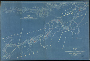
[Plan for proposed Charles River Park]
15.
Plan of Charles River : from the Waltham line to Boston harbor
16.
Plan of Charles River and Warren bridges, with the vicinity
17.
Proposed Charles River Park
18.
Proposed Charles River Park
19.
Public reservations on the banks of the Charles River between Watertown and Cragies Bridge
20.
Sketch plan showing the existing and proposed public reservations upon the banks of the Charles between Waltham line and...
‹ Prev
Next ›
1
2
3
4
5
…
20
21


![[Plan for proposed Charles River Park]](https://bpldcassets.blob.core.windows.net/derivatives/images/commonwealth:cf95jc91c/image_thumbnail_300.jpg)


