Map of the Indian Territory : showing the progress and status of townsite appraisements, under the supervision of the United States Indian Inspector for the Indian Territory, June 30, 1902
Item Information
- Title:
- Map of the Indian Territory : showing the progress and status of townsite appraisements, under the supervision of the United States Indian Inspector for the Indian Territory, June 30, 1902
- Description:
-
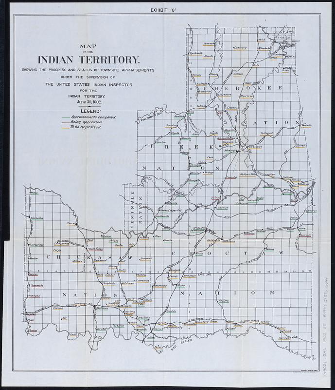
Map of Indian Territory (later to become the eastern part of the state of Oklahoma) showing the boundaries of the Cherokee, Chickasaw, Choctaw, Creek, and Seminole nations. Shows names of townsites underlined in colors indicating "appraisements completed," "being appraised," or "to be appraised." Also shows railroads and Public Land Survey System townships.
- Cartographer:
- United States. Commission to the Five Civilized Tribes
- Lithographer:
- Norris Peters Co.
- Date:
-
[1903]
- Format:
-
Maps/Atlases
- Location:
-
Boston Public Library
Norman B. Leventhal Map & Education Center - Collection (local):
-
Norman B. Leventhal Map & Education Center Collection
- Subjects:
-
Indian Territory--Maps
Oklahoma--Maps
Cities and towns--Valuation--Indian Territory--Maps
Indian reservations--Oklahoma--Maps
- Places:
-
Oklahoma
- Extent:
- 1 map : color ; 53 x 46 cm
- Terms of Use:
-
No known copyright restrictions.
No known restrictions on use.
- Publisher:
-
[Washington, D.C.] :
[Government Printing Office] photo-litho.
- Edition:
- [United States congressional serial set edition]
- Scale:
-
Scale approximately 1:780,000
- Language:
-
English
- Notes:
-
Detached from a United States House of Representatives document in the United States congressional serial set (Serial Set 4459 H.doc.5/4), following page 164: Annual reports of the Department of the Interior for the fiscal year ended June 30, 1902. Indian affairs, part II. Washington : Government Printing Office, 1903.
"Exhibit 'C'."
In lower right corner: DHK-WGB del.
- Notes (date):
-
This date is inferred.
- Identifier:
-
06_01_018351
- Call #:
-
G4021.G46 1902 .U5
- Barcode:
-
39999085966644


