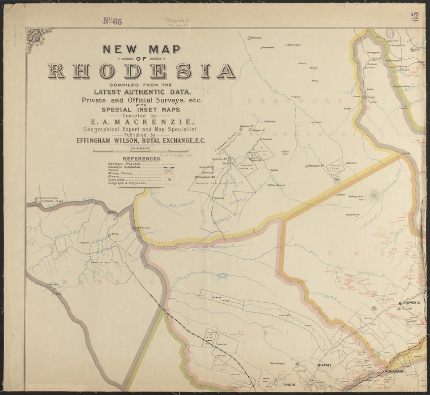
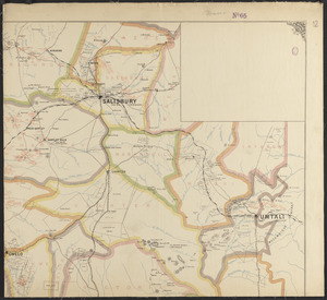
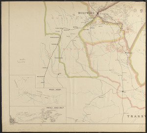
New map of Rhodesia : compiled from the latest authentic data, private and official surveys, etc. with special inset maps
Item Information
- Title:
- New map of Rhodesia : compiled from the latest authentic data, private and official surveys, etc. with special inset maps
- Cartographer:
- Mackenzie, E. A.
- Publisher:
- Wilson, Effingham, 1783-1868
- Name on Item:
-
compiled by E.A. Mackenzie
- Date:
-
[1903]
- Format:
-
Maps/Atlases
- Location:
-
Boston Public Library
Norman B. Leventhal Map & Education Center - Collection (local):
-
Norman B. Leventhal Map & Education Center Collection
- Subjects:
-
Zimbabwe--Maps
- Places:
-
Zimbabwe
- Extent:
- 1 map on 4 sheets : color ; 132 x 145 cm, on sheets 71 x 77 cm
- Terms of Use:
-
No known copyright restrictions.
No known restrictions on use.
- Publisher:
-
London :
Effingham Wilson
- Scale:
-
Scale approximately 1:470,000
- Language:
-
English
- Notes:
-
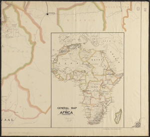
Relief shown by hachures.
Insets: Massi Kessi -- Umtali Gold Belt -- General map of Africa.
- Notes (date):
-
This date is inferred.
- Identifier:
-
06_01_015361A
06_01_015361B
06_01_015361C
06_01_015361D
- Call #:
-
G8560 1903 .M33
- Barcode:
-
39999085935748


