Toggle navigation
LMEC Home
Exhibitions
Georeferencing
Tools for Teachers
Collections
My Favorites
Sign Up / Log In
Search
Search the map portal
Map Collection
Map Collection
Map Sets
Search
Search
Search for
Search In
All Fields
Creator
Title
Subject
Place
Search All Digital Collections
Advanced Search
13694 Results
Filter your Search
Place
North and Central America
10,357
United States
8,484
Massachusetts
2,796
Suffolk (county)
1,678
Boston
1,634
Europe
1,419
Canada
950
New York
650
more
Place
»
Topic
Boston (Mass.)--Maps
748
City planning--Massachusetts--Boston--Maps
418
United States--History--Revolution, 1775-1783--Maps
329
United States--Maps
322
Real property--Massachusetts--Boston--Maps
254
Urban renewal--Massachusetts--Boston--Maps
254
Massachusetts--Maps
233
Insurance surveys
197
more
Topic
»
Date
Date range begin
–
Date range end
Current results range from
1482
to
2023
View distribution
Creator
United States. Hydrographic Office
597
Boston Redevelopment Authority
404
Des Barres, Joseph F. W. (Joseph Frederick Wallet), 1722-1824
247
Royal United Services Institute for Defence and Security Studies
160
Jefferys, Thomas, -1771
154
George, III, King of Great Britain, 1738-1820
152
George, IV, King of Great Britain, 1762-1830
151
O.H. Bailey & Co
148
more
Creator
»
Format
Maps/Atlases
13,513
Manuscripts
985
Prints
102
Books
49
Drawings/Illustrations
44
Photographs
15
Objects/Artifacts
13
Documents
7
more
Format
»
Georeferenced
Yes
979
No
12,715
Collection
Norman B. Leventhal Map & Education Center Collection
9,108
American Revolutionary War-Era Maps
3,305
Boston and New England Maps
2,921
Urban Maps
2,480
Maritime Charts and Atlases
1,169
William L. Clements Library Collection
910
Library of Congress Collection
618
Boston Redevelopment Authority Collection
475
more
Collection
»
Available to use
No known restrictions
10,260
Creative Commons license
1,678
Search Constraints
Sort by date (desc)
relevance
title
date (asc)
date (desc)
Number of results to display per page
50 per page
10
per page
20
per page
50
per page
100
per page
View results as:
grid view
map view
Search Results
401.
Charlestown Navy Yard area
402.
Charlestown Veterans Memorial, Charlestown, Massachusetts
403.
Chesapeake Bay, environmentally sensitive areas
404.
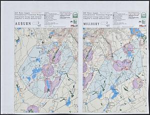
DEP water supply contamination correction program underground storage tank locations compared to natural resource data : Auburn...
405.
Executive Office of Environmental Affairs location of offices
406.
Facsimile general highway map urban area series Peabody
407.
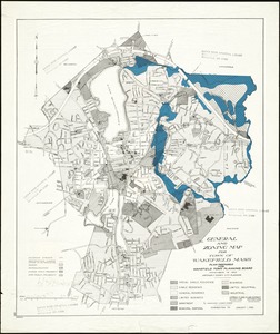
General and zoning map for town of Wakefield Mass.
408.
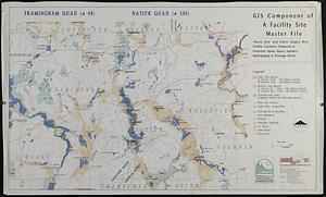
GIS component of a facility site master file : waste site' and public supply well facility locations compared to protected...
409.
Landscaping plan of City Hall Plaza, Boston
410.
Landuse change on Cape Cod 1971-1984
411.
Massachusetts Bay Transportation Authority system map
412.
Massachusetts river basins
413.
Nantucket, Massachusetts : landuse in 1985
414.
The nuclear weapons complex transportation routes
415.
Shawmut Avenue
416.
Swampscott, landuse change 1971-1985
417.
Hancock Woods EGA
418.
Conceptual plan
419.
Downtown and neighborhood cultural facilities
420.
Midtown improvement area
421.
Rose F. Kennedy Garden
422.
Copley Square : layout and pavement plan with tree numbers added
423.
Conceptual plan
424.
Union Park landscape improvements
425.
Aerial photograph of South Boston
426.
Aerial photograph of South Boston
427.
Downtown Boston
428.
Edgartown 1971 to 1985 land use change
429.
Herald Street improvements
430.
Major thoroughfare system : city of Boston, May 1987
431.
Map of Massachusetts : state Senate legislative districts : (Chapter 305 of the Acts of 1987)
432.
Massachusetts coastal zone management
433.
Massachusetts drainage basins
434.
Open space management program index map
435.
Plan of land and street layout in Boston, Mass., Hyde Park : prepared for the Stoney Brook Land Trust
436.
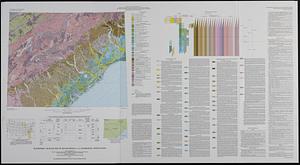
Quaternary geologic map of the Savannah 4° x 6° quadrangle, United States
437.
Site preparation contract for the reconstruction of Copley Square Park, City of Boston, Massachusetts : contract documents
438.
Site preparation contract tree planting - various locations
439.
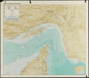
Strait of Hormuz and vicinity
440.
Boston University, Charles River campus master plan
441.
Boston Common - Barry Memorial
442.
Plan for Boston
443.
Long Wharf phase II illustrative plan
444.
Union Park
445.
Long Wharf DEM/BRA master plan : master plan scheme
446.
Long Wharf DEM/BRA master plan : proposed dredging scheme
447.
DEM/BRA Long Wharf master plan : schematic'
448.
Back Bay Fens master plan
449.
Building #33, Charlestown Navy Yard flr. plans
450.
China, military regions
‹ Prev
Next ›
1
2
…
5
6
7
8
9
10
11
12
13
…
273
274