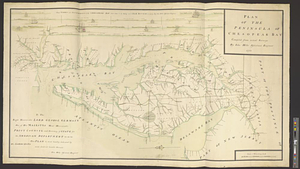
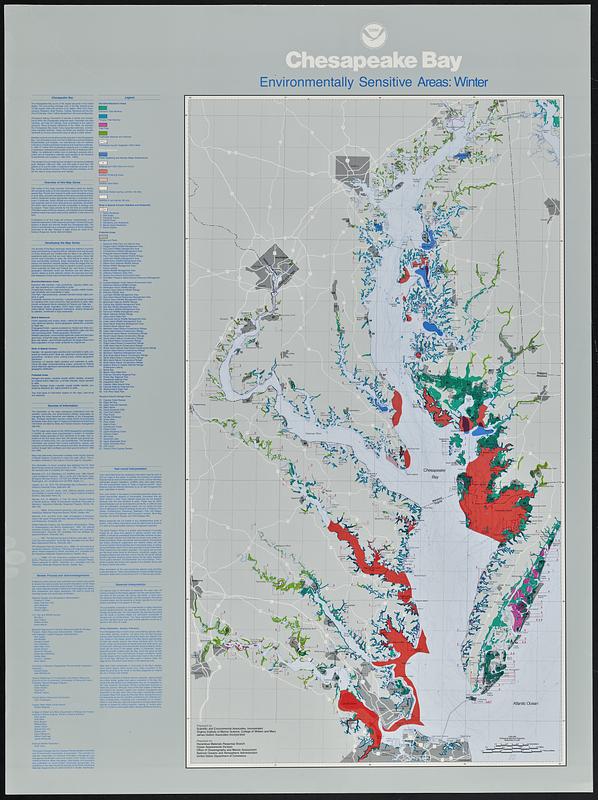
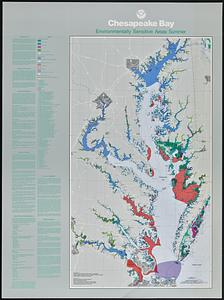
Chesapeake Bay, environmentally sensitive areas

Item Information
- Title:
- Chesapeake Bay, environmentally sensitive areas
- Cartographer:
- Scientific and Environmental Associates
- Project director:
- Walker, Ann Hayward Rooney
- Contributor:
- Virginia Institute of Marine Science
- Contributor:
- James Dobbin Associates Incorporated
- Contributor:
- United States. Ocean Assessments Division. Hazardous Materials Response Branch
- Name on Item:
-
prepared by Scientific and Environmental Associates, Incorporated ; Virginia Institute of Marine Science, College of William and Mary ; James Dobbin Associates Incorporated ; prepared for Hazardous Materials Response Branch, Ocean Assessments Division, Office of Oceanography and Marine Assessment, National Oceanic and Atmospheric Administration, United States Department of Commerce ; the project manager was Ann Hayward Rooney Walker of Scientific and Environmental Associates, Incorporated
- Date:
-
[1988?]
- Format:
-
Maps/Atlases
- Location:
-
Boston Public Library
Norman B. Leventhal Map & Education Center - Collection (local):
-
David Judkins Weaver Papers
- Subjects:
-
Chesapeake Bay (Md. and Va.)--Maps
Wildlife conservation--Chesapeake Bay (Md. and Va.)--Maps
Environmental protection--Chesapeake Bay (Md. and Va.)--Maps
Estuarine area conservation--Chesapeake Bay (Md. and Va.)--Maps
Wetland conservation--Chesapeake Bay Watershed--Maps
Environmentally sensitive areas--Chesapeake Bay Watershed--Maps
- Places:
-
Chesapeake Bay
- Extent:
- 4 maps : color ; 77 x 43 cm, on sheets 92 x 68 cm
- Terms of Use:
-
No known copyright restrictions.
No known restrictions on use.
- Publisher:
-
[Seattle, Wash.?] :
Hazardous Materials Response Branch
- Scale:
-
Scale 1:400,000
- Language:
-
English
- Table of Contents:
-
Spring
Summer
Fall
Winter
- Notes:
-
Also shows biological resources and adjacent wetlands.
Depths shown by isolines.
Includes text, directories, index of protected areas, and NOAA insignia at head of title.
Boston Public Library copy imperfect: Lacking Spring and Fall sheets.
- Identifier:
-
06_01_018810A
06_01_018810B
- Call #:
-
Weaver folder 15 no. 8-9