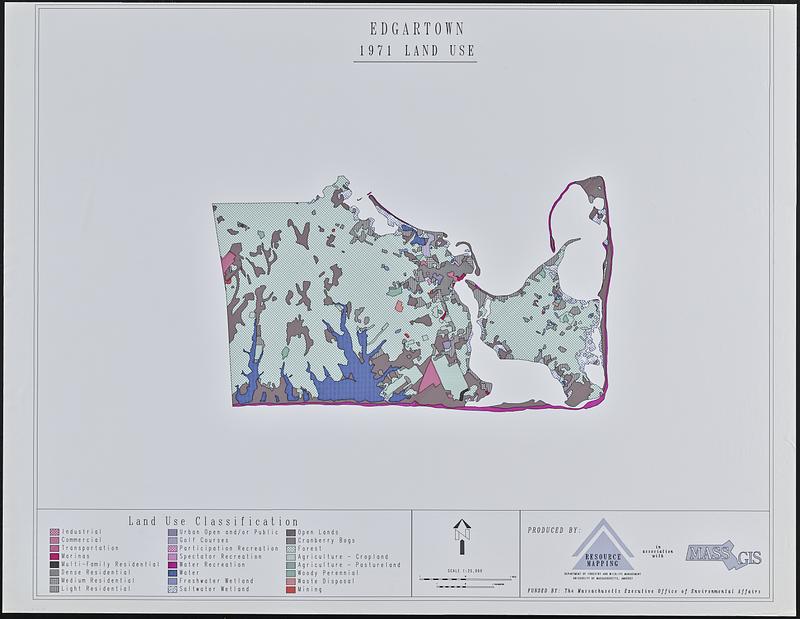
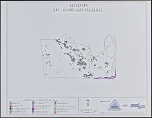
Edgartown 1971 to 1985 land use change
Item Information
- Title:
- Edgartown 1971 to 1985 land use change
- Cartographer:
- University of Massachusetts (Amherst campus). Department of Forestry and Wildlife Management
- Cartographer:
- MassGIS (Office : Mass.)
- Contributor:
- Massachusetts. Executive Office of Environmental Affairs
- Name on Item:
-
produced by Resource Mapping, Department of Forestry and Wildlife Management, University of Massachusetts, Amherst in association with MassGIS
- Date:
-
1987–1991
- Format:
-
Maps/Atlases
- Location:
-
Boston Public Library
Norman B. Leventhal Map & Education Center - Collection (local):
-
David Judkins Weaver Papers
- Subjects:
-
Edgartown (Mass. : Town)--Maps
Land use--Massachusetts--Edgartown (Town)--Maps
- Places:
-
MassachusettsDukes (county)Martha's Vineyard (island)Edgartown
- Extent:
- 2 maps : color ; 83 x 103 cm
- Terms of Use:
-
No known copyright restrictions.
No known restrictions on use.
- Publisher:
-
[Amherst] :
[Department of Forestry and Wildlife Management, University of Massachusetts, Amherst]
- Scale:
-
Scale 1:25,000
- Language:
-
English
- Table of Contents:
-
1971 land use
1971 to 1985 land use change
- Notes:
-
Likely lacking a third sheet showing 1985 land use.
- Identifier:
-
06_01_018823A
06_01_018823B
- Call #:
-
Weaver folder 9 no. 26-27


