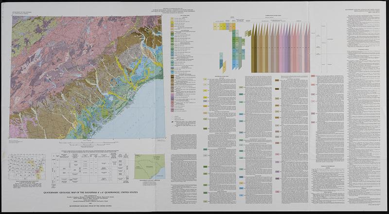
Quaternary geologic map of the Savannah 4° x 6° quadrangle, United States
Item Information
- Title:
- Quaternary geologic map of the Savannah 4° x 6° quadrangle, United States
- Cartographer:
- Geological Survey (U.S.)
- Cartographer:
- Colquhoun, Donald J.
- Cartographer:
- Richmond, Gerald Martin, 1914-
- Cartographer:
- Fullerton, David S.
- Cartographer:
- Weide, David L.
- Contributor:
- Georgia Geologic Survey
- Name on Item:
-
Department of the Interior, U.S. Geological Survey ; state compilations by Donald J. Colquhoun [and six others] ; edited and integrated by Gerald M. Richmond, David S. Fullerton, and David L. Weide
- Date:
-
1987
- Format:
-
Maps/Atlases
- Genre:
-
Geological maps
- Location:
-
Boston Public Library
Norman B. Leventhal Map & Education Center - Collection (local):
-
Applied Geographics, Inc. Records
- Subjects:
-
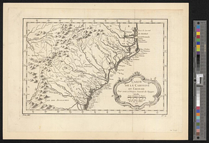
Georgia--Maps
North Carolina--Maps
South Carolina--Maps
Geology, Stratigraphic--Quaternary--Maps
Geology--Georgia--Maps
Geology--North Carolina--Maps
Geology--South Carolina--Maps
- Places:
-
Georgia
North Carolina
South Carolina
- Extent:
- 1 map : col. ; 44 x 56 cm., on sheet 76 x 140 cm., folded in envelope 30 x 24 cm.
- Terms of Use:
-
No known copyright restrictions.
No known restrictions on use.
- Publisher:
-
Reston, Va. :
U.S. Geological Survey
- Scale:
-
Scale 1:1,000,000
- Projection:
- Lambert conformal conic proj.
- Language:
-
English
- Notes:
-
Relief shown by contours and spot heights.
Depths shown by isolines.
Includes text, index map, table, ancillary map, and bibliographies.
- Identifier:
-
06_01_019109
- Call #:
-
AppGeo Folder 35 no.5