Toggle navigation
LMEC Home
Exhibitions
Georeferencing
Tools for Teachers
Collections
My Favorites
Sign Up / Log In
Search
Search the map portal
Map Collection
Map Collection
Map Sets
Search
Search
Search for
Search In
All Fields
Creator
Title
Subject
Place
Search All Digital Collections
Advanced Search
14021 Results
Filter your Search
Place
North and Central America
10,683
United States
8,692
Massachusetts
2,808
Suffolk (county)
1,682
Boston
1,638
Europe
1,420
Canada
1,009
New York
674
more
Place
»
Topic
Boston (Mass.)--Maps
748
City planning--Massachusetts--Boston--Maps
418
United States--History--Revolution, 1775-1783--Maps
331
United States--Maps
328
Real property--Massachusetts--Boston--Maps
254
Urban renewal--Massachusetts--Boston--Maps
254
North America--Maps--Early works to 1800
240
Massachusetts--Maps
234
more
Topic
»
Date
Date range begin
–
Date range end
Current results range from
1482
to
2023
View distribution
Creator
United States. Hydrographic Office
597
Boston Redevelopment Authority
404
Des Barres, Joseph F. W. (Joseph Frederick Wallet), 1722-1824
247
Jefferys, Thomas, -1771
172
Royal United Services Institute for Defence and Security Studies
160
George, III, King of Great Britain, 1738-1820
152
George, IV, King of Great Britain, 1762-1830
151
O.H. Bailey & Co
148
more
Creator
»
Format
Maps/Atlases
13,839
Manuscripts
985
Prints
102
Books
49
Drawings/Illustrations
44
Photographs
15
Objects/Artifacts
13
Documents
7
more
Format
»
Georeferenced
Yes
979
No
13,042
Collection
Norman B. Leventhal Map & Education Center Collection
9,110
American Revolutionary War-Era Maps
3,627
Boston and New England Maps
2,921
Urban Maps
2,480
Maritime Charts and Atlases
1,169
William L. Clements Library Collection
910
Library of Congress Collection
618
Boston Redevelopment Authority Collection
475
more
Collection
»
Available to use
No known restrictions
10,268
Creative Commons license
1,678
Search Constraints
Sort by relevance
relevance
title
date (asc)
date (desc)
Number of results to display per page
20 per page
10
per page
20
per page
50
per page
100
per page
View results as:
grid view
map view
Search Results
8841.
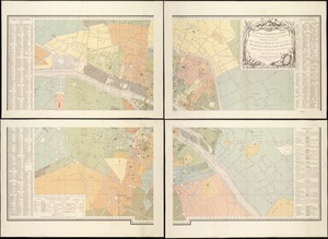
Plan des paroisses de Paris : avec la distinction des parties eparses qui de dépendent
8842.
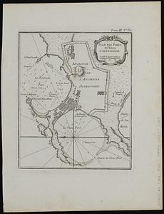
Plan des ports et ville d'Alexandrie
8843.
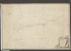
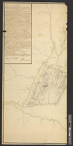
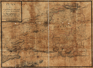
Plan des terres de Abénaquis et Sokokis du village St-Francois situé dans le comté Buckinghamshire, district des Trois-Rivières...
8844.
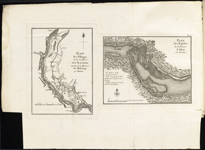
Plan des villages de la contrée des Illinois et partie de la Riviere de Mississipi ; plan des Rapides de la Riviere d'Ohio
8845.
Plan d'operation de l'armée Angloise sous les ordres du General Howe sur Staten.-Long-&Yorck Island, depuis le mois d'Aout...
8846.
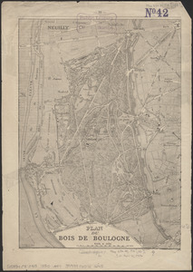
Plan du Bois de Boulogne
8847.
Plan du camp retranchè à Wilmington pour y couvrir notre hospital apres la Battaille de Brandywine
8848.
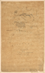
Plan du canton de Plimouth et partie des Baradéres
8849.
Plan du Cap Breton, dit Louisbovrg avec ces environs pries
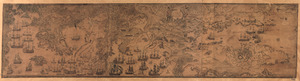
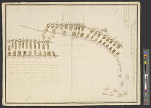
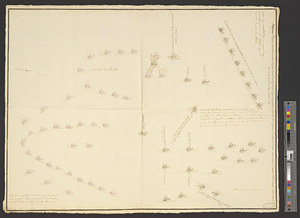
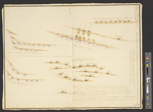
8850.
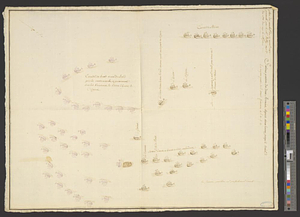
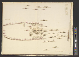
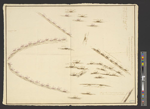
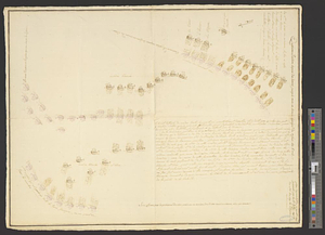
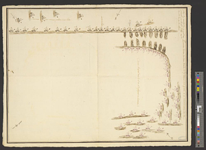
Plan du combat du 12 Avril 1782 présenté par le chr. Dethy capne. du vass. de roy le Citoyen : troisième position des deux...
8851.
Plan du combat du 12 Avril 1782 présenté par le chr. Dethy capne. du vass. de roy le Citoyen : septième position des deux...
8852.
Plan du combat du 12 Avril 1782 présenté par le chr. Dethy capne. du vass. de roy le Citoyen : cinquième position des deux...
8853.
Plan du combat du 12 Avril 1782 présenté par le chr. Dethy capne. du vass. de roy le Citoyen : sixième position des deux armées...
8854.
Plan du combat du 12 Avril 1782 présenté par le chr. Dethy capne. du vass. de roy le Citoyen : neuvième et dernière position...
8855.
Plan du combat du 12 Avril 1782 présenté par le chr. Dethy capne. du vass. de roy le Citoyen : huitième position des deux...
8856.
Plan du combat du 12 Avril 1782 présenté par le chr. Dethy capne. du vass. de roy le Citoyen : quatrième position depuis dix...
8857.
Plan du combat du 12 Avril 1782 présenté par le chr. Dethy capne. du vass. de roy le Citoyen : Première position des deux...
8858.
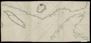
Plan du detroit de Belle Isle et du Golphe St. Laurent pour la coste du nord
8859.
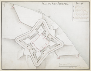
PLAN DU FORT AUGUSTA
8860.
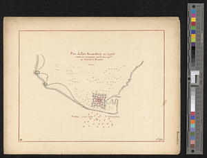
Plan du Fort Boccachica qui deffend l'entrée de Cartagene sur la cote septle de l'isthme de Panama
‹ Prev
Next ›
1
2
…
439
440
441
442
443
444
445
446
447
…
701
702