Toggle navigation
LMEC Home
Exhibitions
Georeferencing
Tools for Teachers
Collections
My Favorites
Sign Up / Log In
Search
Search the map portal
Map Collection
Map Collection
Map Sets
Search
Search
Search for
Search In
All Fields
Creator
Title
Subject
Place
Search All Digital Collections
Advanced Search
14021 Results
Filter your Search
Place
North and Central America
10,683
United States
8,692
Massachusetts
2,808
Suffolk (county)
1,682
Boston
1,638
Europe
1,420
Canada
1,009
New York
674
more
Place
»
Topic
Boston (Mass.)--Maps
748
City planning--Massachusetts--Boston--Maps
418
United States--History--Revolution, 1775-1783--Maps
331
United States--Maps
328
Real property--Massachusetts--Boston--Maps
254
Urban renewal--Massachusetts--Boston--Maps
254
North America--Maps--Early works to 1800
240
Massachusetts--Maps
234
more
Topic
»
Date
Date range begin
–
Date range end
Current results range from
1482
to
2023
View distribution
Creator
United States. Hydrographic Office
597
Boston Redevelopment Authority
404
Des Barres, Joseph F. W. (Joseph Frederick Wallet), 1722-1824
247
Jefferys, Thomas, -1771
172
Royal United Services Institute for Defence and Security Studies
160
George, III, King of Great Britain, 1738-1820
152
George, IV, King of Great Britain, 1762-1830
151
O.H. Bailey & Co
148
more
Creator
»
Format
Maps/Atlases
13,839
Manuscripts
985
Prints
102
Books
49
Drawings/Illustrations
44
Photographs
15
Objects/Artifacts
13
Documents
7
more
Format
»
Georeferenced
Yes
979
No
13,042
Collection
Norman B. Leventhal Map & Education Center Collection
9,110
American Revolutionary War-Era Maps
3,627
Boston and New England Maps
2,921
Urban Maps
2,480
Maritime Charts and Atlases
1,169
William L. Clements Library Collection
910
Library of Congress Collection
618
Boston Redevelopment Authority Collection
475
more
Collection
»
Available to use
No known restrictions
10,268
Creative Commons license
1,678
Search Constraints
Sort by relevance
relevance
title
date (asc)
date (desc)
Number of results to display per page
20 per page
10
per page
20
per page
50
per page
100
per page
View results as:
grid view
map view
Search Results
8861.
Plan du fort de Carillon et de ses environs avec l'attaque des retranchments faite par une armee Angloise de 25000 homes aux...
8862.
Plan du fort de Chouéghen de la Riviere Et de terrain aux Environs au Sud du Lac Ontario
8863.
Plan du Fort des Yachoux, concession de Mgr. le duc de Belle Isle et associez, detruit 1729
8864.
Plan du Fort du Sault de St. Louis et du village des sauvages Iroquois
8865.
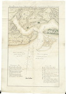
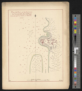
Plan du fort et des environs de l'entrée de la riv. de Chagre sur la cote septle de l'isthme de Panama
8866.
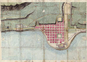
Plan du fort et ville de Louisbourg dans l'Isle Roale
8867.
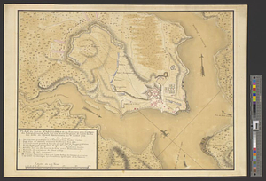
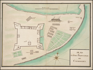
Plan du Fort Frontenac ou Cataracouy
8868.
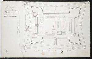
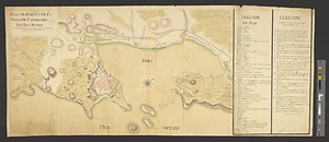
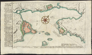
[Plan Du fort Georges appelé par les Anglois William-Henri prie par les francois en 1757 le 9 Aout]
8869.
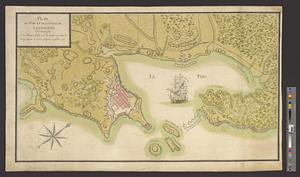
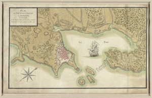
Plan du fort S.t Jean
8870.
Plan du Havre et de la barre de Ste. Marie par les Angloises appellée Amélia, ainsi que de la Barre dans la Floride orientale
8871.
Plan du Môle St. Nicolas
8872.
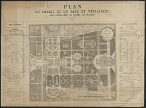
Plan du palais et du parc de Versailles
8873.
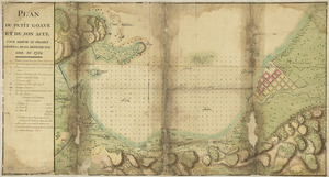
Plan du Petit Goâve et de son acul pour servir au projet général de sa défense par mer en 1752
8874.
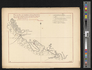
Plan du port de Calidone et de ses environs dans le Golfe de Darien et sur la cote septle de l'isthme de Panama
8875.
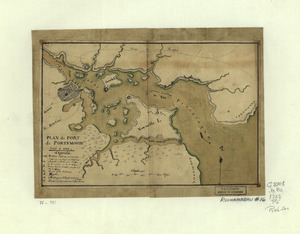
Plan du port de Portsmouth levé à vue
8876.
Plan du port et de la ville de Boulogne
8877.
Plan du port et de la ville de Louisbourg : avec ses batteries et sa perspective, où est réprésenté les batteries faites...
8878.
Plan du port et de la ville de Louisbourg en l'Isle Royale et des attaques faites par les Anglois pandent le siege depuis le 8...
8879.
Plan du port et de la ville de Louisbourg en l'Isle Royale, et des Attaques faites par les Anglois pendant le Siége depuis le 8...
8880.
Plan du port et de la ville de Louisbourg en l'Isle Royale, et des attaques faites par les Anglois pendant le siége dépuis le...
‹ Prev
Next ›
1
2
…
440
441
442
443
444
445
446
447
448
…
701
702
![[Plan Du fort Georges appelé par les Anglois William-Henri prie par les francois en 1757 le 9 Aout]](https://bpldcassets.blob.core.windows.net/derivatives/images/commonwealth:hx11z1913/image_thumbnail_300.jpg)