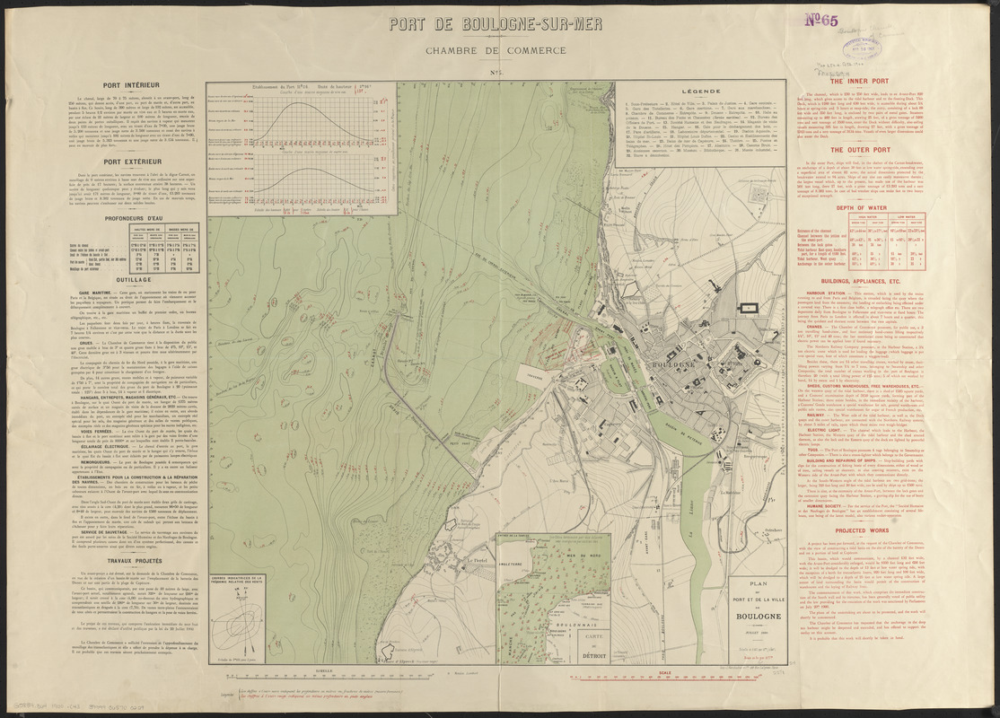
Plan du port et de la ville de Boulogne
Item Information
- Title:
- Plan du port et de la ville de Boulogne
- Title (alt.):
-
Port de Boulogne-sur-Mer
- Publisher:
- Chambre de commerce de Boulogne-sur-Mer
- Printer:
- J. Marchadier et cie.
- Name on Item:
-
Chambre de Commerce
- Date:
-
1900
- Format:
-
Maps/Atlases
- Location:
-
Boston Public Library
Norman B. Leventhal Map & Education Center - Collection (local):
-
Norman B. Leventhal Map & Education Center Collection
- Subjects:
-
Navigation--France--Boulogne-sur-Mer
Harbors--France--Boulogne-sur-Mer--Maps
Boulogne-sur-Mer (France)--Maps
- Places:
-
FranceHauts-de-France (region)Boulogne
- Extent:
- 1 map : color ; 61 x 61 cm on sheet 75 x 104 cm
- Terms of Use:
-
No known copyright restrictions.
No known restrictions on use.
- Publisher:
-
[Boulogne] :
Chambre de Commerce
- Scale:
-
Scale 1:10,000
- Language:
-
French
English
- Notes:
-
Relief shown by contours. Depths shown by soundings and isolines.
Inset: Carte du Détroit.
Includes profile of tides and diagram showing frequency of winds.
Descriptive text to left and right of map.
Above map: no. 5.
Map in French. Text in French and English.
- Identifier:
-
06_01_014208
- Call #:
-
G5834.B64 1900 .C43
- Barcode:
-
39999065700229


