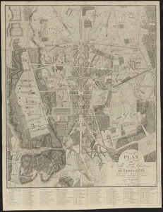
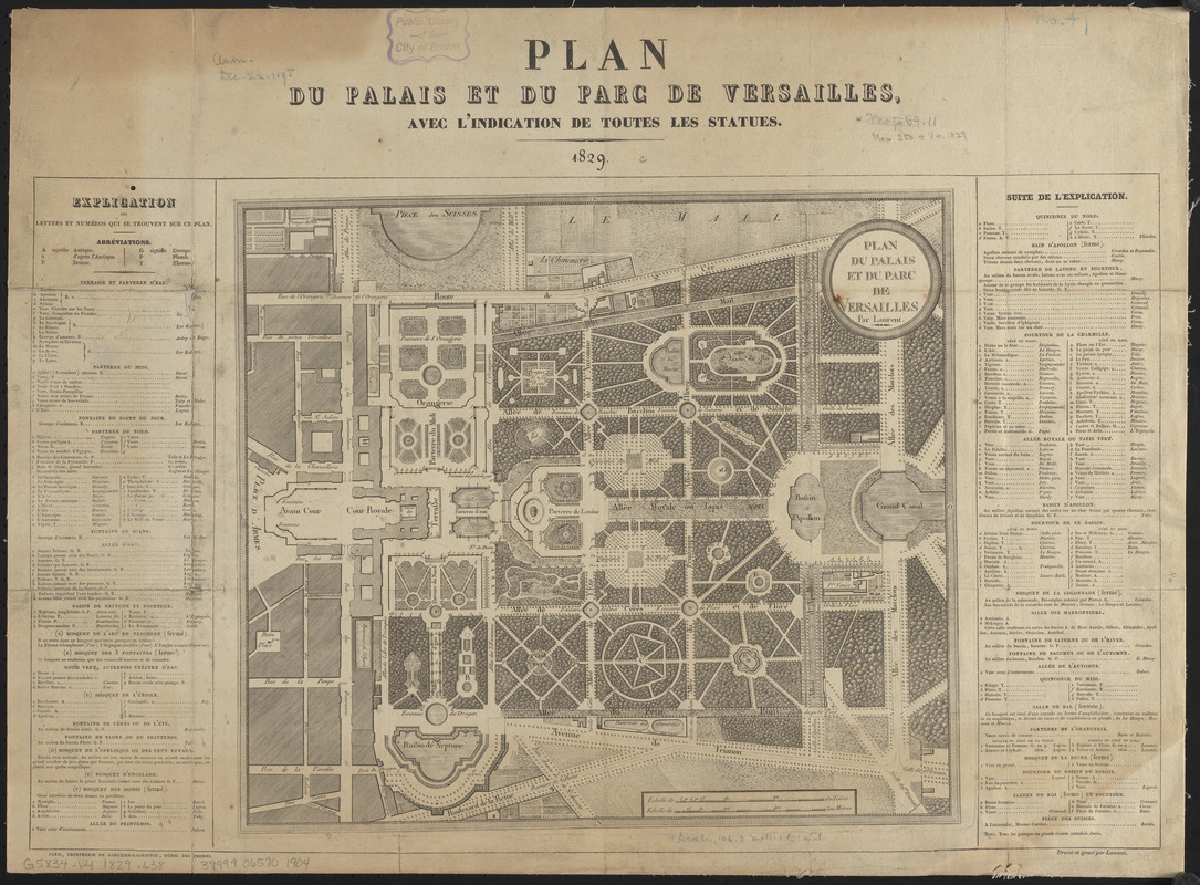
Plan du palais et du parc de Versailles
Item Information
- Title:
- Plan du palais et du parc de Versailles
- Title (alt.):
-
Plan du palais et du parc de Versailles, avec l'indication de toutes les statues
- Cartographer:
- Laurent
- Publisher:
- Imprimerie de Gaultier-Laguionie
- Name on Item:
-
par Laurent
- Date:
-
1829
- Format:
-
Maps/Atlases
- Location:
-
Boston Public Library
Norman B. Leventhal Map & Education Center - Collection (local):
-
Norman B. Leventhal Map & Education Center Collection
- Subjects:
-
Versailles (France)--Maps
- Places:
-
FranceÎle-de-France (region)Versailles
- Extent:
- 1 map ; 29 x 33 cm on sheet 41 x 56 cm
- Terms of Use:
-
No known copyright restrictions.
No known restrictions on use.
- Publisher:
-
Paris :
Imprimerie de Gaultier-Laguinie, Hôtel des Permes
- Scale:
-
Scale approximately 1:4,200
- Language:
-
French
- Notes:
-
Oriented with north towards the upper right.
Includes key to points of interest.
- Identifier:
-
06_01_014242
- Call #:
-
G5834.V4 1829 .L38
- Barcode:
-
39999065701904