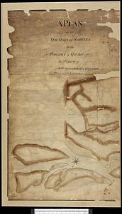
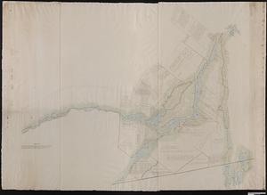
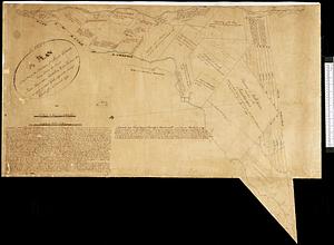
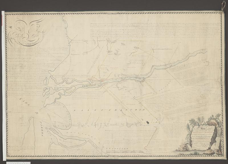
Plan des terres de Abénaquis et Sokokis du village St-Francois situé dans le comté Buckinghamshire, district des Trois-Rivières dans la province du Bas Canada
This map is also available in American Revolutionary Geographies Online (ARGO), a collections portal especially built for material relating to the American Revolutionary War Era. Visit ARGO to learn more about this item and explore the historical geography of North America in the late eighteenth century.
Item Information
- Title:
- Plan des terres de Abénaquis et Sokokis du village St-Francois situé dans le comté Buckinghamshire, district des Trois-Rivières dans la province du Bas Canada
- Cartographer:
- De Pincier, Théodore, 1750-1824
- Cartographer:
- Bouchette, Joseph, 1774-1841
- Name on Item:
-
arpenté par Theodr. De Penciere D.A.P. Copié par Jospeh Bouchette De. Arpt. Genl.
- Date:
-
[1798]
- Format:
-
Maps/Atlases
- Genre:
-
Manuscript maps
- Location:
- Library and Archives Canada
- Collection (local):
-
Library and Archives Canada Collection
- Subjects:
-
Seigneuries--Québec (Province)--Maps
Québec (Province)--Maps--Early works to 1800
Abenaki Indians--Québec (Province)
Land ownership--Québec (Province)--Maps
Odanak (Québec)
- Places:
-
CanadaQuebec (province)
Odanak
- Extent:
- 1 manuscript map : hand color ; 62 x 95 cm
- Terms of Use:
-
Copyright expired. Contact host institution to download image.
Contact host institution for more information.
- Place of origin:
-
[Québec]
- Language:
-
French
- Catalog Record:
-
Catalog record
- Notes (date):
-
This date is inferred.
- Identifier:
-
e011314008
- Barcode:
-
4133855