Search Constraints
Search Results


10906. Railroad map of Illinois


10909. Railroads of Lithuania, 1939


10912. The railway map of Japan


10944. Randolph, Massachusetts

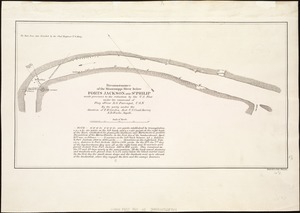
![The rapids of the Ohio commonly called the falls 682 miles below Fort Pitt in 38 [degrees]; 08' no. latitude](https://bpldcassets.blob.core.windows.net/derivatives/metadata/commonwealth-oai:3x81bj69w/image_thumbnail_300.jpg)


10948. Reading : town of Reading
![Reading Village, east side [Massachusetts]](https://bpldcassets.blob.core.windows.net/derivatives/images/commonwealth:pv63g493p/image_thumbnail_300.jpg)

10951. Readville, Massachusetts


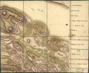

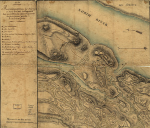
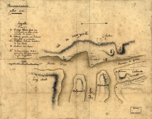
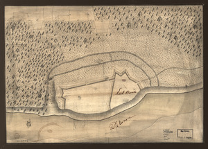
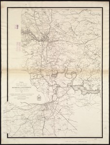
10967. Reconnoissance, juillet 1781


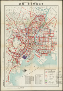
10972. Reconstruction work in Tokyo

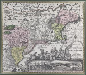
10974. Red Banke
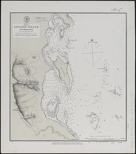
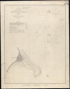
10976. Red Sea, Strait of Jubal


10986. Region of Gaspee Bay

10987. Region of Hare Island

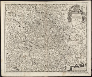
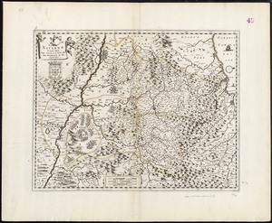
![Regni Hungariae, et regionum, quae ei quondam fuêre unitae, ut Transilvaniae, Valachiae, Moldaviae, Serviae, Romaniae, Bulgariae, Bessarabiae, Croatiae, Bosniae, Dalmatiae, Sclavoniae, Morlachiae, Ragusanae Reipublicae, maximaeq[ue] partis Danubii Fluminis, novissima delineatio](https://bpldcassets.blob.core.windows.net/derivatives/images/commonwealth:cj82ks70z/image_thumbnail_300.jpg)
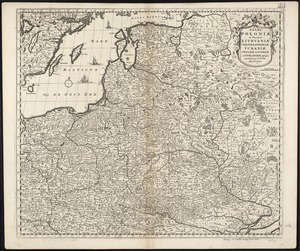
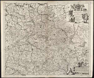
![Regni Sueciae tabula generalis, divisa in Sueciae, Gotiaeq[ue] regna Finniae ducatum Lapponiam, Livoniam Ingrianq[ue] et in omnes subiacentes provincias](https://bpldcassets.blob.core.windows.net/derivatives/images/commonwealth:cj82kt14t/image_thumbnail_300.jpg)
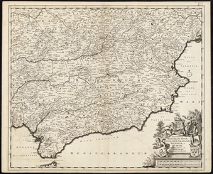
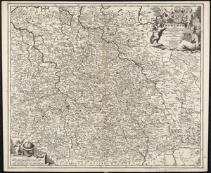
![Regnorum Castellae veteris, Legionis, et Gallaeciae, principatuumq[ue] Biscaiae, et Asturiarum, accuratissima descriptio](https://bpldcassets.blob.core.windows.net/derivatives/images/commonwealth:cj82km30z/image_thumbnail_300.jpg)