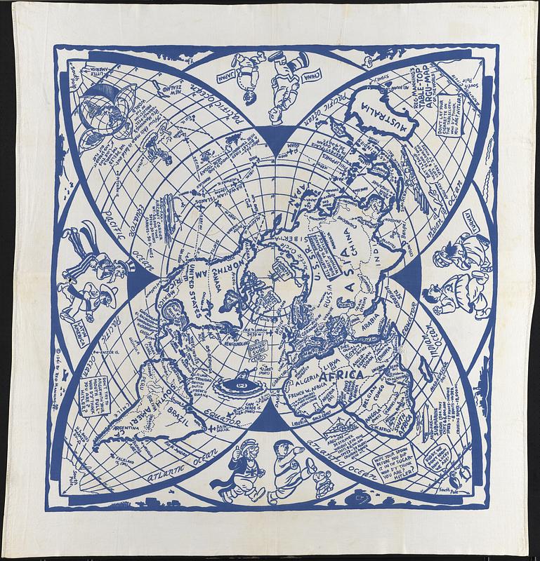
Reg Manning's table-top argu-map of the world
Item Information
- Title:
- Reg Manning's table-top argu-map of the world
- Title (alt.):
-
Table-top argu-map of the world
- Cartographer:
- Manning, Reg, 1905-1986
- Date:
-
1941
- Format:
-
Maps/Atlases
Objects/Artifacts
- Genre:
-
World maps
Pictorial maps
Tablecloths
- Location:
-
Boston Public Library
Norman B. Leventhal Map & Education Center - Collection (local):
-
Norman B. Leventhal Map & Education Center Collection
- Subjects:
-
World War, 1939-1945--Caricatures and cartoons--Maps
- Places:
-
World
- Extent:
- 1 map : cloth ; 107 x 100 cm, on sheet 128 x 122 cm
- Terms of Use:
-
No known copyright restrictions.
No known restrictions on use.
- Publisher:
-
[Phoenix, Arizona] :
[Goldwaters]
- Scale:
-
Scale not given
- Projection:
- orange-peel projection
- Language:
-
English
- Notes:
-
Printed in blue on white cloth.
Cartoon pictorial map tablecloth with caricatures, illustrations, and text relating to World War II.
Accompanied by four illustrated napkins, each 32 x 28 cm. Boston Public Library lacking napkins.
Hole on eastern coast of Africa at the equator (roughly darned with white thread) and hole in the foot of the illustration of Uncle Sam.
- Identifier:
-
06_01_017387
- Call #:
-
G3201.S7 1941 .M36
- Barcode:
-
39999085965711


