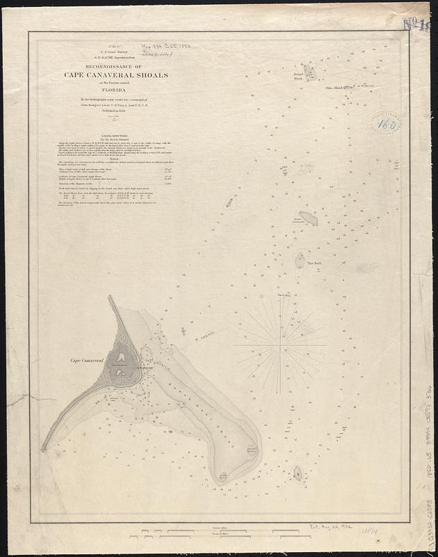
Reconnoissance of Cape Canaveral Shoals on the eastern coast of Florida
Item Information
- Title:
- Reconnoissance of Cape Canaveral Shoals on the eastern coast of Florida
- Title (alt.):
-
Reconnaissance of Cape Canaveral Shoals on the eastern coast of Florida
- Cartographer:
- United States Coast Survey
- Contributor:
- Bache, A. D. (Alexander Dallas), 1806-1867
- Surveyor:
- Rodgers, John, 1812-1882
- Name on Item:
-
by the hydrographic party under the command of John Rodgers Lieut. U.S. Navy & Asst. U.S.C.S.
- Date:
-
1850
- Format:
-
Maps/Atlases
- Genre:
-
Nautical charts
- Location:
-
Boston Public Library
Norman B. Leventhal Map & Education Center - Collection (local):
-
Norman B. Leventhal Map & Education Center Collection
- Subjects:
-
Canaveral, Cape (Fla. : Cape)--Maps
Nautical charts--Florida--Canaveral, Cape (Cape)
- Places:
-
FloridaBrevard (county)Canaveral, Cape
- Extent:
- 1 map ; 47 x 37 cm
- Terms of Use:
-
No known copyright restrictions.
No known restrictions on use.
- Publisher:
-
[Washington, D.C.] :
U.S. Coast Survey
- Scale:
-
Scale 1:60,000
- Language:
-
English
- Notes:
-
Depths shown by gradient tints and soundings.
Includes sailing directions and notes.
Above title: "(F No. 2) U.S. Coast Survey A.D. Bache Superintendent."
- Identifier:
-
06_01_017051
- Call #:
-
G3932.C25P5 1850 .U5
- Barcode:
-
39999085953766


