Search Constraints
Search Results


35. Middlebury, Vt

36. Springfield, Vt


39. Ludlow, Vt

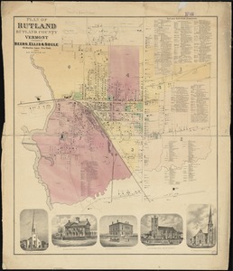
40. Rutland, Vt


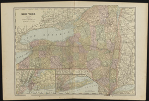
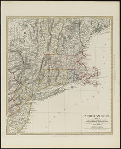
45. New York


52. Colton's Vermont


![Map showing the relative distances of Porsmouth [i.e. Portsmouth] and Boston from Concord & Manchester, N.H](https://bpldcassets.blob.core.windows.net/derivatives/images/commonwealth:7h14b104z/image_thumbnail_300.jpg)


![[Map of the railroads of Massachusetts running west from Boston]](https://bpldcassets.blob.core.windows.net/derivatives/images/commonwealth:x059cc84w/image_thumbnail_300.jpg)


![A comprehensive atlas geographical, historical & commercial [title page]](https://bpldcassets.blob.core.windows.net/derivatives/images/commonwealth:3f463182f/image_thumbnail_300.jpg)


77. Africa


79. South America


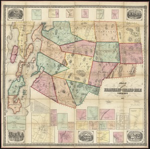
82. Vermont


84. The world


![A new map of part of the United States of North America, containing those of New York, Vermont, New Hampshire, Massachusets [sic], Connecticut, Rhode Island, Pennsylvania, New Jersey, Delaware, Maryland and Virginia](https://bpldcassets.blob.core.windows.net/derivatives/images/commonwealth:6t053p06v/image_thumbnail_300.jpg)


![[Map depicting early land division and ownership in Barnard, Vermont]](https://bpldcassets.blob.core.windows.net/derivatives/images/commonwealth:kk91ft09h/image_thumbnail_300.jpg)


