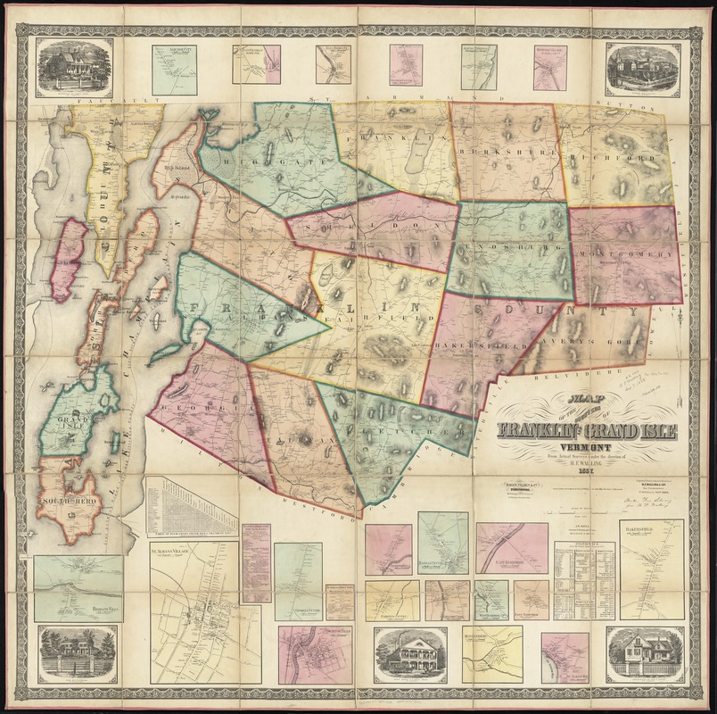
Map of the counties of Franklin and Grand Isle, Vermont : from actual surveys
Item Information
- Title:
- Map of the counties of Franklin and Grand Isle, Vermont : from actual surveys
- Creator:
- Walling, Henry Francis, 1825-1888
- Name on Item:
-
under the direction of H.F. Walling.
- Date:
-
1857
- Format:
-
Maps/Atlases
- Location:
-
Boston Public Library
Norman B. Leventhal Map & Education Center - Collection (local):
-
Norman B. Leventhal Map & Education Center Collection
- Subjects:
-
Real property--Vermont--Franklin County--Maps
Real property--Vermont--Grand Isle County--Maps
Cities and towns--Vermont--Franklin County--Maps
Cities and towns--Vermont--Grand Isle County--Maps
Villages--Vermont--Franklin County--Maps
Villages--Vermont--Grand Isle County--Maps
Landowners--Vermont--Franklin County--Maps
Landowners--Vermont--Grand Isle County--Maps
Franklin County (Vt.)--Maps
Grand Isle County (Vt.)--Maps
- Places:
-
VermontFranklin (county)
VermontGrand Isle (county)
- Extent:
- 1 map : hand col. ; 136 x 138 cm.
- Terms of Use:
-
No known copyright restrictions.
No known restrictions on use.
- Publisher:
-
Boston :
Baker, Tilden & Co.
- Scale:
-
Scale 1:50,000
- Language:
-
English
- Notes:
-
Shows buildings with names of property owners.
Relief shown by hachures.
"Engraved, printed, colored and mounted at H.F. Walling & Co.'s Map Establishment."
"Entered according to Act of Congress A.D. 1857 by H.F. Walling in the Clerks Office of the District of Massachusetts."
Includes cadastral insets of 20 towns or villages, and 5 ill. of local residences and buildings.
Includes also tables of statistics and distances, and business directories for St. Albans and Swanton Falls.
- Identifier:
-
06_01_010601
- Call #:
-
G3753.F7 1857 .W35
- Barcode:
-
39999065675512
- LCCN:
-
2005625354


