Map of the railroads of the state of Massachusetts : accompanying the report of the railroad commissioners : 1899
Item Information
- Title:
- Map of the railroads of the state of Massachusetts : accompanying the report of the railroad commissioners : 1899
- Creator:
- Massachusetts. Board of Railroad Commissioners
- Date:
-
1900
- Format:
-
Maps/Atlases
- Location:
-
Boston Public Library
Norman B. Leventhal Map & Education Center - Collection (local):
-
Norman B. Leventhal Map & Education Center Collection
- Subjects:
-
Railroads--Massachusetts--Maps
Narrow gauge railroads--Massachusetts--Maps
Massachusetts--Maps
- Places:
-
Massachusetts
- Extent:
- 1 map : col. ; 66 x 85 cm.
- Terms of Use:
-
No known copyright restrictions.
No known restrictions on use.
- Publisher:
-
Boston :
Geo. H. Walker & Co.
- Scale:
-
Scale [1:443,520]
- Language:
-
English
- Notes:
-
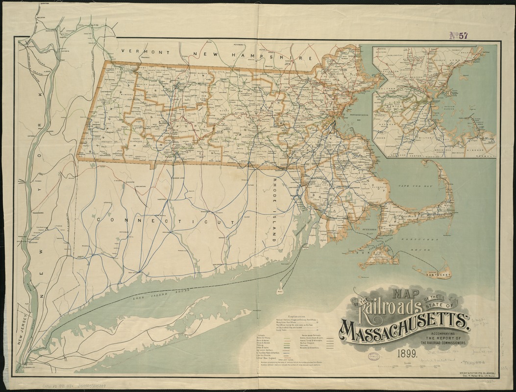
Shows town and county boundaries, railroad stations, villages, ordinary post offices, money order post offices, and county towns; nine named standard-gauge railroads or systems, distinguished by color and hatching; and five narrow-gauge railroads.
No graticule. Coordinates not given; calculated from data given in American atlas, 4th ed. rev. 1987.
Shows continuation of lines into New Hampshire, Vermont, New York, New Jersey, Connecticut and Rhode Island.
Inset: [Boston and suburbs (Bedford to Marblehead, Dover and Norwood to Norwell and Cohasset)]. Shows same details as on main map.
- Identifier:
-
06_01_005591
- Call #:
-
G3761.P3 1899 .M3x
- Barcode:
-
39999059015337
![[Boston and Northwestern Junction Railroad]](https://bpldcassets.blob.core.windows.net/derivatives/images/commonwealth:x059cc74n/image_thumbnail_300.jpg)


