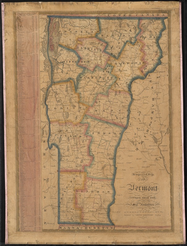
An improved map of Vermont : compiled from the latest authorities
Item Information
- Title:
- An improved map of Vermont : compiled from the latest authorities
- Date:
-
1834
- Format:
-
Maps/Atlases
- Location:
-
Boston Public Library
Norman B. Leventhal Map & Education Center - Collection (local):
-
Norman B. Leventhal Map & Education Center Collection
- Subjects:
-
Vermont--Maps
- Places:
-
Vermont
- Extent:
- 1 map : col. ; 60 x 42 cm.
- Terms of Use:
-
No known copyright restrictions.
No known restrictions on use.
- Publisher:
-
Reading, [Vt.] :
Lewis Robinson
- Scale:
-
Scale [ca. 1:456,000]
- Language:
-
English
- Notes:
-
Shows town and county boundaries, roads, and neighboring towns in New York, New Hampshire and Massachusetts.
Relief shown by hachures.
Prime meridian: Washington.
Includes table listing towns, population, and distance by mail route from Montpelier.
- Identifier:
-
06_01_010416
- Call #:
-
G3750 1834 .I47
- Barcode:
-
39999065671305


