Map of Addison County, Vermont
Item Information
- Title:
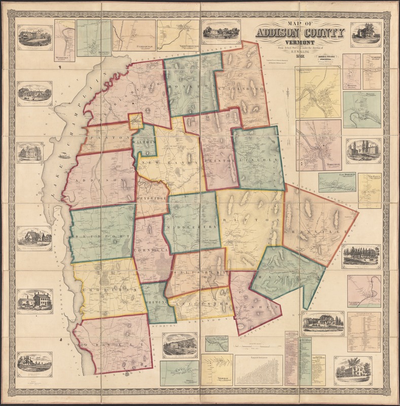
- Map of Addison County, Vermont
- Description:
-
Engraved wall map. 16 insets of village plans, 13 views of prominent places, table of distances, 3 business directories, statistics from 1850 census. Shows buildings and householders' names.
- Creator:
- Walling, Henry Francis, 1825-1888
- Name on Item:
-
from actual surveys under the direction of H.F. Walling.
- Date:
-
1857
- Format:
-
Maps/Atlases
- Location:
-
Boston Public Library
Norman B. Leventhal Map & Education Center - Collection (local):
-
Norman B. Leventhal Map & Education Center Collection
- Subjects:
-
Addison County (Vt.)--Maps
- Places:
-
VermontAddison (county)
- Extent:
- 1 map : hand-col. ; 132 x 132 cm.
- Terms of Use:
-
No known copyright restrictions.
No known restrictions on use.
- Publisher:
-
Boston :
Baker & Tilden
- Scale:
-
Scale 1:47,520. 1 in. equals 3/4 mile.
- Language:
-
English
- Notes:
-
Views taken by J.H. Stearns, daguerrean artist, Vergennes, Vt.
Cadastral map.
Relief shown by hachures.
- Identifier:
-
06_01_002500
- Call #:
-
G3753.A2 1857 .W3
- Barcode:
-
39999058995273


