Toggle navigation
LMEC Home
Exhibitions
Georeferencing
Tools for Teachers
Collections
My Favorites
Sign Up / Log In
Search
Search the map portal
Map Collection
Map Collection
Map Sets
Search
Search
Search for
Search In
All Fields
Creator
Title
Subject
Place
Search All Digital Collections
Advanced Search
54 Results
My Search
Start Over
More Like
commonwealth:z603vp14k
Remove constraint More Like: commonwealth:z603vp14k
Filter your Search
Place
North and Central America
47
Northeastern United States
32
United States
12
New York
11
New England
10
North America
10
Canada
6
Middle Atlantic
6
more
Place
»
Topic
Northeastern States--Maps--Early works to 1800
37
New England--Maps--Early works to 1800
10
New York (State)--Maps--Early works to 1800
9
North America--Maps--Early works to 1800
7
Middle Atlantic States--Maps--Early works to 1800
6
New Jersey--Administrative and political divisions--Maps--Early works to 1800
6
New Jersey--Maps--Early works to 1800
5
New York (State)--Administrative and political divisions--Maps--Early works to 1800
5
more
Topic
»
Date
Date range begin
–
Date range end
Current results range from
1635
to
1800
View distribution
Creator
Bellin, Jacques Nicolas, 1703-1772
4
Evans, Lewis, 1700?-1756
4
Pownall, Thomas, 1722-1805
4
Jefferys, Thomas, -1771
3
Sauthier, Claude Joseph
3
Allard, Huych, 1625-1691
2
Amherst, Jeffery Amherst, Baron, 1717-1797
2
Andrews, Peter, active 1765-1782
2
more
Creator
»
Format
Maps/Atlases
54
Manuscripts
1
Georeferenced
Yes
2
No
52
Collection
American Revolutionary War-Era Maps
43
New York Public Library Collection
26
Norman B. Leventhal Map Center Collection
22
Mapping Boston Collection
6
Maritime Charts and Atlases
3
Richard H. Brown Revolutionary War Map Collection at Mount Vernon
3
Sidney R. Knafel Map Collection at Phillips Academy
2
New-York Historical Society Collection
1
Available to use
Creative Commons license
35
No known restrictions
17
Search Constraints
Sort by relevance
relevance
title
date (asc)
date (desc)
Number of results to display per page
100 per page
10
per page
20
per page
50
per page
100
per page
View results as:
grid view
map view
Search Results
1.
Mappa geographica Provinciæ Nova Eboraci ab Anglis New-York : dictæ ex ampliori delineatione ad exactas dimensiones concinnata...
2.
Carta della Nuova Inghilterra, Nuova Yorc, e Pensilvania
3.
Carte de la Nouvelle Angleterre, New York, Pensilvanie et Nouveau Jersay suivant les cartes angloises
4.
Carte de la partie nord, des Etats Unis, de l'Amérique Septentrionale
5.
Carte des Etats-unis : provinces septentrionales
6.
Carte du théatre de la guerre entre les Anglais et les Américains
7.
Carte du théatre de la guerre entre les Anglais et les Américains
8.
Carte d'une partie du Nord Amerique dans la quelle se trouvent les isles et les provinces suivantes : l'Isle de la Terre-Neuve...
9.
Carte reduite des costes orientales de l'Amerique septentrionale : 1re. feuille contenant L'Isle Royale, L'Accadie, La Baye...
10.
A chart of the sea coast of New Foundland, New Scotland, New England, New York, New Jersey, with Virginia and Maryland
11.
A general map of the middle British colonies in America : Viz. Virginia, Maryland, Delaware, Pensilvania, New-Jersey, New-York,...
12.
A general map of the middle British colonies in America : viz. Virginia, Maryland, Delaware, Pensilvania, New-Jersey, New-York,...
13.
A general map of the middle British colonies, in America : viz Virginia, Màriland, Dèlaware, Pensilvania, New-Jersey, New-York,...
14.
A general map of the middle British colonies in America, viz. Virginia, Maryland, Delaware, Pensilvania, New-Jersey, New York,...
15.
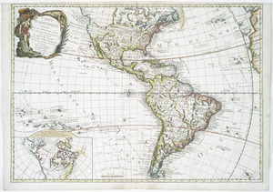
[Globe gore featuring North American coastline]
16.
Karte von Neu England, Neu Yorck und Pensilvanien : sur Allgemeinen historie der reisen
17.
A large draught of New England, New York and Long Island
18.
A map of the middle British colonies in North America : first published by Mr. Lewis Evans, of Philadelphia, in 1755; and since...
19.
A map of the middle British colonies in North America : first published by Mr. Lewis Evans, of Philadelphia, in 1755; and since...
20.
Map of the middle states of America : drawn from the latest and best authorities
21.
Map of the northern provinces of the United States
22.
A map of the Province of New York, with part of Pensilvania, and New England : from an actual survey by Captain Montresor,...
23.
A map of the Province of New York, with part of Pensilvania, and New England : from an actual survey by Captain Montresor,...
24.
A map of the Province of New-York : reduc'd from the large drawing of that province, compiled from actual surveys by order of...
25.
A map of the provinces of New-York and New Jersey, with a part of Pennsylvania and the Province of Quebec
26.
A New and correct map of the British colonies in North America comprehending eastern Canada with the province of Quebec, New...
27.
New Engelland, New York, New Yersey und Pensilvania
28.
A new map of New England, New York, New Iarsey, Pensilvania, Maryland and Virginia
29.
Noui Belgii Nouaeque Angliae nec non partis Virginiae tabula
30.
Nova Anglia Septentrionali Americae implantata Anglorumque coloniis florentissima geographicè exhibita
31.
Nova Belgica et Anglia Nova
32.
Novi Belgii Novaeqve Angliae nec non partis Virginiae Tabula
33.
Part of North America : comprehending the course of Ohio, New England, New York, New Jersey, Pennsylvania, Maryland, Virginia,...
34.
Partie occidentale de la Virginie, Pensylvanie, Maryland, et Caroline septle. la Rivière d'Ohio, et toutes celles qui s'y...
35.
Pas caert van Nieu Nederland, Virginia en Nieu Engelant
36.
Pas-caert van Nieu Nederland, Virginia, Nieu Engeland als mede Penn-silvania, met de stad Philadelfia van Baston tot Carrik = a...
37.
The provinces of New York and New Jersey : with part of Pensilvania, and the Province of Quebec
38.
An accurate map of the British Empire in Nth. America as settled by the preliminaries in 1762
39.
L'Amérique septentrionale
40.
Amérique Septentrionale publiée sous les auspices de Monseigneur le Duc d'Orleans prémier prince du sang
41.
Carte d'Amerique : divisée en ses principaux etats avec les nouvelles decouvertes faites au Nord et dans la Mer du Sud par les...
42.
Carte de la Louisiane et des pays voisins : dédiée à M. Rouillé, sécretaire d'État, ayant le Département de la marine
43.
Carte de la Louisiane et du cours du Mississipi avec les colonies anglaises
44.
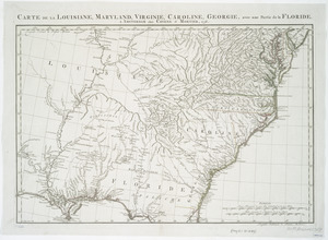
Carte de la Louisiane, Maryland, Virginie, Caroline, Georgie, avec une partie de la Floride
45.
A map of Maryland with the Delaware counties and the southern part of New Jersey &c
46.
A new and accurate map of North America : laid down according to the latest, and most approved observations and discoveries
47.
A new and accurate map of North America : laid down according to the latest, and most approved observations and discoveries
48.
Nouveau Mexique, Louisiane, Canada, et les Etats Unis
49.
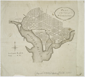
Plan of the city of Washington
50.
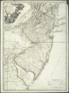
The Province of New Jersey : divided into East and West, commonly called the Jerseys
51.
The provinces of New York, and New Jersey; with part of Pensilvania, and the governments of Trois Rivières, and Montreal
52.
The state of New York, compiled from the most authentic information, 1796
53.
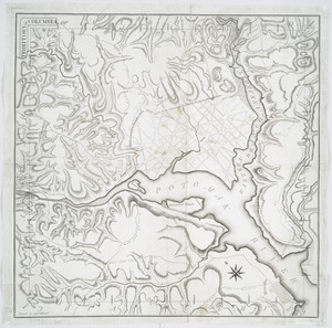
Territory of Columbia
54.
Various plans and draughts of cities, towns, harbours &c


![[Globe gore featuring North American coastline]](https://bpldcassets.blob.core.windows.net/derivatives/images/commonwealth:qb98n804g/image_thumbnail_300.jpg)