Toggle navigation
LMEC Home
Exhibitions
Georeferencing
Tools for Teachers
Collections
My Favorites
Sign Up / Log In
Search
Search the map portal
Map Collection
Map Collection
Map Sets
Search
Search
Search for
Search In
All Fields
Creator
Title
Subject
Place
Search All Digital Collections
Advanced Search
8162 Results
My Search
Start Over
More Like
commonwealth:wd3760108
Remove constraint More Like: commonwealth:wd3760108
Filter your Search
Place
North and Central America
4,911
United States
3,743
Suffolk (county)
1,026
Boston
999
Europe
963
Canada
427
France
269
Massachusetts
258
more
Place
»
Topic
Boston (Mass.)--Maps
574
United States--Maps
270
Real property--Massachusetts--Boston--Maps
174
Massachusetts--Maps
160
Landowners--Massachusetts--Boston--Maps
132
North America--Maps--Early works to 1800
103
New England--Maps
99
Europe--Maps
78
more
Topic
»
Date
Date range begin
–
Date range end
Current results range from
1482
to
2023
View distribution
Creator
United States. Hydrographic Office
357
O.H. Bailey & Co
147
Des Barres, Joseph F. W. (Joseph Frederick Wallet), 1722-1824
123
United States. Post Office Dept
120
Ptolemy, 2nd cent
100
Walling, Henry Francis, 1825-1888
94
Jefferys, Thomas, -1771
84
Geological Survey (U.S.)
82
more
Creator
»
Format
Maps/Atlases
8,103
Manuscripts
215
Prints
51
Books
36
Objects/Artifacts
10
Drawings/Illustrations
8
Posters
4
Georeferenced
Yes
869
No
7,293
Collection
Norman B. Leventhal Map Center Collection
8,162
Boston and New England Maps
2,183
Urban Maps
1,924
Maritime Charts and Atlases
750
American Revolutionary War-Era Maps
616
Boston Redevelopment Authority Collection
86
Available to use
No known restrictions
8,021
Creative Commons license
46
Search Constraints
Sort by date (desc)
relevance
title
date (asc)
date (desc)
Number of results to display per page
100 per page
10
per page
20
per page
50
per page
100
per page
View results as:
grid view
map view
Search Results
401.
South Pacific Ocean, Solomon Islands, Guadalcanal and Florida Is. with a portion of Malaita I. : from British surveys to 1912
402.
South-east New Guinea
403.
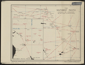
The southwest Pacific
404.
Total war battle map
405.
Tribal map of Morocco
406.
The victory war map
407.
The fifth column menaces America on a thousand fronts
408.
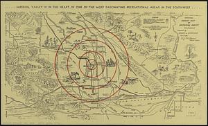
Official tourist map of Imperial County, California
409.
Plan of Boston & Maine Railroad terminal division Boston, Cambridge, Somerville, Everett and Medford
410.
Reg Manning's table-top argu-map of the world
411.
The town of Winchester, Massachusetts
412.
38,000,000 escaped -- 10,000,000 died
413.
America the wonderland : a pictorial map of the United States
414.
Art forms of the Pacific area
415.
Boston Elevated Railway system route map
416.
A map of Cape Cod
417.
Massachusetts tourists map : showing tourways, picnic sites, beaches, and camp grounds
418.
Peoples of the Pacific
419.
P.W.A. and industry : how benefits are spread
420.
Los recursos de los Estados Unidos
421.
Rural cultural regions in the United States
422.
United Air Lines mainliner vacation map : the main line airway to the nation's greatesst vacationlands east and west
423.
The United States as viewed by California (very unofficial)
424.
White Mountain National Forest : New Hampshire-Maine
425.
Limited edition, 500 only of a pictorial map covering the New England States U.S.A
426.
Map of Scituate Rhode Island
427.
Pictorial map of Mexico
428.
A pictorial map of that portion of New York City known as Manhattan, also showing parts of the Bronx
429.
A pictorial map of the British Isles
430.
A pictorial map of the New England states U.S.A.
431.
PWA rebuilds the nation
432.
Shall Union Square overshadow the United States? : America's other 60 families : the real rulers of America
433.
World wonders : a pictorial map
434.
Atlas of the city of Boston : Boston proper and Back Bay : from actual surveys and official plans
435.
Boston Elevated Railway system route map
436.
Boston (Massachusetts) and vicinity : a pictorial map
437.
Boston (Massachusetts) and vicinity : a pictorial map
438.
Boston (Massachusetts) and vicinity : a pictorial map
439.
Carriers of the new black plague
440.
Downtown district of Manhattan
441.
Europe : a pictorial map
442.
Lake Champlain streamline ferries : direct routes to Whiteface Mtn., Ausable Chasm, scenic short-cuts between Green Mountains,...
443.
Midsummer's marvels
444.
North Atlantic Ocean, Bermuda Islands : from British surveys to 1926, with additions and corrections to 1936
445.
Now see America by Grace Line
446.
Boston Elevated Railway system route map
447.
Civil airways of the United States as designated in Civil Air Regulations - chapter 60
448.
Frontier, Montana, pioneer : a one page history dedicated to the Old Timers
449.
The White Mountains of New Hampshire
450.
America : beauty, wonders, inspiration, progress, without end
451.
Boston Elevated Railway system map
452.
A New Yorker's idea of the United States of America
453.
Olde York County Maine : published in commemoration of the 300th anniversary
454.
Property atlas of city of Lowell, northern district, Middlesex County, Massachusetts, showing the entire city complete in one...
455.
Winter sports map of the Berkshire Hills
456.
Asia, ca. 100 A.D.
457.
Asia under the Mongols, 1290 A.D.
458.
Atlas town of Wellesley
459.
The beginnings of ancient China, 1900-1300 B.C.
460.
Boston, Massachusetts
461.
A canoeist's guide to New England's rivers
462.
China's situation in the world
463.
The contending states - boundaries of 350 B.C.
464.
The country of So red the rose, by Stark Young, Scribners
465.
Eastern, Central and Southern Asia, 1760 A.D.
466.
Europe in search of new routes to India and China, 1486-1616 A.D.
467.
Foreign religions in Central Asia and China up to the 14th century A.D.
468.
France
469.
[Illustrated historical map of Shanghai]
470.
Italy
471.
The land of make believe
472.
The Manchu Empire and the European powers, 1644-1912, A.D.
473.
Map of the city of Providence, Rhode Island
474.
Modern Tibet (Hsi-K'Ang and Hsi-Tsang) - Political and Economic
475.
The oil and gas journal, August 29, 1935
476.
Philips Radio
477.
Physical geography with the boundaries of ancient China
478.
A pictorial map of Germany
479.
A pictorial map of Germany
480.
A pictorial map of the British Isles
481.
P.W.A. in action
482.
Racing routes of the Yankee clippers
483.
Route and pictorial map of Maine
484.
This map presents a Bostonian's idea of the United States of America
485.
Transportation map of Manchoukuo
486.
The United States of America
487.
Van Loon's map of the United States : enlivened by thumbnail sketches of American history
488.
Wallowa National Forest, Oregon
489.
Being a cartograph of Ohio : the oldest state west of the thirteen original colonies; now the fourth state in the Union in...
490.
City of Melrose assessors plans
491.
Financial irrigation of the United States by funds appropriated for emergency use under the New Deal
492.
Map of Boston Common : with surrounding streets & adjacent parts of Beacon Hill
493.
Republican mid-summer outing and Massachusetts Bay Cruise to Provincetown Saturday, August 4, 1934
494.
Teton National Forest, Wyoming
495.
The townships of Dedham, Westwood, Needham, Dover, Sherborn, Norwood, Medfield, Millis, Walpole, Norfolk, Massachusetts
496.
Umpqua National Forest, Oregon
497.
Whitman National Forest, Blue Mountains Division, Oregon
498.
Whitman National Forest, Minam Division, Oregon
499.
Atlas of the city of Boston : Dorchester : from actual surveys and official plans
500.
Capital Park : Hyde Park ... Boston
‹ Prev
Next ›
1
2
3
4
5
6
7
8
9
…
81
82


![[Illustrated historical map of Shanghai]](https://bpldcassets.blob.core.windows.net/derivatives/images/commonwealth:qb98n805r/image_thumbnail_300.jpg)