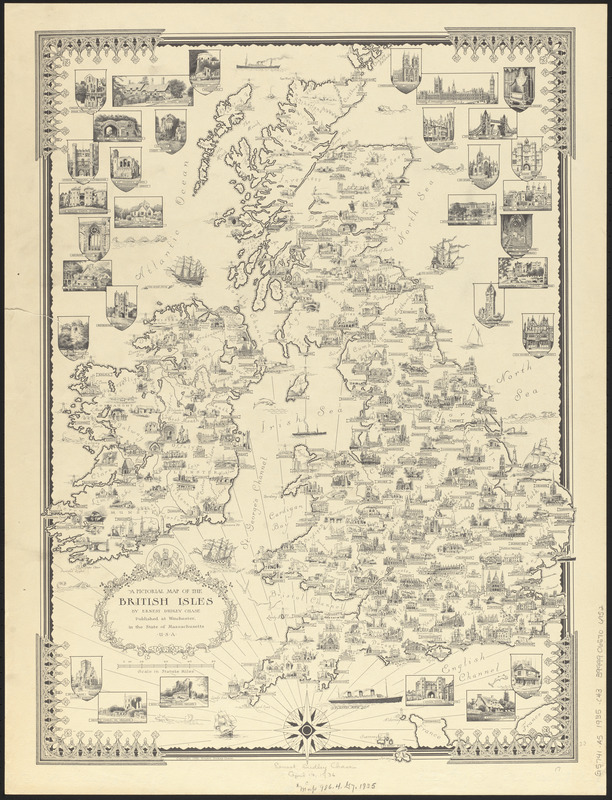
A pictorial map of the British Isles
Item Information
- Title:
- A pictorial map of the British Isles
- Cartographer:
- Chase, Ernest Dudley, 1878-1966
- Name on Item:
-
by Ernest Dudley Chase
- Date:
-
1935
- Format:
-
Maps/Atlases
- Location:
-
Boston Public Library
Norman B. Leventhal Map & Education Center - Collection (local):
-
Norman B. Leventhal Map & Education Center Collection
- Subjects:
-
Great Britain--Maps
- Places:
-
United KingdomGreat Britain (island)
- Extent:
- 1 map ; 58 x 42 cm
- Terms of Use:
-
No known copyright restrictions.
No known restrictions on use.
- Publisher:
-
Winchester, Mass. :
[Ernest Dudley Chase]
- Scale:
-
Scale approximately 1:1,680,000
- Language:
-
English
- Notes:
-
Relief shown pictorially.
Pictorial map.
Includes illustrations.
- Identifier:
-
06_01_014785
- Call #:
-
G5741.A5 1935 .C43
- Barcode:
-
39999065706952