Map of the superficial geology of the British Isles with the physical and topographical features, the line of railways
Item Information
- Title:
- Map of the superficial geology of the British Isles with the physical and topographical features, the line of railways
- Description:
-
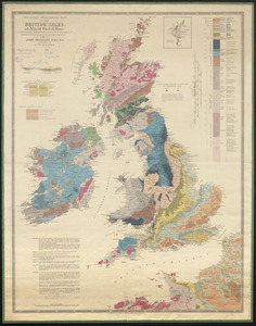
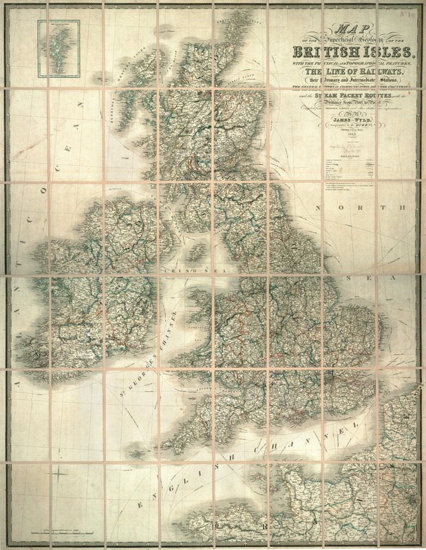
Despite the title's suggestion that this is a geological map, it is much more. It not only shows the standard cartographical features, such as roads, railroads and stations, canals, steamboat passages, towns, cities, counties, and distances for all of the British Isles, it is also an electoral map as it indicates the number of parliamentary seats for each borough. Electoral representation was a topic of particular importance in early- and mid-19th century Britain. Population decline in many formerly important centers combined with the implementation of representation policies that were hundreds of years old meant that many towns and villages with only a few dozen residents or even less, had the right to elect members of the House of Commons. Newer industrial centers such as Manchester, meanwhile had no representation at all. The electoral reforms of 1832 revised this system to provide at least nominally equitable representation. By including this electoral data, the map maker, James Wyld, the younger (1812-1887), added a human element to the otherwise purely structural elements of the maps--it is a map of Brits as well as of Britain.
- Creator:
- Wyld, James, 1812-1887
- Publisher:
- Wyld, James, 1812-1887
- Name on Item:
-
by James Wyld.
- Date:
-
1843
- Format:
-
Maps/Atlases
- Location:
-
Boston Public Library
Norman B. Leventhal Map & Education Center - Collection (local):
-
Norman B. Leventhal Map & Education Center Collection
- Subjects:
-
Geology--Great Britain--Maps
Geology--British Isles--Maps
British Isles--Maps
Great Britain--Maps
- Places:
-
British Isles (area)
United Kingdom
- Extent:
- 1 map : col. ; 102 x 129 cm.
- Terms of Use:
-
No known copyright restrictions.
No known restrictions on use.
- Publisher:
-
London :
Wyld
- Scale:
-
Scale [ca. 1:1,050,000]
- Language:
-
English
- Notes:
-
Relief shown by hachures.
Includes inset of the Shetland Islands.
Exhibited in “Faces and Places,” at the Boston Public Library, Boston, MA, October 2003 - September 2004. MB (BRL)
- Identifier:
-
05_04_000131
- Call #:
-
G5741.C5 1843 .W9
- Barcode:
-
39999052507223