Toggle navigation
LMEC Home
Exhibitions
Georeferencing
Tools for Teachers
Collections
My Favorites
Sign Up / Log In
Search
Search the map portal
Map Collection
Map Collection
Map Sets
Search
Search
Search for
Search In
All Fields
Creator
Title
Subject
Place
Search All Digital Collections
Advanced Search
8165 Results
My Search
Start Over
More Like
commonwealth:js956j15q
Remove constraint More Like: commonwealth:js956j15q
Filter your Search
Place
North and Central America
4,914
United States
3,746
Suffolk (county)
1,026
Boston
999
Europe
963
Canada
427
France
269
Massachusetts
258
more
Place
»
Topic
Boston (Mass.)--Maps
574
United States--Maps
270
Real property--Massachusetts--Boston--Maps
174
Massachusetts--Maps
160
Landowners--Massachusetts--Boston--Maps
132
North America--Maps--Early works to 1800
103
New England--Maps
99
Europe--Maps
78
more
Topic
»
Date
Date range begin
–
Date range end
Current results range from
1482
to
2023
View distribution
Creator
United States. Hydrographic Office
357
O.H. Bailey & Co
148
Des Barres, Joseph F. W. (Joseph Frederick Wallet), 1722-1824
123
United States. Post Office Dept
120
Ptolemy, 2nd cent
100
Walling, Henry Francis, 1825-1888
94
Jefferys, Thomas, -1771
84
Geological Survey (U.S.)
82
more
Creator
»
Format
Maps/Atlases
8,106
Manuscripts
214
Prints
51
Books
36
Objects/Artifacts
10
Drawings/Illustrations
8
Posters
4
Georeferenced
Yes
868
No
7,297
Collection
Norman B. Leventhal Map Center Collection
8,165
Boston and New England Maps
2,183
Urban Maps
1,924
Maritime Charts and Atlases
750
American Revolutionary War-Era Maps
616
Boston Redevelopment Authority Collection
86
Available to use
No known restrictions
8,024
Creative Commons license
46
Search Constraints
Sort by relevance
relevance
title
date (asc)
date (desc)
Number of results to display per page
50 per page
10
per page
20
per page
50
per page
100
per page
View results as:
grid view
map view
Search Results
1.
[Plan of section of proposed Charles River Park]
2.
[Plan of property in the Cambridgeport marshes]
3.
Copy of an ancient plan belonging to the City (not dated probably about 1738)
4.
Copy of an old plan belonging to the city
5.
Plan of an estate in Boston belonging to Jos. Head Esqr
6.
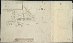
Plan of Bishop Parker's estate Bedford Street
7.
[Plan of lots on Pine Street, Boston, between Washington and Front Streets]
8.
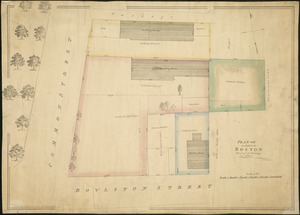
[Plan of residences on Park Street in Boston]
9.
A plan of the town dock, formerly called Bendalls Dock, in Boston, with the buildings round & flats before it
10.
[Plan of Tremont Street from Park to Boylston]
11.
[Plan of Tremont Street, from West to Boylston]
12.
Boston Harbor Mass : Charles River from Brookline Street bridge to Market Street bridge
13.
Boston Harbor, Mass : map of Charles River from Brookline Street bridge to its mouth
14.
Boston water works : map showing the several sources of supply already constructed, also the drainage areas of Lake Cochituate...
15.
Broad Canal, Cambridge : condition of retaining walls and bed of Canal, inspection for Committee on Charles River Dam, Oct. 30,...
16.
Charles River
17.
Charles River embankment : Boston district
18.
Compiled plan, showing Millers Creek and a portion of Charles River
19.
Lechmere Canal, Cambridge : condition of retaining walls and bed of canal, inspection for Committee on Charles River Dam, Nov....
20.
Map of Charles River showing principal sources of pollution
21.
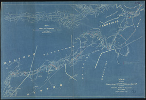
Map of the lower portion of Charles River showing principal sources of pollution
22.
New Boston and Charles River Bay
23.
Plan of Charles River : from the Waltham line to Boston harbor
24.
Plan of Charles River and Warren bridges, with the vicinity
25.
Proposed Charles River Park
26.
Proposed Charles River Park
27.
Public reservations on the banks of the Charles River between Watertown and Cragies Bridge
28.
Sketch plan showing the existing and proposed public reservations upon the banks of the Charles between Waltham line and...
29.
Charles River Basin contour map of lower basin from surveys and soundings made in Aug. and Sept. 1902 for Committee on Charles...
30.
Charles River Basin contour map of upper basin from surveys and soundings
31.
Charles River, Boston Harbor, and the proposed Charles River basin : prepared to accompany report made to Henry L. Higginson,...
32.
The 100th anniversary map of Abraham Lincoln's visit to Massachusetts, September 11-23, 1848
33.
1630 shoreline
34.
1879. Progress map of the U.S. Geographical Surveys west of the 100th Meridian : prepared under the direction of 1st Lieut....
35.
1903 Map of Salem and surrounding places
36.
19th annual convention of the National Association of Real Estate Boards : at Tulsa, June 7 to June 11 in 1926
37.
2005 significant U.S. hurricane strikes
38.
The 2100 project : an atlas for the Green New Deal
39.
227 Harzgerode
40.
305 Glatz
41.
38,000,000 escaped -- 10,000,000 died
42.
4 Kinten
43.
660 Wakulah St., Roxbury
44.
[A chart of Boston Bay and vicinity]
45.
[A chart of New York Island & North River : East River, passage through Hell Gate, Flushing Bay, Hampstead Bay, Oyster,...
46.
The A.A.A. key road map of continental Europe
47.
Aaron Bohrod's America, its history
48.
ABC pathfinder railway guide map : eastern division
49.
Abolition of Slavery, 1863
50.
Aboriginal map of North America, denoting the boundaries and the locations of various Indian tribes
‹ Prev
Next ›
1
2
3
4
5
…
163
164
![[Plan of section of proposed Charles River Park]](https://bpldcassets.blob.core.windows.net/derivatives/images/commonwealth:x059cc51b/image_thumbnail_300.jpg)
![[Plan of property in the Cambridgeport marshes]](https://bpldcassets.blob.core.windows.net/derivatives/images/commonwealth:1257bb747/image_thumbnail_300.jpg)


![[Plan of lots on Pine Street, Boston, between Washington and Front Streets]](https://bpldcassets.blob.core.windows.net/derivatives/images/commonwealth:9s161h488/image_thumbnail_300.jpg)
![[Plan of residences on Park Street in Boston]](https://bpldcassets.blob.core.windows.net/derivatives/images/commonwealth:9s161h36g/image_thumbnail_300.jpg)
![[Plan of Tremont Street from Park to Boylston]](https://bpldcassets.blob.core.windows.net/derivatives/images/commonwealth:9s161b59r/image_thumbnail_300.jpg)
![[Plan of Tremont Street, from West to Boylston]](https://bpldcassets.blob.core.windows.net/derivatives/images/commonwealth:sn00b611k/image_thumbnail_300.jpg)


![[A chart of Boston Bay and vicinity]](https://bpldcassets.blob.core.windows.net/derivatives/images/commonwealth:cj82m2976/image_thumbnail_300.jpg)


