Toggle navigation
LMEC Home
Exhibitions
Georeferencing
Tools for Teachers
Collections
My Favorites
Sign Up / Log In
Search
Search the map portal
Map Collection
Map Collection
Map Sets
Search
Search
Search for
Search In
All Fields
Creator
Title
Subject
Place
Search All Digital Collections
Advanced Search
151 Results
My Search
Start Over
More Like
commonwealth:j38608070
Remove constraint More Like: commonwealth:j38608070
Filter your Search
Place
World
64
North and Central America
46
New England
20
United States
17
Massachusetts
16
Rhode Island
8
New York
7
Connecticut
6
more
Place
»
Topic
World maps--Early works to 1800
76
New England--Maps--Early works to 1800
15
America--Maps--Early works to 1800
11
Massachusetts--Maps
8
North America--Maps--Early works to 1800
8
Western Hemisphere--Maps--Early works to 1800
8
Connecticut--Maps--Early works to 1800
5
Cook, James, 1728-1779
5
more
Topic
»
Date
Date range begin
–
Date range end
Current results range from
1482
to
1990
View distribution
Creator
Ortelius, Abraham, 1527-1598
6
Mercator, Gerhard, 1512-1594
5
Bordon, Benedetto, 1450-1530
4
Bew, John, -1793
3
Carey, Mathew, 1760-1839
3
Gastaldi, Giacomo, approximately 1500-approximately 1565
3
Hondius, Hendrik, 1597-1651
3
Hondius, Jodocus, 1594 or 1595-1629
3
more
Creator
»
Format
Maps/Atlases
151
Manuscripts
2
Books
1
Georeferenced
Yes
10
No
141
Collection
Sidney R. Knafel Map Collection at Phillips Academy
87
Norman B. Leventhal Map Center Collection
64
American Revolutionary War-Era Maps
29
Mapping Boston Collection
19
Available to use
No known restrictions
45
Creative Commons license
19
Search Constraints
Sort by relevance
relevance
title
date (asc)
date (desc)
Number of results to display per page
50 per page
10
per page
20
per page
50
per page
100
per page
View results as:
grid view
map view
Search Results
51.
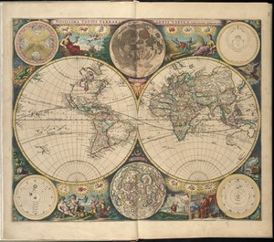
Novissima totius terrarum orbis tabula
52.
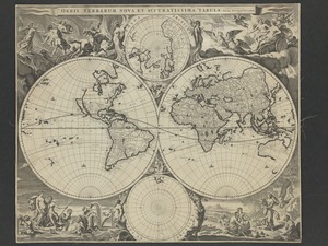
Orbis terrarum nova et accuratissima tabula
53.
Orbis terrarum nova et accuratissima tabula
54.
Orbis terrarum typus de integro multis in locis emendatus
55.
Orbis typus uniuersalis iuxta hydrographorum traditionem
56.
Orbis vetus in utrâque continente juxtà mentem Sansonianam distinctus, nec non observationibus astronomicis
57.
Planiglobii terrestris mappa universalis utrumq hemisphærium orient. et occidentale repræsentans ex IV mappis generalibus =...
58.
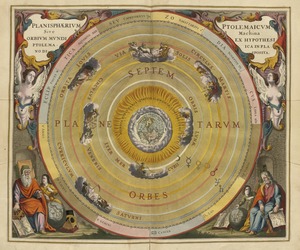
Planisphaerium Ptolemaicum siue machina orbium mundi ex hypothesi Ptolemaica in plano disposita
59.
A plat of all the world : projected according to the truest rules being far more exact than either the plain-card or the maps...
60.
Quam hic vides orbis imagine[m] lector ca[n]dide ea[m] ut posteriore[m] ita & eme[n]datiorem ijs que hactenus...
61.
Secunda etas mundi = Secunda etas mũdi
62.
Systema ideale quo exprimitur, aquarum per canales hydragogos subterraneos ex mari et in montium hydrophylacia protrusio,...
63.
[The World]
64.
[The World]
65.
Tipus orbis uniuersalis iuxta Ptolomei cosmographi traditionem et Americi Vespucii alior[um]que
66.
Typus cosmographicus uniuersalis
67.
Typus orbis terrarum
68.
Uniuersalior cogniti orbis tabula ex recentibus confecta obseruationibus
69.
Uniuersi orbis seu terreni globi in plano effigies
70.
A variation chart
71.
The world, according to the latest discoveries
72.
World map
73.
World map
74.
[World map]
75.
[World map]
76.
The world with all modern discoveries
77.
An accurate map of Rhode Island, part of Connecticut and Massachusets, shewing Admiral Arbuthnot's station in blocking up...
78.
An accurate map of the English colonies in North America, bordering on the river Ohio
79.
America
80.
America sive India Nova : ad magnae Gerardi Mercatoris aui universalis imitationem in compendium redacta
81.
America sive novvs orbis respectv Evropaeorvm inferior globi terrestris pars
82.
Americae pars Borealis, Florida, Baccalaos, Canada, Corterealis
83.
Americae siue noui orbis, noua descriptio
84.
Americae siue noui orbis, noua descriptio
85.
The American Atlas or, A Geographical Description of the whole continent of America : wherein are delineated at large, its...
86.
The American pilot : containing the navigation of the sea coat of North America . . .
87.
Atlantic Ocean
88.
L'Atlas de mer ou monde aquatique, remontrant toutes les côtes de la mer, a scavoir de la partie connuë de I'Univers, avec une...
89.
Barnstable County, Dukes County and Nantucket Island, Massachusetts
90.
Baye et port d'Yorc, capitale de la Nouvelle Yorc
91.
Bowles's new pocket map of the most inhabited part of New England : comprehending the provinces of Massachusets Bay and New...
92.
Carte de la Nouvelle Angleterre, New York, Pensilvanie et Nouveau Jersay suivant les cartes angloises
93.
Carte de la Nouvelle Angleterre, Nouvelle York, Nouvelle Jersey et Pensilvanie
94.
Chart and plan of the harbour of New York & the couny. adjacent, from Sandy Hook to Kingsbridge, comprehending the whole of New...
95.
Chart for the journal of Mr. le Mquis. de Chastellux
96.
A chart of the gulf stream
97.
Costes et rivieres de Virginie, de Mariland, et de Nouvelle Angletere
98.
The English pilot. The fourth book. Describing the West-India navigation, from Hudson's-Bay to the River Amazones. Particulary...
99.
Garden of Eden
100.
Geological map of Massachusetts
‹ Prev
Next ›
1
2
3
4


![Quam hic vides orbis imagine[m] lector ca[n]dide ea[m] ut posteriore[m] ita & eme[n]datiorem ijs que hactenus circu[m]ferebantur esse America sarmatiaq[ue] ac India testantur ... lemei expectato vale](https://bpldcassets.blob.core.windows.net/derivatives/images/commonwealth:3f463b69r/image_thumbnail_300.jpg)

![Systema ideale quo exprimitur, aquarum per canales hydragogos subterraneos ex mari et in montium hydrophylacia protrusio, aquarumq[ue] subterrestrium per pyragogos canales concoctus](https://bpldcassets.blob.core.windows.net/derivatives/images/commonwealth:n8710p89m/image_thumbnail_300.jpg)
![[The World]](https://bpldcassets.blob.core.windows.net/derivatives/images/commonwealth:9g54xj67p/image_thumbnail_300.jpg)
![[The World]](https://bpldcassets.blob.core.windows.net/derivatives/images/commonwealth:st74cx537/image_thumbnail_300.jpg)
![Tipus orbis uniuersalis iuxta Ptolomei cosmographi traditionem et Americi Vespucii alior[um]que](https://bpldcassets.blob.core.windows.net/derivatives/images/commonwealth:3f463b65n/image_thumbnail_300.jpg)


![[World map]](https://bpldcassets.blob.core.windows.net/derivatives/images/commonwealth:st74cz00d/image_thumbnail_300.jpg)
![[World map]](https://bpldcassets.blob.core.windows.net/derivatives/images/commonwealth:wd3762879/image_thumbnail_300.jpg)


