World map
Item Information
- Title:
- World map
- Description:
-
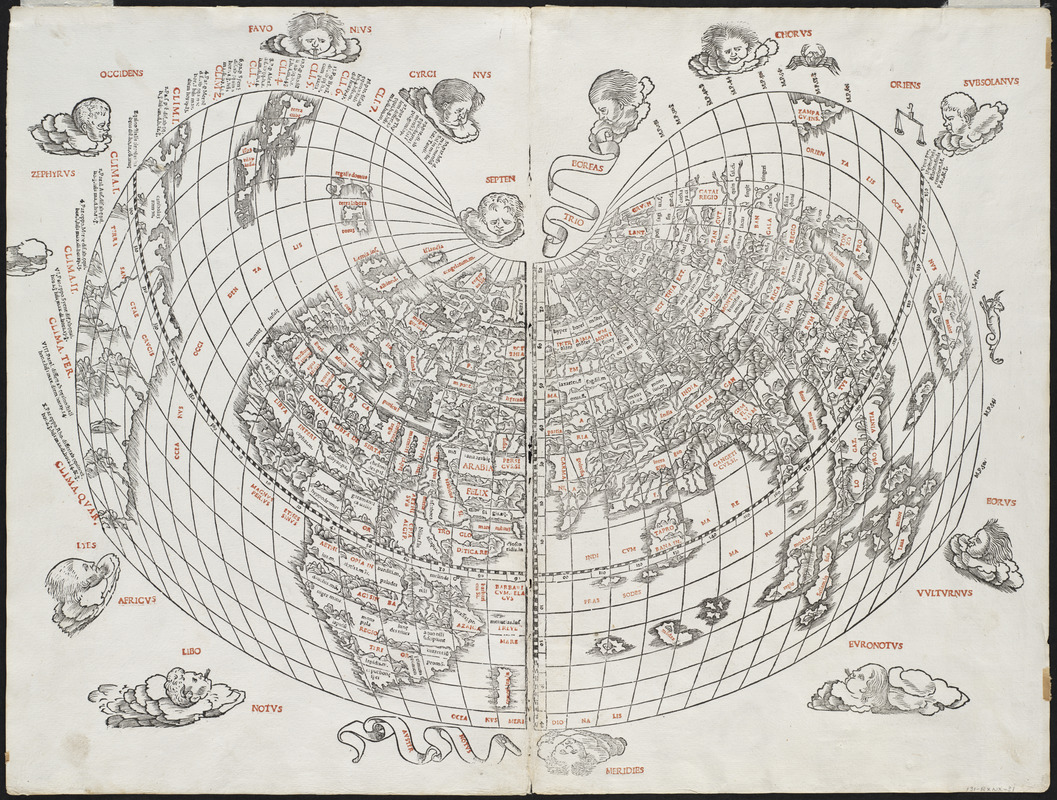
As the first map printed in two colors, this is a monument to map printing. The place names in capital letters were printed in red ink by means of type set into the woodblocks. The decorative windheads, zodiacal signs, and the distinctive cordiform (or heart-shaped) projection, all contribute to the striking nature of this map. Geographically, Sylvanus included the New World discoveries of the previous two decades, showing Cuba, Hispaniola, and northern South America. However, he labeled the latter “Terra Sanctae Crucis,” rather than “America”, a name that was just beginning to be used by other European cartographers.
- Creator:
- Silvani, Bernardo
- Date:
-
[1511]
- Format:
-
Maps/Atlases
- Location:
- Private Collection
- Collection (local):
-
Mapping Boston Collection
- Subjects:
-
World maps--Early works to 1800
- Places:
-
World
- Extent:
- 1 map : col. ; 44 x 58 cm.
- Terms of Use:
-
No known copyright restrictions.
This work is licensed for use under a Creative Commons Attribution Non-Commercial Share Alike License (CC BY-NC-SA).

- Publisher:
-
Venice :
J. Pentius de Leucho
- Scale:
-
Scale not given
- Language:
-
Latin
- Notes:
-
Relief shown pictorially.
Appears in Ptolemy's Geographia, edited by Bernard Sylvanus. Venetiis : Per Iacobum Pentium de Leucho, anno Domini 1511.
- Notes (date):
-
This date is inferred.
- Identifier:
-
06_01_001143
- Barcode:
-
39999052508643


![Hemispheriu[m] ab aequinoctiali linea, ad circulu[m] Poli Arctici](https://bpldcassets.blob.core.windows.net/derivatives/images/commonwealth:3f462s45p/image_thumbnail_300.jpg)

