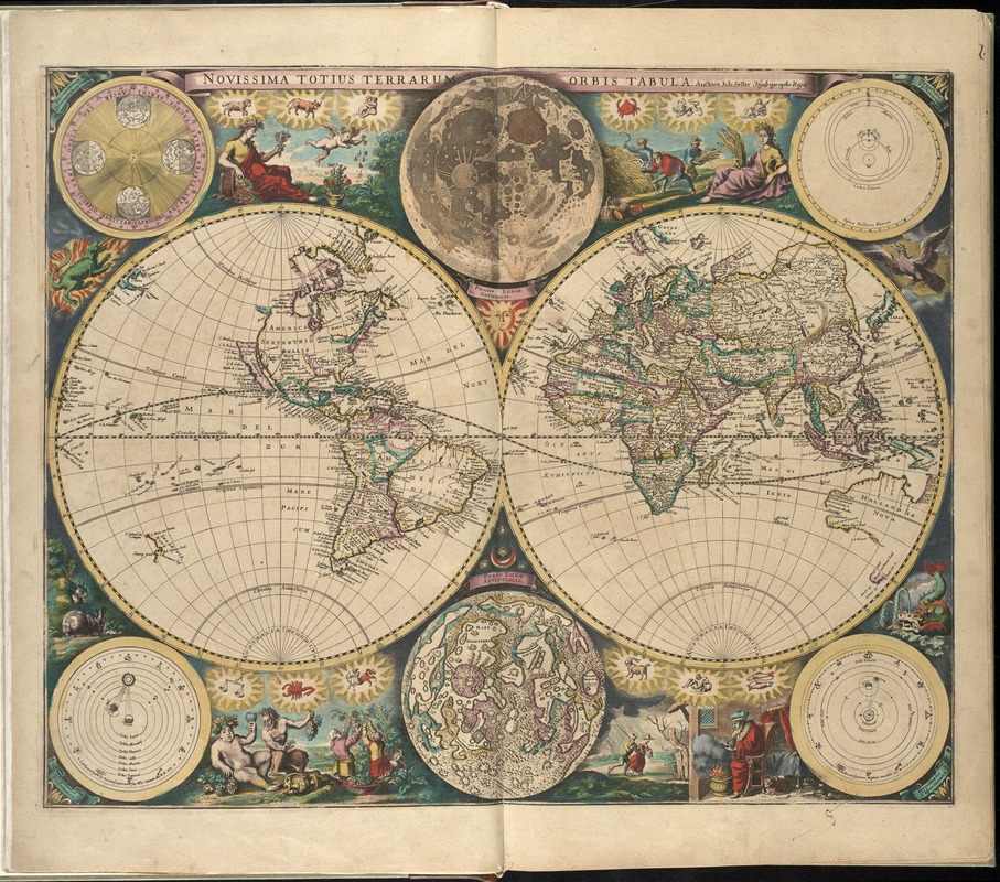
Novissima totius terrarum orbis tabula
Item Information
- Title:
- Novissima totius terrarum orbis tabula
- Creator:
- Seller, John, fl. 1658-1698
- Name on Item:
-
auctore Joh: Seller.
- Date:
-
[1672?]
- Format:
-
Maps/Atlases
- Location:
-
Boston Public Library
Norman B. Leventhal Map & Education Center - Collection (local):
-
Norman B. Leventhal Map & Education Center Collection
- Subjects:
-
World maps--Early works to 1800
- Places:
-
World
- Extent:
- 1 map : hand col. ; 2 hemispheres each 27 cm in diam., on sheet 52 x 59 cm.
- Terms of Use:
-
No known copyright restrictions.
No known restrictions on use.
- Publisher:
-
London :
John Seller
- Scale:
-
Scale not given.
- Language:
-
Latin
- Notes:
-
Relief shown pictorially.
Includes Classical imagery, zodiac symbols, and illustrations of creatures.
Insets: Incrementum et decrementum die[ru?] -- Phasis lunae naturalis -- Hypothesis Tychonican -- Hypothesis Ptolomaica -- Phasis lunæ artificialis -- Hypothesis Copernicana.
Appears in the author's Atlas maritimus, or A book of charts. London : John Seller, [1672?]
Cataloging, conservation, and digitization made possible in part by The National Endowment for the Humanities: Exploring the human endeavor.
Atlas scanned by Internet Archive http://archive.org/details/atlasmaritimusor00sell
- Identifier:
-
06_01_007935
- Call #:
-
G1059 .S45 1672
- Barcode:
-
30000003777499


