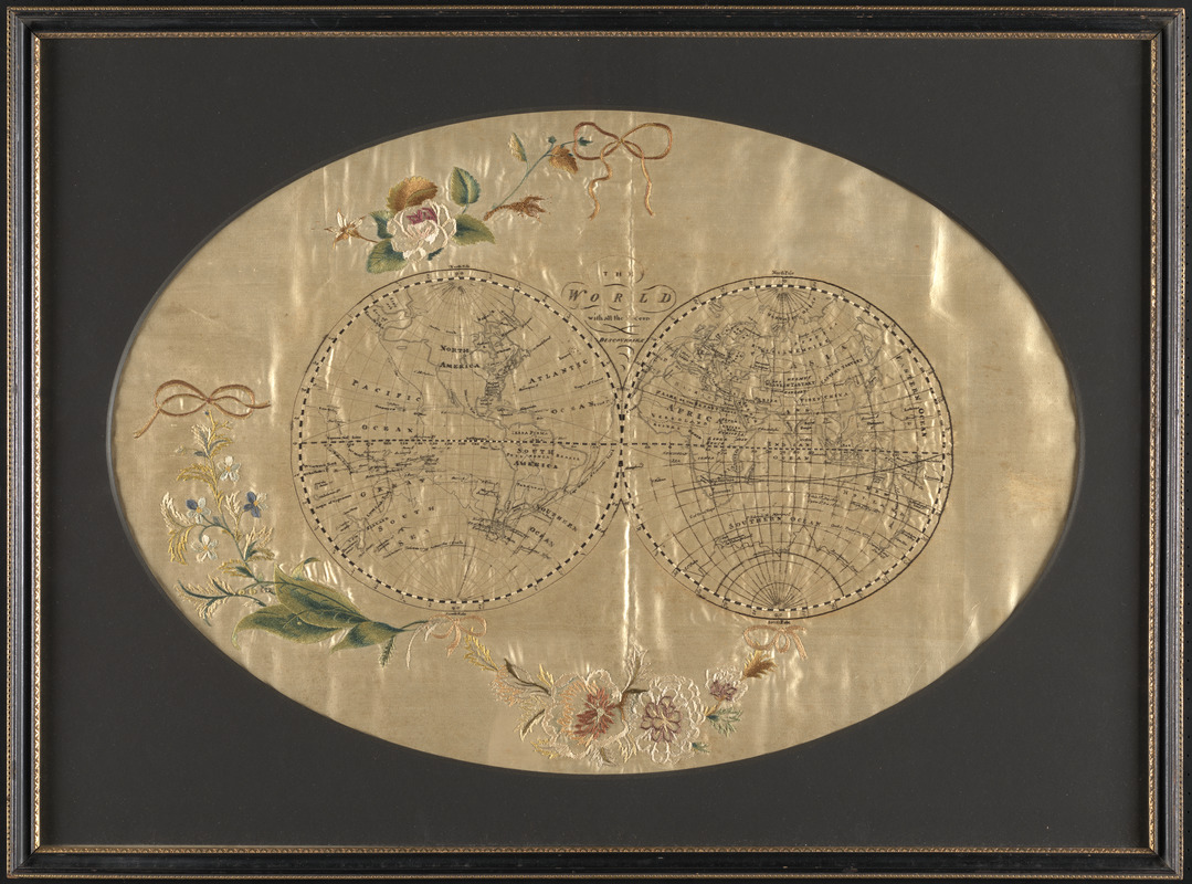
The world with all modern discoveries
This map is also available in American Revolutionary Geographies Online (ARGO), a collections portal especially built for material relating to the American Revolutionary War Era. Visit ARGO to learn more about this item and explore the historical geography of North America in the late eighteenth century.
Item Information
- Title:
- The world with all modern discoveries
- Date:
-
[ca. 1780–1800]
- Format:
-
Maps/Atlases
Manuscripts
- Location:
-
Boston Public Library
Norman B. Leventhal Map & Education Center - Collection (local):
-
Norman B. Leventhal Map & Education Center Collection
- Subjects:
-
World maps--Early works to 1800
Manuscript maps--Early works to 1800
Byron, John, 1723-1786
Carteret, Philip, -1796
Cook, James, 1728-1779
Wallis, Samuel, 1728-1795
- Places:
-
World
- Extent:
- 1 manuscript map : color, embroidered on silk, framed ; 2 hemispheres each 22 cm in diameter, on sheet 54 x 74 cm
- Terms of Use:
-
No known copyright restrictions.
No known restrictions on use.
- Scale:
-
Scale approximately 1:120,000,000
- Language:
-
English
- Notes:
-
Double-hemisphere world map embroidered by a schoolgirl with colored threads on silk.
Shows the voyages of Cook, Wallis, and Byron and Carteret.
Ornamental floral sprays and ribbons in margins.
Framed with an oval window.
- Identifier:
-
06_01_016149
- Call #:
-
G3200 1800 .W67
- Barcode:
-
39999085944179