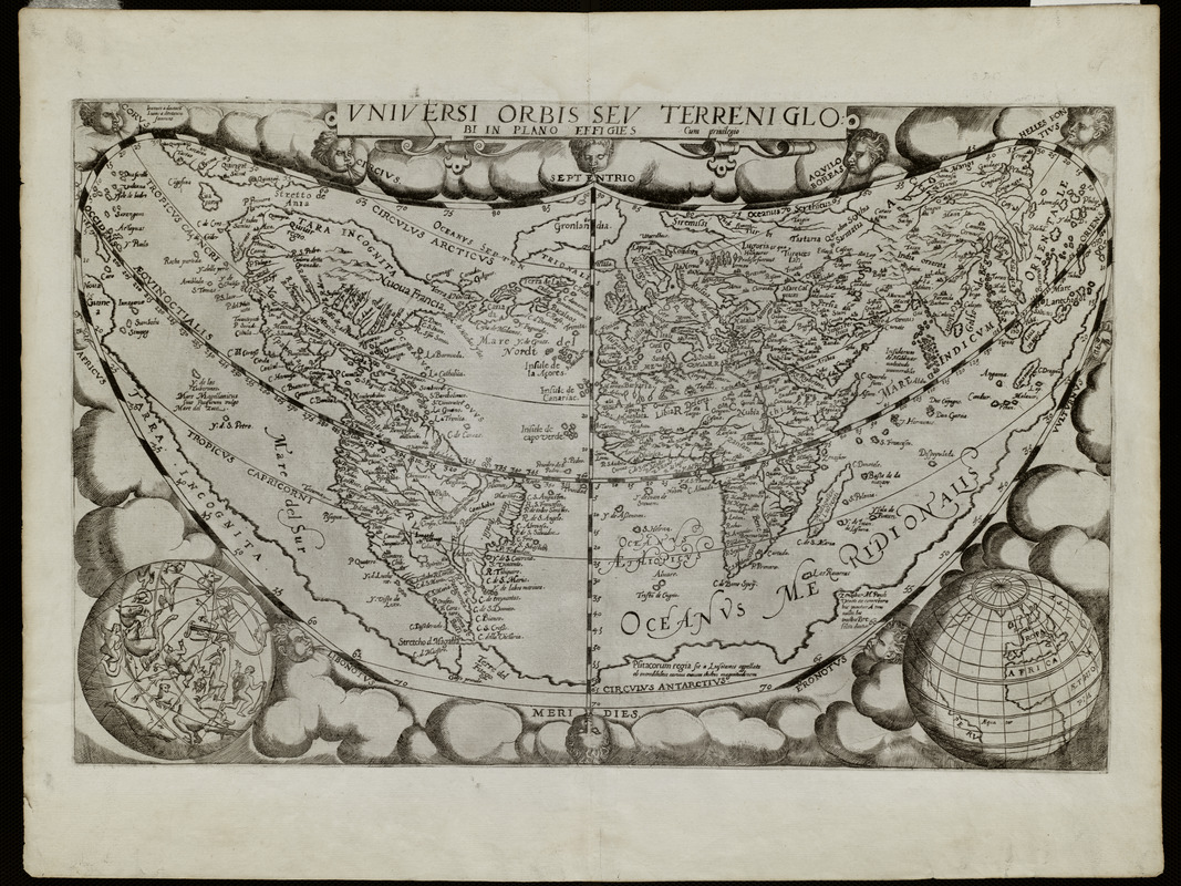
Uniuersi orbis seu terreni globi in plano effigies
Item Information
- Title:
- Uniuersi orbis seu terreni globi in plano effigies
- Title (alt.):
-
Universi orbis seu terreni globi in plano effigies
Vniversi orbis sev terreni globi in plano effigies
- Description:
-
Created during Shakespeare's lifetime, this map illustrates the late 16th-century concept of the world. Europe and the Mediterranean regions were well understood and confidently mapped, along with Africa and Asia. The Americas are shown with recognizable east coasts, but the west coasts are based on conjecture. The unknown territories in the Americas and stories of the natives played into the fears of people in Europe. Maps of these areas display imaginative "barbarians," "cannibals," and dangerous alien creatures constituting a threat to "civilized" society.
- Creator:
- Jode, Gerard de, 1509-1591
- Name on Item:
-
Gerardus Iudoes
- Date:
-
1578
- Format:
-
Maps/Atlases
- Location:
- Private Collection
- Collection (local):
-
Mapping Boston Collection
- Subjects:
-
World maps--Early works to 1800
- Places:
-
World
- Extent:
- 1 map ; 54 x 34 cm.
- Terms of Use:
-
No known copyright restrictions.
This work is licensed for use under a Creative Commons Attribution Non-Commercial Share Alike License (CC BY-NC-SA).

- Publisher:
-
Antwerp :
[s.n.]
- Scale:
-
Scale not given
- Language:
-
Latin
- Notes:
-
Relief shown pictorially.
Exhibited in “Journeys of the Imagination,” at the Boston Public Library, Boston, MA, April - August 2006.
- Notes (exhibitions):
-
Exhibited: "Shakespeare’s Here and Everywhere" organized by the Norman B. Leventhal Map Center at the Boston Public Library, 2016-2017.
- Identifier:
-
05_01_000216
- Barcode:
-
39999052509559


![Hemispheriu[m] ab aequinoctiali linea, ad circulu[m] Poli Arctici](https://bpldcassets.blob.core.windows.net/derivatives/images/commonwealth:3f462s45p/image_thumbnail_300.jpg)

