A variation chart
Item Information
- Title:
- A variation chart
- Description:
-
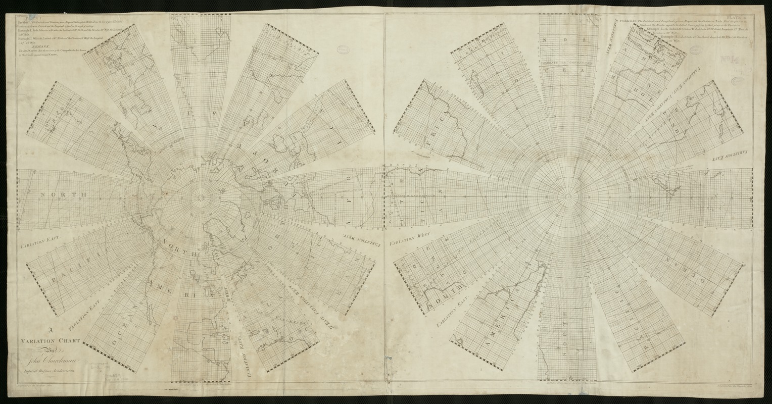
Although this world map appears, at first glance, to be drawn in the same tradition as the ornately-decorated double-hemisphere world maps that appeared so widely during the 17th and 18th centuries, it represents a new and much more scientific presentation. Reflecting the Age of Enlightenment interest in explaining the laws of nature, a Maryland surveyor and mathematician prepared this map which portrays a single, highly technical theme - geomagnetism. The study of the Earth's magnetism became a topic of major scientific investigation and a subject for thematic mapping during the 18th century. Navigators realized that a compass needle did not always align with a true north-south line, rather it pointed to a magnetic pole which does not coincide with the Earth's polar axis. By systematically measuring and mapping this variation or declination, scientists hypothesized that they could find another reliable method for determining longitude. In preparing this map, Churchman logically centered his two spheres on the North and South poles but separated each sphere into 12 segments or gores. In his words, if the blank areas were cut out, the remainder would fit and cover a globe forty-eight English inches in circumference. By focusing on the polar regions, he demonstrated the relationship between the magnetic pole and the actual pole. He employed line symbols, which he labeled as "dotted curves" but now known as isolines, to delineate lines of equal variation or declination. Churchman's book, first published in 1790, was reissued in three further editions by 1804. His variation charts were some of the first maps copyrighted in the newly independent United States. However, Churchman's charts were of greater interest to his European counterparts than they were to his fellow Americans.
- Creator:
- Churchman, John, 1753-1805
- Name on Item:
-
by John Churchman.
- Date:
-
1800
- Format:
-
Maps/Atlases
- Location:
-
Boston Public Library
Norman B. Leventhal Map & Education Center - Collection (local):
-
Norman B. Leventhal Map & Education Center Collection
- Subjects:
-
World maps--Early works to 1800
- Places:
-
World
- Extent:
- 1 map ; 64 x 122 cm.
- Terms of Use:
-
No known copyright restrictions.
No known restrictions on use.
- Publisher:
-
New York :
[s.n.]
- Scale:
-
Scale not given.
- Language:
-
English
- Notes:
-
Comprises a system of the variation and dip of the needle by which the observations being truly made, the longitude may be ascertained.
Engraved for the Magnetic Atlas.
Appears in Churchman's Magnetic atlas, or, Variation charts. New York. 1800.
Exhibited in “Journeys of the Imagination,” at the Boston Public Library, Boston, MA, April - August 2006 MB (BRL)
- Identifier:
-
05_01_000226
- Call #:
-
G3200 1800 .C48
- Barcode:
-
39999052507181


